Thursday, March 31, 2011

More spring weather to come: warmth and storms

It's been a cloudy and cold week so far for most of the area with temperatures having a difficult time getting anywhere close to normal of late.  This after last week's well-above-average temps and nice spring weather.  The big picture is about to change again as the upper-level pattern undergoes transition and we get back to a more spring-like regime.  This will mean warmer weather, but also greater chances of strong to severe thunderstorms as cold fronts will be more potent and will be able to work with warmer and moister conditions as they arrive.

I expect conditions to moderate Friday and last right through the weekend as temps climb to near 70 on Saturday and near 80 on Sunday. The next big weather-maker (following tonight's rain-producing disturbance) will be a strong cold front and low pressure system that will affect the Mid-South on Monday and Tuesday of next week. Though it is still several days out, we are definitely looking at the possibility of all modes of severe weather with this system, especially Monday night.  We'll continue to keep you updated through the next few days, but just bear in mind that while temperatures near 80 might feel very nice, at this time of year they are likely to mean the threat of severe weather.

Severe weather outlook areas - day 5 is Monday and Monday night.
For the complete MWN Forecast, click here.  It's also a good time to sign up for severe weather alerts from MWN. You can sign up for any metro county by clicking here or just follow @shelbyalerts on Twitter for alerts specific to Shelby County.  Lastly, don't forget to download our new iPhone app!  It's got the latest conditions, MWN Forecast, StormView Radar and more packed into the convenience of an iPhone.

----
Stay up to date on the latest weather conditions and forecast by checking out MemphisWeather.net on Facebook and Twitter and our BRAND-NEW iPhone app!

Saturday, March 26, 2011

Anatomy of a hail storm - Gallaway, TN - 3/26/11

Last night, a severe thunderstorm rumbled through northern Shelby and Fayette Counties between 4-5am. Fortunately, I was able to grab some screenshots of cross-sectional radar data to go along with a picture sent to me by a Twitter follower in Gallaway, TN (extreme northwest Fayette County, near I-40) that will allow me to demonstrate some of the principles of hail formation and what meteorologists look for when predicting hail. (Note that a Severe Thunderstorm Warning had been issued for the affected areas before the hail storm arrived.)

First off, in traditional situations, there must be a thunderstorm and it's rising currents of air present for hail to be produced.  The dynamics within a thunderstorm, including the upward motion of air (or lift) is a necessary ingredient.  Hail begins small in storms and grows through a process of ascending and descending in the storm through sub-freezing air. Rising air in a storm, sometimes at a very fast rate, throws the hail higher into the storm. It subsequently gets heavier due to accumulating more ice around the core of the hailstone and descends. Stronger gusts of rising air can push it back up which cause it to accumulate another layer of ice, and the process it repeated.  The more times the process is repeated, the larger the hailstone.  A good animation of the process can be found here.

Another important factor is the freezing level, or what height above the ground the air drops below 32F (0C).  Liquid droplets must be present above this levels to produce ice, and hailstones must rise above this level to continue to accumulate more ice around the core.  In addition, if the freezing level is very high, the hail will melt on it's way to the ground and shrink in size, or melt completely.  For the largest hail to reach the surface, optimal conditions are a strong thunderstorm with strong updrafts and a low freezing level (near 10,000 feet or less in the Mid-South).

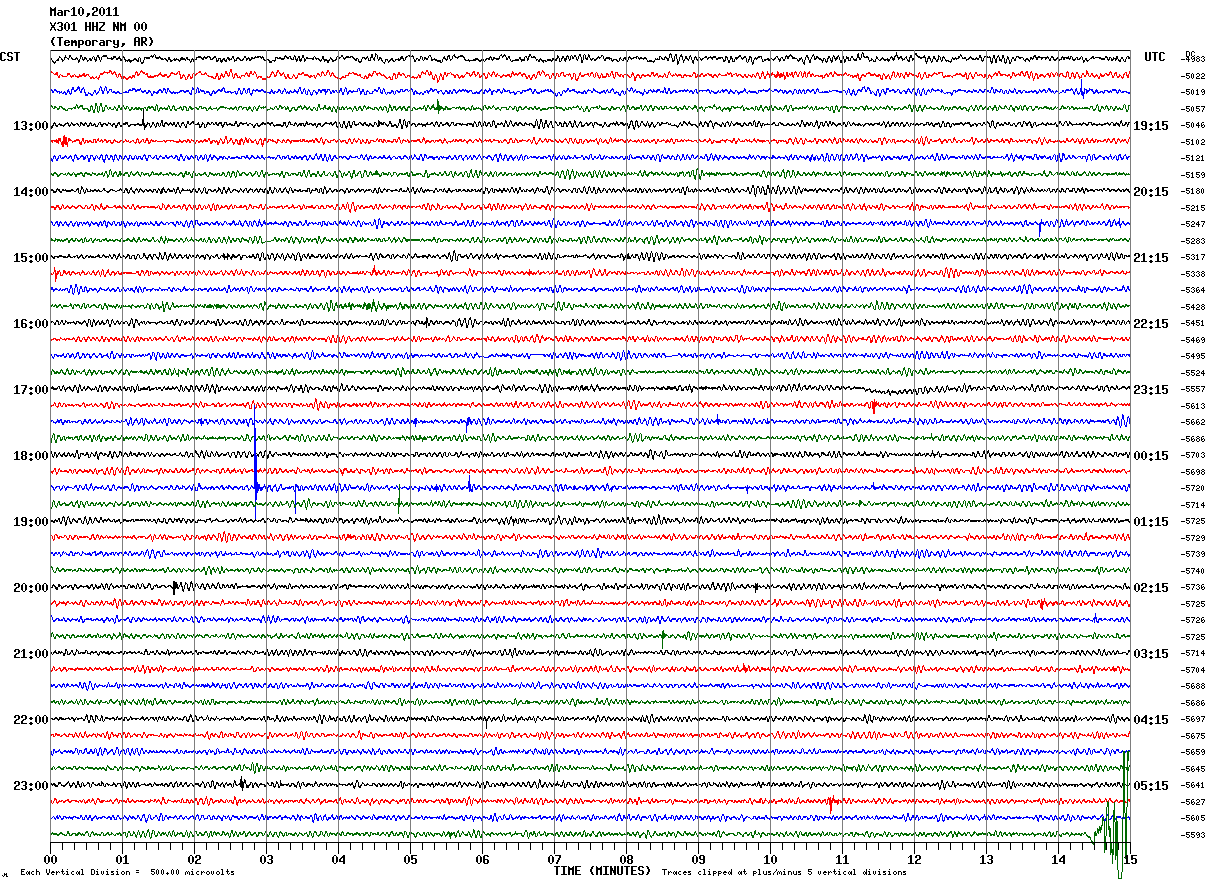
Let's take a look at the storm from last night.  The first image below is a cross-section of the storm at 4:22am from the Millington NEXRAD radar.  Left to right is roughly west to east (so we are looking north in this image) and bottom to top in the image is increasing altitude (or going up in the sky).  Each horizontal white line is 10,000 feet.  The brightest colors (reds and purples) are the heaviest rain, or in this case rain and hail. The  freezing level last night was fairly favorable at about 11,000 feet.  So, any heavy precipitation you see above that level is likely freezing/frozen.

In the image below, hail resides in the white circled area, and actually are being thrown up to even higher levels in the reds between 20,000-30,000 feet.  Gallaway is labelled and the storm is moving from left to right, so the storm has not quite reached there yet.  Note that nearest the ground, the color above Gallaway is green, or light rain, but the storm is tilted from west to east by upper-level wind and the strongest precipitation (reflectivity) aloft is almost over Gallaway.


In the next image, taken at 4:31am, the color nearest the surface directly over Gallaway is red and that red extends up to about 25,000 feet.  Hail is now falling at Gallaway, though the storm has weakened a little, as evidenced by the pack of purples.  The darkest reds are now below 10,000 feet and there is much less red between 10,000-25,000 feet, indicating that the storm is in the process of collapsing, the updrafts are weakening, and the hail suspended aloft is falling to the ground.


Twenty minutes later (4:50am), in the last image below, the process appears to be starting over again as plenty of heavy rain and probably some hail is reaching the ground, while another core of heavier precipitation is forming between 5,000-20,000 feet above the ground. This is the nature of the thunderstorm beast, continuing to mature and dissipate repeatedly until an unfavorable atmosphere is encountered.


So what did this storm produce?  The picture below, sent by Cam Fondren of Gallaway, tells the story - hail, some of it qurater-sized (1" diameter), which verifies the Severe Thunderstorm Warning that was is effect for Fayette County when the hail fell.  Special thanks to Cam for sending the picture!


----
Stay up to date on the latest weather conditions and forecast by checking out MemphisWeather.net on Facebook and Twitter and our BRAND-NEW iPhone app!

Friday, March 25, 2011

Two rounds of thunderstorms over the next 24 hours

The Mid-South is positioned to see two rounds of rain and thunderstorms on Saturday as a stationary/cold front sits across southern Arkansas and central Mississippi (moving slowly north) and two disturbances will move swiftly along the front tonight and again on Saturday afternoon and evening.

The first round of storms will develop right here in the Mid-South rather than moving in from the west, later this evening.  As an upper-level disturbance approaches, we'll see scattered thunderstorms begin to fire up over AR and move east and develop further during the overnight hours, mainly after midnight. Cluster of storms will be possible and a few could be borderline-severe, mainly over east-central AR and northwest MS (see graphic below for SLIGHT RISK area), with the main threat being large hail.

Severe weather threat area for Friday night
This first round of rain and thunderstorms will likely move out of the area by mid-morning, with a short break before the next round moves in during the mid-afternoon hours. This round of storms will also focus along the cold-turned-warm front, which will probably move a little further north into east-central AR, north MS, and north AL.  Once again, a SLIGHT RISK of severe weather is possible over these areas and possibly the southern tier of counties in TN, including the Memphis area (see graphic below).  The northern extent of the severe weather will depend strongly on the position of the warm front. Areas north of the front will be much less susceptible.  The severe weather threats will be large hail, damaging wind, and possibly tornadoes.  The greatest tornado threat appears to be centered over northeast MS and north AL.

Severe weather threat area for Saturday
This second round of storms will exit the region stage-right during the evening hours on Saturday, leaving behind cloudy skies and a cool, but likely dry, Sunday.

MemphisWeather.net's StormView Radar and Storm Center will have your severe weather coverage during both events. Our Twitter feed - @shelbyalerts - will also automatically tweet severe thunderstorm watches and warnings and we'll have as much coverage as possible on Facebook and Twitter (@memphisweather1) via the links in the footer below.

----
Stay up to date on the latest weather conditions and forecast by checking out MemphisWeather.net on Facebook and Twitter and our BRAND-NEW iPhone app!

Thursday, March 24, 2011

Putting the winter of 2010-2011 "in the books"

The winter of 2010-2011 is officially over, both meteorologically (on February 28) and astronomically (on March 20), so now is a good time to go back and review what Memphis and the Mid-South dealt with during this La Nina winter.  For this post, I'll define winter using the meteorological period of December-February.

Referring back to late last fall, I wrote a post on the expected conditions for this past winter.  Due to a consensus among many organizations that La Nina would dominate the weather pattern throughout the winter months, I predicted a warmer and wetter winter than average, with an increased risk of a severe weather outbreak not unlike to the La Nina winter of 2008.  How did it turn out? Well, La Nina existed, but was overshadowed by a fairly strongly negative North Atlantic Oscillation (NAO), which allowed colder than normal weather to exist across eastern North America.

The balance between La Nina and the negative NAO resulted in temperatures that started off very cold in December, but warmed some in January and February, thus an average winter temperature of 42.1 degrees, which is slightly below the average of 42.7 degrees.  In terms of precipitation, despite some significant snowfall (more on that in a minute), drought conditions from late fall persisted into winter and Memphis ended up with just over 50% of normal winter precipitation. The total was 7.37" of liquid precip versus an average of 14.23", ranking this winter as the 8th driest on record.  The severe weather threat never really materialized this winter, other than on February 24th when strong wind ripped through the metro area with a line of thunderstorms, causing damage in parts of the region.

While a great deal of snowfall was not expected, the Memphis area experienced a third straight snowy winter. The total snowfall at Memphis International Airport was 9.7", which was the most since 1987-88, with six days of measurable snowfall, the most since 1984-85.  This is 6.1" above the normal of 3.6".  Below is a graphic courtesy of NWS-Memphis showing winter snowfall totals across the Mid-South.
2010-2011 Winter Snowfall Totals, from NWS-Memphis
More details on the recently completed winter season can be found in a National Weather Service review.

----
Stay up to date on the latest weather conditions and forecast by checking out MemphisWeather.net on Facebook and Twitter and our BRAND-NEW iPhone app!

Wednesday, March 23, 2011

Red Flag Warning issued for parts of the metro region

So you're probably asking, what in the world is a "Red Flag Warning?"  Below is the text of the warning, which pretty well explains it, but basically the air is quickly drying out behind a cold front, the ground is dry (except where river flooding is occurring of course), and winds are gusty - which is a combination that promotes and sustains wildfires.  It's somewhat rare to see these warnings here in the Memphis area, but behind an early spring cold front is one way to get them.  Here's the warning:

URGENT - FIRE WEATHER MESSAGE
NATIONAL WEATHER SERVICE MEMPHIS TN
619 PM CDT WED MAR 23 2011

...RED FLAG CONDITIONS INTO THE EARLY EVENING...

.VERY DRY AIR CONTINUES TO SURGE INTO PORTIONS OF THE MIDSOUTH ON
STRONG WEST WINDS. WITH LOW FUEL MOISTURE AND VERY LOW RELATIVE
HUMIDITY...THIS IS CREATING DANGEROUS FIRE WEATHER CONDITIONS.
THESE CONDITIONS ARE EXPECTED TO PERSIST FOR THE NEXT FEW HOURS.

A LARGE BRUSH FIRE HAS BEEN REPORTED IN DYER COUNTY...PROMPTING
THE EXPANSION AND EXTENSION OF THE WARNING.

THE NATIONAL WEATHER SERVICE IN MEMPHIS HAS ISSUED A RED FLAG
WARNING...WHICH IS IN EFFECT UNTIL 9 PM CDT THIS EVENING.

RELATIVE HUMIDITIES THIS AFTERNOON HAVE DROPPED OR WILL DROP TO
NEAR 20 PERCENT. 20 FOOT WINDS RANGE BETWEEN 15 AND 20 MPH WITH
GUSTS OF 25 TO 30 MPH. 10 HOUR FUEL MOISTURE IS ALSO LOW. THESE
CONDITIONS ARE AT RED FLAG WARNING CRITERIA AND THUS ARE MAKING
FOR A DANGEROUS FIRE WEATHER SITUATION.

PRECAUTIONARY/PREPAREDNESS ACTIONS...

A RED FLAG WARNING MEANS THAT CRITICAL FIRE WEATHER CONDITIONS
ARE EITHER OCCURRING NOW...OR WILL SHORTLY. A COMBINATION OF
STRONG WINDS...LOW RELATIVE HUMIDITY...AND WARM TEMPERATURES WILL
CREATE EXPLOSIVE FIRE GROWTH POTENTIAL.

So, especially if you live in rural areas, please take this in consideration before burning brush or debris.  Conditions are favorable for that small fire to get quickly out of control.  More information is available on Wikipedia.

----
Stay up to date on the latest weather conditions and forecast by checking out MemphisWeather.net on Facebook and Twitter and our BRAND-NEW iPhone app!

So what's the weather going to do this weekend in the Mid-South?

Earlier in the week, in a post about the weather pattern for the first week of spring, I talked about what could only be described at that time as a "murky situation" in the extended forecast. It's 3 days later and I am realizing more why it was murky... because it is.  Friday through Tuesday will not be one of those easy to predict "cold front...high pressure...cold front" types of patterns. Models are beginning to zero in on the framework of the upcoming pattern, even if the details leave a bit to be desired.

Here's the framework: a cold front moves through today and sinks south to the Gulf Coast. That will bring an end to our mid-May weather of the past several days. I don't see us threatening 80 degrees or any records again after today for some time (remember, the normals for this time of year are highs of 65 and lows of 45). Most all of the precip associated with this front will be well to our northeast, so I went with a 20% chance today. Much cooler weather (i.e., 20 degrees cooler) will filter in behind the front so look for highs in the 50s tomorrow as the next system organizes over the southern Rockies.

A cold front moves through the metro area today, bringing a slight chance of rain
By Friday, clouds increase as the cold front makes a return north as a warm front. As the front meanders around in the Mid-South Saturday and low pressure moves across the region along the front, we will see increased rain chances and possibly a few thunderstorms, though I don't see anything to point to severe weather right now. As the warm front gets to our north, we'll probably see 70 degrees again Saturday. Behind the low, clouds will still linger on Sunday and, with a slightly-modified airmass, it will be a touch cooler with slight chances of rain.

Warm front positioned over the area and low pressure approaching Saturday will bring rain
By Monday and Tuesday, another low pressure forms over the southern Plains and moves east towards the region. The track of the low through the lower Mississippi River Valley is one of those "sketchy details", but no matter where it eventually ends up, our rain chances will be higher again early next week. The track of the low will determine our thunder chances, as well as any severe risk from this system. Right now, I would say it is minimal, but we'll have to continue to monitor. It's one of the things we do pretty well here at MWN - that and keeping you updated.  We'll continue to do both!  Here's the complete forecast.

NOTE: We're having some difficulties with StormView Radar today. While we work on that, you can use our alternate radar to keep tabs on any rain that forms.

Links of interest that are important as we approach severe weather season:
MWN Storm Center - with radar, severe weather warning map, safety tips, and more!
MWN severe weather notification - alerts of impending severe weather by e-mail or Twitter
WXLIVE! RapidFire - the fastest updates of current weather in Memphis - every 3 seconds

----
Stay up to date on the latest weather conditions and forecast by checking out MemphisWeather.net on Facebook and Twitter and our BRAND-NEW iPhone app!

Tuesday, March 22, 2011

Mississippi River at Memphis cresting today, beginning slow fall

The Mississippi River at the Memphis gauge downtown went above flood stage of 34.0 feet on Tuesday morning, March 15.  Based on hourly river stages and the forecast, it appears that the river has reached a high-water mark at 36.5 feet this morning and will now begin a very slow fall over the next several days.  The forecast calls for flood waters to continue through the next week at least.  The graph below shows the recent readings and the forecast over the next 5 days or so.


Because the river will still be in flood for several more days and tributaries remain very high, please be continue to exercise caution around flooded areas.  More information on safety around swollen waterways can be found in a recent MWN Blog post: Flood Safety Awareness Week coincides with local river flooding

Also, you may wish to check out another recent blog post containing pics of the Mississippi River above flood stage.  While the forecast is for a sow decline, further snowmelt or heavy rain upstream could exacerbate conditions in the Mid-South. We'll keep you posted.

Have you been affected by high waters of the river or it's tributaries? How?

----
Stay up to date on the latest weather conditions and forecast by checking out MemphisWeather.net on Facebook and Twitter and our BRAND-NEW iPhone app!

Sunday, March 20, 2011

Weather for the first week of spring

Spring officially begins at 6:21pm CDT today (Sunday, March 20).  Mid-Southerners have already had a very nice taste of spring the past few days with temperatures more typical of mid to late-May than mid-March. In fact, we will end up within a degree or two of the record high of 84 for today. So how long will this warm weather continue?

Regional temperatures as of 4:45pm - Sunday, March 20
The current pattern is dominated by ridging high pressure in the upper and lower levels of the atmosphere.  This is steering the weather systems that come in from the west well to our north. High pressure in the mid and upper levels is causing the air to sink towards the ground and resulting in warm temperatures at the surface. I expect this pattern to continue for the next 48 hours, so high temps in the 80s will continue through Tuesday. Meanwhile, south wind will continue throughout the overnight hours, helping to keep low temperatures up in the 60s. The warm temperatures at night (which are not too far below our normal daytime highs this time of year) are waking up dormant vegetation, such as the carpets of Bermuda grass that encompass many neighborhoods around the region. Unfortunately, mowing probably isn't too far behind!  South to south-southwest wind will likely be strong and gusty on Tuesday.

Forecast surface map valid 7pm Monday, March 21
By Wednesday, one of the low pressure systems that is riding the storm track to our north will drag a weak cold front through the region. A slight chance of showers or thundershowers is possible along the front, though high pressure will limit the effects of the front, so highs will still be in the upper 70s to near 80.

Forecast surface map valid Wednesday morning, March 23 - frontal system approaching from west
Slightly cooler air will move in behind the front so Thursday will see temperatures held back a little, but still well above normal.  By Friday, the long-range models are having a very difficult time agreeing. Low pressure will again move towards the central and eastern U.S.  The main differences in the models are how strong to maintain the ridge of high pressure over our area, or whether to break down it down in favor of the incoming low. Slight chances of rain are indicated in the MWN Forecast throughout next weekend, though I expect to better refine that once models come to some sort of consensus.

----
Stay up to date on the latest weather conditions and forecast by checking out MemphisWeather.net on Facebook and Twitter and our BRAND-NEW iPhone app!

Thursday, March 17, 2011

Mississippi River flooding pics

The Mississippi River at Memphis went above flood stage of 34.0' early Tuesday morning,  March 15, and has continued to slowly rise.  The pictures below were taken by MemphisWeather.net in the Memphis downtown area on the afternoon of March 17, with the river at 35.1 feet.  Click any image for a larger version.  The forecast calls for a continued slow rise to 37.0 feet by next Thursday evening, March 24.

Trees growing out of the river near the Tennessee Welcome Center

The Mud Island boat ramp

South end of Mud Island, partially submerged

The Memphis Queen Riverboat and a tug at the riverboat dock, plus a gangplank to nowhere (and a stray finger - sorry!)

Taken at Greenbelt Park in Harbor Town with the Hernando DeSoto bridge in background.

Looking upstream from Greenbelt Park, Harbor Town

Another view looking downstream from Harbor Town
Do you have pics of flooding of the Mississippi River or its tributaries to share?  E-mail them to photos @ memphisweather.net, tweet them to @memphisweather1, or upload them to our Facebook page!  We'll take some of the best and re-post them. Provide location, date of picture, and your name when submitting.

----
Stay up to date on the latest weather conditions and forecast by checking out MemphisWeather.net on Facebook and Twitter and our BRAND-NEW iPhone app!

Tuesday, March 15, 2011

"Turn Around, Don't Drown" - Flood Safety Awareness Week continues

Vehicles ignore the threat of rushing water across a roadway. Photo courtesy MemphisWeather.net.
TODAY'S THEME IS "TURN AROUND...DONT DROWN" OR TADD. TADD IS AN
EFFORT TO INCREASE AWARENESS OF THE DANGERS OF DRIVING OVER FLOODED
ROADS OR WALKING IN FLOODED AREAS. TADD SIGNS ARE BEING PLACED AHEAD
OF LOW WATER CROSSINGS WHERE FLASH FLOODS OCCUR.

TOO MANY PEOPLE DIE DUE TO MISJUDGING THE POWER OF MOVING WATER OR
THEIR ABILITY TO NAVIGATE FLOODED AREAS. FLOODING CAN HAPPEN RAPIDLY
DUE TO ISOLATED THUNDERSTORM RAINS OR SLOWLY DUE TO RAINFALL EVENTS
THAT IMPACT A LARGE AREA. IN ADDITION... IT ONLY TAKES SIX INCHES OF
WATER FOR A VEHICLE TO LOSE CONTACT WITH THE ROAD SURFACE AND MOST
VEHICLES CAN BE SWEPT AWAY IN 18 TO 24 INCHES OF WATER. SADLY... MANY
DEATHS IN THE MID-SOUTH COULD HAVE BEEN PREVENTED BY SIMPLY TURNING
AROUND. A CANCELED... DELAYED OR REROUTED TRIP IS WORTH THE TIME AND
EFFORT.

SOME ITEMS TO CONSIDER TO INCREASE YOUR FLOOD SAFETY...

- TURN AROUND...DONT DROWN! CANCEL... DELAY OR REROUTE A TRIP IF IT
IS ON FLOODED ROADS.
- FLOODED ROADS MAY BE TEMPORARILY BLOCKED BY A "TURN AROUND DONT
DROWN" SIGN OR A BARRIER... DO NOT DRIVE AROUND THE BARRIERS.
- GET OR STAY ON HIGHER GROUND... AVOID LOW SPOTS IN THE ROAD
OR OTHERWISE.
- FLOODED ROAD MAY HAVE HIDDEN DANGERS... SUCH AS WASHED OUT
ROAD BEDS OR UNDERWATER OBSTRUCTIONS.
- KEEP CHILDREN AWAY FROM FLOODED AREAS OR AREAS OF FAST MOVING
WATER.
- DONT CAMP NEAR THE RIVER IF THERE IS A FLASH FLOOD THREAT.
- FLASH FLOODING CAN HAPPEN AT NIGHT WHEN IT IS HARDER TO RECOGNIZE
FLOOD DANGERS.
- FLASH FLOODS OCCUR IN THE MID-SOUTH.

TURN AROUND...DONT DROWN IS A JOINT EFFORT BETWEEN THE NATIONAL
WEATHER SERVICE AND THE FEDERAL ALLIANCE FOR SAFE HOMES (FLASH).

THE INFORMATION ABOUT TADD CAN BE FOUND AT WWW.SRH.NOAA.GOV/SRH/TADD

ADDITIONAL INFORMATION ABOUT AHPS AND FLOOD SAFETY AWARENESS WEEK
IS AVAILABLE AT WWW.WEATHER.GOV/FLOODSAFETY/


----
Stay up to date on the latest weather conditions and forecast by checking out MemphisWeather.net on Facebook and Twitter and our BRAND-NEW iPhone app!

Monday, March 14, 2011

Flood Safety Awareness Week coincides with local river flooding

This week is set aside by the National Weather Service as National Flood Safety Awareness Week.  It happens to be a good week to highlight the threats of flooding since the Mississippi River is rising above flood stage of 34.0 feet at Memphis this week.  See the graph below showing the forecast for the Memphis gauge.  From the National Weather Service, a Flood Warning is in effect:

THE FLOOD WARNING CONTINUES FOR THE MISSISSIPPI RIVER AT MEMPHIS
* FROM TUESDAY EARLY AFTERNOON UNTIL FURTHER NOTICE.
* AT 9 PM MONDAY THE STAGE WAS 33.8 FEET.
* MINOR FLOODING IS FORECAST.
* FLOOD STAGE IS 34.0 FEET.
* FORECAST TO RISE ABOVE FLOOD STAGE BY TUESDAY EARLY AFTERNOON AND
  CONTINUE TO RISE TO NEAR 36.0 FEET BY WEDNESDAY MORNING. ADDITIONAL
  RISES ARE POSSIBLE THEREAFTER.
* AT 36.0 FEET...LAND BETWEEN THE MAINLINE LEVEE SYSTEM FLOODED

The river has been rising for the past few weeks as snowmelt and recent heavy rain upstream have caused the tributaries feeding into the main rivers to rise (see our blog post from early March on the subject). This is a fairly normal occurrence in the spring, but due to heavier snowfall in the northern U.S., flooding will likely affect large areas to the south. This will be especially true for agricultural land inside the mainline levees around and downstream from Memphis.

For more information on river stages in the Mid-South, including forecast stages and effects of high water levels, visit the NWS Advanced Hydrologic Prediction Service (AHPS). AHPS provides you with user friendly text, graphical forecasts, and flood maps. The goal of these products is to help citizens be aware of river conditions and make plans accordingly. This information can help make recreational plans, plan for floods, and get ready for seasonal changes

If you live or work near a swollen body of water, please exercise caution and remain at a safe distance from it, particularly if it is swiftly-moving, and warn children under your watch to stay away from rivers and creeks as well. One small mis-step could mean the difference between curiously watching the current and fighting for your life as you get swept downstream.

----
Stay up to date on the latest weather conditions and forecast by checking out MemphisWeather.net on Facebook and Twitter and our BRAND-NEW iPhone app!

Sunday, March 13, 2011

Week-ahead outlook: springtime rain, then springtime temps!

What a fabulous early spring weekend the Mid-South enjoyed! Saturday was near perfect, if it weren't for all the pollen and junk floating around in the air! Temps reached the lower to mid 70s with abundant sunshine. Sunday, though cloudy, was still nice with highs in the upper 60s as the showers held off until evening. I even got some grilling done today after breaking a sweat on yard work yesterday!

The upcoming week is Spring Break week for all kids in Memphis City and Shelby County schools, and probably for other metro districts. For those staying in the Mid-South this week, you'll be treated to more wonderful springtime weather once we get the early-week weather system out of here.

Low pressure will move from western AR tomorrow (Monday) morning very slowly through the region to middle Tennessee by Tuesday morning, followed by a distinct upper-level trough. This system will bring rain and scattered thunderstorms to the region on Monday - keep an umbrella with you if you venture out. It will also temper highs somewhat, keeping them in the lower 60s, and possibly falling back into the 50s by afternoon behind a cold front.

Clouds will stick around Tuesday as the upper-level trough moves over, though rain is not expected that day. Temperatures will remain cool Tuesday - in the lower 50s. Clearing takes place Tuesday night, then partly cloudy skies are expected through much of the rest of the week. Wednesday morning's low could dip into the upper 30s in normally cooler areas, but highs will rebound into the upper 60s during the day. Look for lows in the 50s and highs in the 70s Thursday through next weekend with an 80 degree day not out of the question. For a complete look at the upcoming week's forecast, click here for the MWN Forecast.

Just a reminder that MWN's new iPhone app is now available and also works well on iPod Touch and iPad. Click the link in the footer of this blog to get it.  I've been told by one fan that "it's the best $0.99 I ever spent!" Wow - I know I've spent $0.99 many times over and gotten great deals, so that's a wonderful compliment! Maybe you should find out for yourself?

Finally, a huge shout-out to this blog's favorite team - the Memphis Tigers basketball squad!  After defeating UTEP in the closing seconds of the Conference USA Championship on Saturday, they are headed to Tulsa to play the Arizona Wildcats in the NCAA Tournament on Friday.  GO TIGERS!

----
Stay up to date on the latest weather conditions and forecast by checking out MemphisWeather.net on Facebook and Twitter and our BRAND-NEW iPhone app!

Saturday, March 12, 2011

Follow-up on Japanese quake & Pacific tsunami and spring weather in the Mid-South

Following the massive "Great Quake" in Japan on Thursday night and subsequent tsunami that affected nearly the entire Pacific basin, I posted some interesting images and links on Twitter and Facebook.  I thought I'd take a minute to recap those if you missed them.

First, helicorders in northeastern Arkansas detected the earth's movement halfway around the globe from Japan. The first picture is from a "normal" day with almost no ground movement.  (The lines read from left to right, top to bottom, and each line represents 15 minutes.)  You'll notice at the very bottom right of the image, some shaking is detected - this is shortly before midnight Thursday night.  The second image is from Friday. Wow!  Though the earthquake wasn't "felt" in Arkansas, it was certainly detected by the sensitive instrumentation.

Thursday, March 10, 2011

Friday, March 11, 2011

Next, an image from the West Coast and Alaska Tsunami Warning Center showing the propagation forecast of the tsunami waves (note, 30 centimeters = 1 foot).


And to see that tsunami "in motion," check out the video animation below provided by the NOAA Center for Tsunami Research.  Thanks to Ryan Vaughan (KAIT-TV, Jonesboro) for digging this one up! It's eery to watch.


As for the aftermath, here are a couple of links to photos and video I found and shared yesterday.  There is just SO MUCH information and video/imagery that this is just a small sampling.  If you have some favorites you would like to share, leave them in the comments so that I and my readers can check them out!

50 Stunning Pictures of the Japan Earthquake and Tsunami
Massive Wave Flattens Buildings in Japan (YouTube)

Switching gears.......
Locally, we're in for a GREAT spring day! The sky will be mostly sunny with a high near 70 and a steady southwest wind today. A low chance of showers appears tomorrow as a weak cold front moves into the area. Additional cloud cover will hold temperatures back 7-8 degrees from today's readings. A better chance of rain and isolated storms will be possible Monday as an upper-level system moves through the region. Highs will be back in the 50s. Outside of a couple of small rain chances, next week will see a warming trend with highs into the 70s for mid to late week. For those on Spring Break and staying in the area, it should be a good week to get out and enjoy Mid-South spring! For the complete MWN forecast, click here.

Also, remember that tonight we "spring forward" to Daylight Savings Time.  Move the clocks ahead one hour, change the batteries in your smoke detectors AND in your NOAA Weather Radio. Then, be ready to see the sun a little longer into the evening!

---- Stay up to date on the latest weather conditions and forecast by checking out MemphisWeather.net on Facebook and Twitter and our BRAND-NEW iPhone app!

Thursday, March 10, 2011

EF-2 tornado strikes suburban Mobile, AL

The storm system that moved through the Mid-South on Tuesday night also battered the Gulf Coast as a squall line raced across that region and flooding was reported in many areas of the south.  If you read yesterday morning's blog entry that showed the Mid-South on the backside of a large area of rain and t'storms, you may recall seeing that squall line moving across the FL panhandle.

As it turns out, about 2 hours earlier, it raced through Mobile, AL and some popular Mid-South beach retreat spots - Gulf Shores, Dauphin Island, and Orange Beach.  The storm system dropped an EF-2 tornado with 120 mph wind south of Mobile in the town of Theodore, AL. The twister, which touched down around 8:40am, severely damaged several buildings in a commercial district, injuring 4 but thankfully taking no lives.  Radar is shown below at the time the tornado warning [red polygon] was issued at 8:27am.  You'll see the proximity of the storm to downtown Mobile and the AL beaches many Mid-Southerners are familiar with (click the image for a larger version).

Radar and Tornado Warning about 10 minutes before damage was reported in Theodore, AL
You can also find many pictures of the damage (including the one below) taken by meteorologist Jim Loznicka (@jimwxgator on Twitter) of WJHG-TV in Panama City Beach, who happened to be within a couple of miles of the tornado when it ripped up the business district in Theodore.

Tornado damage in Theodore, AL - courtesy Jim Loznicka (@jimwxgator)
Some important lesson can be learned from this storm that apply anywhere. Tornadoes can strike quickly and leave a trail of devastation in a matter of seconds and running towards windows or outdoors to "see the tornado" and not taking cover is the WRONG thing to do.  The security camera videos from Alexander Hardware and Small Engine (of which there are many on YouTube), located in the business district that suffered EF-2 damage, show just how quickly it can happen and the damage that often occurs. A couple of the videos are shown below. Notice how lightning/power flashes three times, the power goes out, then the tornado hits, and within seconds it is all done.


MemphisWeather.net reminds you that anytime a Tornado Warning is issued, take cover immediately in the interior of the lowest floor available or under ground if possible.  For more safety tips, see the MWN Storm Center.

Wednesday, March 9, 2011

Current weather scenario as of late Wednesday morning

Below you will find the weather scenario the Mid-South is dealing with as of late Wednesday morning, as seen by radar and annotated satellite imagery.

The overnight rain and thunderstorms have moved to the east and are covering the central Appalachians into northern GA, much of AL, and the FL panhandle.  There is actually quite a line of impressive storms that have spawned tornado warnings over extreme southern AL and the panhandle of FL this morning.  The cold front has moved east of Memphis.  It's passage brought low clouds and some light rain showers during the morning rush hour.  It is picked up well by satellite as a narrow thin line and can be seen in the same location on radar as a narrow faint line of rain from west KY into west TN.

Behind the front, a few breaks in the clouds have brought peeks of sunshine this morning, but low clouds will be moving back into the region this afternoon, lasting through tonight.  These clouds are in association with an upper-level trough of low pressure that commonly trails a cold front.  This one has enough moisture to produce clouds and could bring some sprinkles or drizzle overnight tonight into early Thursday.  I am expecting at least the morning hours on Thursday to be cloudy, with these clouds departing by afternoon, leading to a nice weekend!  The complete forecast can be found at MemphisWeather.net.

Radar and visible satellite imagery valid at about 11am CST.
----
Stay up to date on the latest weather conditions and forecast by checking out MemphisWeather.net on Facebook and Twitter and our BRAND-NEW iPhone app!

Monday, March 7, 2011

Slight risk of severe weather early Wednesday

The Storm Prediction Center has placed the Memphis metro area and points south and west (AR and MS) in a SLIGHT RISK for severe weather during the early morning hours on Wednesday.  The primary threat with storms that form ahead of an approaching cold front will be straight-line wind, large hail, and isolated tornadoes.

Abundant moisture will arrive in the region on Tuesday with showers and some thunderstorms likely on Tuesday afternoon and evening.  These storms are not expected to be severe. Another round of storms will arrive sometime early Wednesday (likely between 4-10am) that could bring the threat of severe weather.  In addition, many locations could see another 2" or so of rain from this system from Tuesday afternoon through Wednesday morning.  The areas to watch for potential severe weather are shown in the images below.

Risk of severe weather for Tuesday and Tuesday night, 3-8-11

Risk of severe weather for Wednesday, 3-9-11

Stay with MemphisWeather.net on the web, the blog, Facebook, and Twitter for more on the potential for severe weather.

Sunday, March 6, 2011

Sunday afternoon forecast discussion

Clouds have been hanging tough across the Mid-South in the wake of  a cold front that moved through Saturday morning. The clouds are not breaking up thanks to moisture trapped beneath a low-level inversion (increasing temperatures with height) and a cool northeasterly breeze. (See the atmospheric sounding, or vertical slice, below.)
3/6/11, 3pm, Memphis model sounding. Red line is temp, green line is dewpoint (moisture), dashed purple line is freezing. Ground level is at the bottom, height rises going up to the top of the image. Where they are close together, humidity is high and clouds are expected. Temperatures increase with height at around 850mb (red line moving right as it increases in height), with the cloud layer below, trapping the clouds under sinking air. 
I expect to see these clouds erode this evening just as high clouds stream in from the west, thus a variably cloudy sky. With light wind and cool temperatures heading into the night, it won't be hard to get near the freezing mark by morning, especially outside of the city.

For Monday, high pressure maintains control and we should see partly sunny skies (high clouds will filter the sun somewhat) and temperatures rebounding into the mid 50s. As clouds thicken Monday night and the wind remains steady from the southeast, temps won't drop as far - only into the mid 40s.

The next rainmaker will move into the Southern Plains Tuesday, then eject to the northeast Tuesday night.  Low pressure will be in eastern OK on Tuesday evening then quickly reach southern WI by Wednesday night.  Meanwhile, Gulf moisture and some instability, along with lift provided by an approaching front, will bring widespread showers and some thunderstorms.  Scattered showers should break out Tuesday afternoon with most of the inclement weather Tuesday night and early Wednesday.  The front will pass through the Mid-South Wednesday morning.

GFS forecast model for Tuesday night (Wednesday morning) at midnight. Green/blue shading is rain/storms. Thick blue line is cold front (MO-AR-LA), and Memphis is indicated by the yellow dot.
While severe weather cannot be ruled out with this system, it does not appear likely at this time. However, some strong storms are possible ahead of the front early Wednesday.  We'll continue to monitor the situation and bring you the latest on MWN and the MWN Blog and social media sites.

----
Stay up to date on the latest weather conditions and forecast by checking out MemphisWeather.net on Facebook and Twitter!

Friday, March 4, 2011

Heavy rain expected in the Mid-South Friday night and Saturday

The National Weather Service has posted Flash Flood Watches for the entire Mid-South as a slow-moving frontal system approaches the region from Arkansas and low pressure moves along the front.  This afternoon, the front resides over central OK  but will move slowly east across Arkansas overnight before reaching the Memphis area around 10am Saturday.

Strong to severe thunderstorms are possible to our west tonight, but are not expected to remain severe as they move east into our region.  However, "general" thunderstorms are possible throughout the night and especially ahead of the cold front tomorrow morning.  These storms will enhance precipitation totals where they occur and bring some cloud-to-ground lightning.

The heaviest precipitation will likely occur in morning hours Saturday ahead of and just behind the cold front, though scattered showers will likely linger throughout much of the day.  Rain totals will likely be near 2" for nearly everyone, though places that see more convective activity could see totals as high as 3"+.  For this reason, the Flash Flood Watches have been posted.  The map below shows average precipitation amounts for the period from 6pm tonight through 6pm Saturday.  Many locations could see more than the 1.75" posted for the Mid-South area.
24-hour rainfall totals, forecast by the NWS - 6pm Friday through 6pm Saturday
After the cold front passes, temperatures will drop quickly into the 40s during the afternoon hours as wind shifts to the north and remains gusty.  Sunday morning's low temperature will be in the 30s and it will barely reach 50 on Sunday afternoon.  The next weather-maker arrives around mid-week.  Click here for the complete MWN Forecast.

MWN encourages you to read over flood and flash flood safety tips in case water rises in your neighborhood, especially if you live in a flood prone area.  Remember that it is hard to see flooding when driving at night, especially to gauge the depth of water crossing the road.  Do not drive into areas where water covers the road. It takes as little as one foot of rushing water to sweep a car off the road and it's sometimes hard to tell if the roadbed underneath the water is intact. "Turn Around, Don't Drown" is the NWS slogan.  The pictures below, provided by Andrew Simpson, were taken 10 minutes apart on February 28th in East Knox County.  Water can rise VERY quickly!
Before flash flood
During flash flood - 10 minutes later
----
Stay up to date on the latest weather conditions and forecast by checking out MemphisWeather.net on Facebook and Twitter!

February climate data and MWN Forecast accuracy

Memphis International Airport, Memphis, TN
Overall, February was warmer than average, snowier than average, but drier than average in Memphis. Despite the snow, total precipitation was an inch below normal and temperatures actually averaged over 2 degrees above normal due in large part to a warm spell the last half of the month in which high temperatures routinely hit 70 degrees. As of March 1, the region was classified as being in a moderate drought, which is an improvement over severe conditions in recent months.

The average February temperature was 47.1 degrees, which was 2.2 degrees above normal. The average high temperature was 56.9 degrees and the average low was 37.4. Low temperatures dropped to freezing or below 12 times during the month, while four days saw high temperatures at or below freezing (2nd-3rd and 9th-10th). The lowest temperature for the month was 11 degrees on the 11th and the highest temperature was 77 on the 20th and 24th.

Precipitation for the month of February totaled 3.36", or 0.95" below the normal of 4.31". There were nine days with measurable rainfall and the maximum 24-hour total was 1.25" on the 23rd-24th. Snowfall measured 3.3" for the month, bringing the seasonal total to 9.7", which is 3.5" above normal. Most of the snow fell on the 9th (3.1") while 0.2" fell on the 7th and snowflakes were recorded each day from the 2nd through the 5th. The peak wind gust was 54 mph on February 1st with an average wind speed for the month of 10.1 mph. Click here for a daily statistical recap for Memphis International for February .

Bartlett, TN
The average temperature for February at the WXLIVE! station in north Bartlett was 46.0 degrees with a maximum of 77.6 on the 20th and a minimum of 8.3 degrees on the 11th -- a 69 degree difference between maximum and minimum!

February precipitation ended below normal with a total of 3.38". A co-located manual gauge used for the CoCoRaHS program measured 3.46". Two days saw measurable snow which totaled 4.1" for the month. These included 1.8" between 7-11:30am on the 7th and 2.3" over several hours (mainly in the afternoon) on the 9th. The peak wind gust was 36 mph on the 1st. Average relative humidity was 66%. Click here for a daily recap on MemphisWeather.net.

MWN Forecast Accuracy
For the month of February, the average temperature error in all MWN temperature forecasts was 3.25 degrees, lower than all compared computer models, including the National Weather Service. Over 48% of the MWN temperature forecasts for the month were within 2 degrees of the actual temperature. MWN's forecasts extend out five periods (or 2.5 days). For dewpoint accuracy, the MWN forecast beat all data sources, averaging 3.55 degrees error and falling within 2 degrees of the actual dewpoint nearly 50% of the time. Detailed accuracy statistics can be found here.

----
Stay up to date on the latest weather conditions and forecast by checking out MemphisWeather.net on Facebook and Twitter!

Wednesday, March 2, 2011

Springtime storm approaching the Mid-South

After a few days of nice weather, with crisp mornings and warm afternoons, the next weather system will be making it's way into the Mid-South Friday and Saturday.  Showers and a few thunderstorms will be likely Friday as south wind brings in ample moisture from the Gulf of Mexico ahead of a cold front.  High temperatures will be mild though - in the upper 60s. Showers and thunderstorms will continue into the night Friday night and at least the first half of Saturday with a slight chance of a few storms becoming severe, though the severe potential does not appear to be as high as last week's storms systems.  The main threat with this system could end up being flooding as training thunderstorms (storms that move over the same areas) and many hours of rain could bring a few to several inches to some areas.  The total rainfall expected with this system is shown in the image below - nearly 2" for much of the Mid-South.

5-day total precipitation forecast from Wednesday evening through Monday evening
The cold front will move through during the day Saturday, bringing a temporary end to warm weather as temps plummet into the 40s by Saturday evening.  Scattered showers could also linger into the evening hours. By Sunday morning, the rain will be gone, but it will be a cold day behind the departing system with lows in the 30s and highs struggling to reach 50.  Another warm-up begins Monday before the next weather-maker arrives around the middle of next week.

For forecast details, check out the Memphis forecast from MWN and stay tuned for later statements regarding possible severe weather and flooding concerns.

----
Stay up to date on the latest weather conditions and forecast by checking out MemphisWeather.net on Facebook and Twitter!

Mississippi River on the rise

The muddy Mississippi River is beginning to stir up some issues for boaters, river enthusiasts, barge traffic, and many others over the past couple of days, including those who live and play near it's tributaries. If you live or work downtown, cross one of the bridges, or have traveled over the Wolf or Loosahatchie Rivers, you may have noticed higher water levels this week.  And the river and streams are not done rising!

A Flood Advisory has been issued for the Mississippi River at Memphis due to recent heavy rain upstream (north) from Memphis, as well as winter snow melting upstream and flowing into the Mississippi or it's feeder rivers.  This morning's river stage at Memphis was 25.4 feet (above an arbitrary level chosen as "zero").  The river is forecast to rise above the "action stage" of 28.0 feet Friday afternoon, then reach 32.0 feet by a week from tomorrow.  Flood stage is 34.0 feet and it's not out of the question that the river could go above flood stage sometime later in March.

At 28.0 feet, flooding is occurring in isolated lowlands along the river, and at 32.0 feet flooding in occurring over unprotected farmland along the river, mainly on the Arkansas side.You will also notice that tributaries like the Wolf and Loosahatchie Rivers may begin to overflow their banks into susceptible lowlands.  The graph below shows the forecast for the Mississippi River at Memphis (click for larger view), followed by the percentage of normal rainfall over the past 14 days.  Notice in particular the 200-300% of normal rainfall seen over the Ohio Valley!  It's no wonder the river is rising!


----
Stay up to date on the latest weather conditions and forecast by checking out MemphisWeather.net on Facebook and Twitter!