
First, helicorders in northeastern Arkansas detected the earth's movement halfway around the globe from Japan. The first picture is from a "normal" day with almost no ground movement. (The lines read from left to right, top to bottom, and each line represents 15 minutes.) You'll notice at the very bottom right of the image, some shaking is detected - this is shortly before midnight Thursday night. The second image is from Friday. Wow! Though the earthquake wasn't "felt" in Arkansas, it was certainly detected by the sensitive instrumentation.
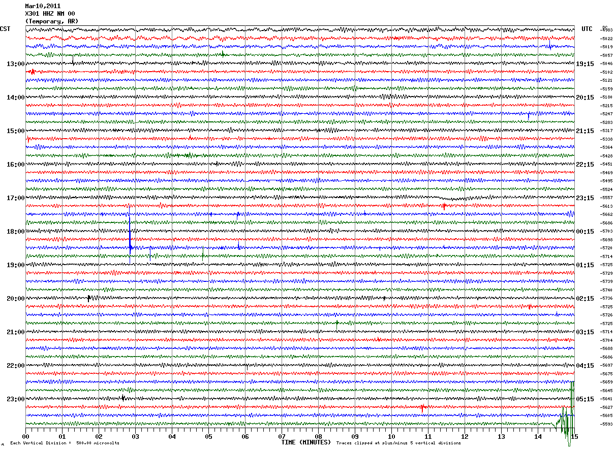 |
| Thursday, March 10, 2011 |
 |
| Friday, March 11, 2011 |
Next, an image from the West Coast and Alaska Tsunami Warning Center showing the propagation forecast of the tsunami waves (note, 30 centimeters = 1 foot).

And to see that tsunami "in motion," check out the video animation below provided by the NOAA Center for Tsunami Research. Thanks to Ryan Vaughan (KAIT-TV, Jonesboro) for digging this one up! It's eery to watch.
As for the aftermath, here are a couple of links to photos and video I found and shared yesterday. There is just SO MUCH information and video/imagery that this is just a small sampling. If you have some favorites you would like to share, leave them in the comments so that I and my readers can check them out!
50 Stunning Pictures of the Japan Earthquake and Tsunami
Massive Wave Flattens Buildings in Japan (YouTube)
Switching gears.......
Locally, we're in for a GREAT spring day! The sky will be mostly sunny with a high near 70 and a steady southwest wind today. A low chance of showers appears tomorrow as a weak cold front moves into the area. Additional cloud cover will hold temperatures back 7-8 degrees from today's readings. A better chance of rain and isolated storms will be possible Monday as an upper-level system moves through the region. Highs will be back in the 50s. Outside of a couple of small rain chances, next week will see a warming trend with highs into the 70s for mid to late week. For those on Spring Break and staying in the area, it should be a good week to get out and enjoy Mid-South spring! For the complete MWN forecast, click here.
Also, remember that tonight we "spring forward" to Daylight Savings Time. Move the clocks ahead one hour, change the batteries in your smoke detectors AND in your NOAA Weather Radio. Then, be ready to see the sun a little longer into the evening!
---- Stay up to date on the latest weather conditions and forecast by checking out MemphisWeather.net on Facebook and Twitter and our BRAND-NEW iPhone app!
No comments:
Post a Comment