Friday, May 27, 2022

Beautiful holiday weekend ahead as high pressure arrives

We're finally putting this week's wet weather in the rearview mirror as the unofficial start of summer - Memorial Day weekend - arrives. In fact, the three-day weekend looks fabulous with sunny skies, warm but not overly hot temperatures, and acceptable humidity levels. The dry spell that starts today continues for nearly a week as temperatures warm back to near 90 by mid-week before the next front approaches.

Friday: upper low spins by to our north

Trailing the wet system that departed yesterday morning, an upper level low pressure system has been moving slowly by to our north. Today, that low is pulling into the Ohio Valley with northwesterly wind aloft, which is bringing in additional cloud cover. Fortunately the clouds will keep their moisture aloft and rain chances are nearly nil. Those clouds, and a westerly breeze, will keep temperatures in check with highs in the mid 70s. By this evening, the clouds dissipate relatively quickly and wind becomes light. That will make for idea radiational cooling conditions, meaning we'll wake up to temperatures in the 50s on Saturday morning with the potential for some patchy fog thanks to saturated ground, light wind, and clear sky.

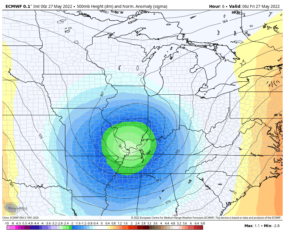
An upper level low pressure center will move off to the northeast over the next 24 hours, according to the European model. High pressure builds in for the coming week. (WeatherBell)

Memorial weekend: grill, swim, or work on the tan

We really couldn't ask for a much better weekend to kick off summer! Abundant sunshine is expected throughout the three-day holiday with slowly moderating temperatures. Though Saturday starts cool in the upper 50s, the afternoon will be pleasant with highs in the low 80s and a very slight south breeze. That south wind increases a bit on Sunday but sunshine remains. Morning lows will be a bit warmer in the mid 60s with highs in the mid to upper 80s. 

By Monday, the warming trend moves the mercury up a couple more degrees, but still shy of 90, with mostly sunny skies and a south breeze. Dewpoints remain near 60, which is comfortable for this time of year. The sunshine will be great for working on those pasty legs and arms and taking a dip in the pool, though the cooler mornings and recent rain might mean it's a tad chilly yet!


Mid-week: dry and hot

If you have to go back to work Tuesday, it'll be a good day to be in the air conditioning. Temperatures warm to 90 degrees in the afternoon with mostly sunny skies and a south breeze. By Wednesday, moisture levels increase, resulting in stickier conditions and increasing high clouds. A stray shower can't be ruled out, but it should be mainly dry. Highs will be in the lower 90s.


End of the week: cold front arrives

Though still about a week out, computer models are indicating the next cold front arrives on Thursday. I've increased rain chances into the "scattered" range for thunderstorms during the day with slightly cooler temperatures due to rain and cloud cover. A lingering shower could stick around Friday, but the front appears to dry up and move off to our south. Temperatures drop back to the lower to mid 80s with lows in the 60s. Overall, with one rain day over the coming week and not excessively hot conditions, there's not a lot to complain about for the coming week!

In closing: I want to proactively extend great appreciation for my team, led by meteorologist Richard, for taking the reins of MWN over the coming week. My wife and I will be celebrating our 25th wedding anniversary in a "tropical climate" next week. You'll be in good hands, and we'll be recharging for the next 25! 


When I return, the first order of business will be onboarding two brand new interns, who I look forward to introducing you to! Be safe and keep those who gave everything for our country in your thoughts this Memorial Day weekend!

Erik Proseus
MWN Meteorologist

----
Follow MWN on Facebook and Twitter for routine updates and the latest info!
Complete MWN Forecast: MemphisWeather.net on the mobile web or via the MWN mobile app
Download our iPhone or Android apps, featuring StormWatch+ severe weather alerts!
MWN is a NOAA Weather Ready Nation Ambassador Meteorologist Erik Proseus is an NWA Digital Seal Holder

Friday, May 20, 2022

Hot and dry weather turns cooler and wetter starting Sunday

Another warm weekend with near record-breaking temperatures, but we finally get a break next week! After an especially warm first three weeks of the month, we finally see some cooler temperatures behind this weekend’s showers. Starting on Sunday and leading into most of next week, we’ll see temperatures right around average, with some days even below. This decrease in temperatures doesn’t come without consequences however; we’ll see an increased chance for showers and maybe a thunderstorm or two come mid-week. 


Friday/Saturday: Will this heat ever end?

Short answer: yes. Long answer: More near-record temperatures – highs in the low 90s – kick off this weekend along with high winds! A warm and windy southerly breeze will help keep temperatures up along with the sun shining through a few clouds. Summer temps only start off the weekend though as a "cold" front moves through on Sunday, bringing cooler, near-average temperatures for the week ahead.

HRRR model from 1pm Saturday to 7am Sunday showing overnight showers and thunderstorms that  continue throughout Sunday. (WeatherBell)


Saturday evening/Sunday

Chances of isolated thunderstorms increase Saturday afternoon but showers and thunderstorms are expected starting Saturday evening and throughout Sunday. Fans of the Storm Prediction Center Convective Outlooks have likely noticed that we are right on the cusp between a Slight (level 2) and Marginal (level 1) Risk for Saturday night. If things do take a turn for the worse however, and stronger storms take shape, we’re looking at main threats of small hail, high winds, and heavy rain (a typical May thunderstorm). Starting Saturday night and heading into Sunday, we start to see temperatures fall, with highs on Sunday peaking in the low 70s! 

SPC Day 2 Convective Outlook: Most of the metro appears to be in a Slight Risk (level 2) with some towns to the east of Memphis in a Marginal Risk (level 1) for severe weather.


Monday: A break from the rain

Temperatures stay in the 70s again on Monday, but conditions dry up, as rain chances decrease to start a new work week. Clouds will decrease, but a slight temperature increase will start on Monday as temperatures are expected to reach the upper 70s. They will increase a little more in the days following, though will still be cooler than the near-record temps we’ve had the rest of the month.

Tuesday/Wednesday

Temperatures increase and will peak in the 80s on Tuesday and Wednesday as more rain comes into the region. Showers are likely throughout both days and isolated thunderstorms, some of which may be severe, are not out of the question. These days will bring the highest temperatures of the week, likely only reaching the mid 80s as clouds and rain will keep higher temperatures away. 


Thursday/Friday

As of right now, temperatures look like they’ll decrease a bit by the end of next week, and chances for rain diminish. Highs towards the end of the week will be in the 70s, and overnight lows will stay in the 60s. There’s a slight chance for showers early on Thursday, but otherwise expect a few clouds, lots of sun, and below-average temperatures to cap off this upcoming week!

All in all, this week will bring more pleasant and spring-like conditions, like more normal temperatures and lots of rain. A cold front to start off and a high pressure system moving in by the end of the week will keep temperatures in the 70s most days, and in the 60s every night. Be prepared for lots of rain and remember that severe weather has not been ruled out yet!

Natalie Naquin
MWN Meteorologist Intern

----
Follow MWN on Facebook and Twitter for routine updates and the latest info!
Complete MWN Forecast: MemphisWeather.net on the mobile web or via the MWN mobile app
Download our iPhone or Android apps, featuring StormWatch+ severe weather alerts!
MWN is a NOAA Weather Ready Nation Ambassador Meteorologist Erik Proseus is an NWA Digital Seal Holder

Thursday, May 12, 2022

April 2022 Climate Report for Memphis, TN

April Climate Recap

Coming out of a slightly warmer than average month of March, April returned to the slightly below average temperatures that marked the first couple of months of 2022. As typical for spring, temperatures varied from above normal to below normal as fronts crossed the region. By mid-month, the first 80s of the year arrived, though a front dropped highs back into the 60s  for a few days before returning to the 80s again. The multiple frontal passages resulted in a wet month as well, with precipitation above normal, even during the wettest month of the year. Five days recorded more than a half inch of rain, while thunderstorms on the 13th dropped over two inches.


Multiple days with thunderstorms resulted in scattered damage reports over the course of the month. The main event for the month occurred on the afternoon and evening of the 13th with multiple reports of wind damage, including trees downed, a funnel cloud sighting in West Memphis that prompted a Tornado Warning, and a few reports of flooding due to more than two inches of rain falling.

Memphis International Airport, Memphis, TN

Temperature 
Average temperature: 62.6 degrees (0.6 degrees below average) 
Average high temperature: 72.8 degrees (0.6 degrees below average) 
Average low temperature: 52.4 degrees (0.6 degrees below average) 
Warmest temperature: 84 degrees (24th, 29th) 
Coolest temperature: 36 degrees (1st) 
Heating Degrees Days: 135 (5 above average)
Cooling Degree Days: 70 (6 below average) 
Records set or tied: None
Comments: None

Precipitation 
Monthly total: 6.62" (0.75" above average) 
Days with measurable precipitation: 11 (0.5 days above average) 
Wettest 24-hour period: 2.72" (12th-13th) 
Snowfall: 0.0"
Records set or tied: None
Comments: None

Miscellaneous 
Peak wind: South/42 mph (10th) 
Average wind: 9.9 mph 
Average relative humidity: N/A
Average sky cover: N/A

 Click here for a daily statistical recap for Memphis International Airport.
 

Cirrus Weather Solutions / MemphisWeather.net, Bartlett, TN

Temperature 
Average temperature: 61.1 degrees 
Average high temperature: 73.4 degrees 
Average low temperature: 49.6 degrees 
Warmest temperature: 85.9 degrees (29th) 
Coolest temperature: 32.6 degrees (1st) 
Comments: None 

Precipitation 
Monthly total: 5.97" (automated rain gauge), 6.19"(manual CoCoRaHS rain gauge) 
Days with measurable precipitation: 11
Wettest date: 2.59" (13th) (via automated gauge) 
Snowfall: 0.0"
Comments: None

Miscellaneous 
Peak wind: Southwest/34 mph (12th)
Average relative humidity: 65% 
Average barometric pressure: 30.01 in. Hg
Comments: None

Click here for a daily statistical recap for Bartlett, TN.
 

MWN Forecast Accuracy

MWN average temperature error: 2.14 degrees 
MWN forecast temperatures within 2 degrees of actual: 64% 
MWN average dewpoint error: 2.82 degrees 
MWN forecast dewpoints within 2 degrees of actual: 52% 

MWN's forecasts extend out five periods (2.5 days, or roughly 60 hours). Historical accuracy statistics can be found here.
 

Climate Outlook - May 2022

The May climate outlook for the United States from the Climate Prediction Center is shown below. Above average temperatures are forecast for much of the southern tier and up the east coast with strongest chances in the Southern Plains into New Mexico. Below average temperatures are expected for the Pacific Northwest and Northern Plains to Upper Midwest. Odds favor near average temperatures for Memphis. The average temperature for May is 72.1 degrees.


Precipitation is expected to be above normal across the northern U.S. from the Pacific Northwest to the Upper Midwest, as well as into the Central Plains. Below average precipitation is forecast for the central Pacific coast into the intermountain west, Four Corners, and then into the Rio Grande Valley. For Memphis, odds favor near average precipitation, which historically averages 5.27 inches in May.

--- 
Follow MWN on Facebook and Twitter for routine updates and the latest info! 
Complete MWN Forecast: MemphisWeather.net on the mobile web or via the MWN mobile app 
Download our iPhone or Android apps, featuring StormWatch+ severe weather alerts!
MWN is a NOAA Weather Ready Nation Ambassador Meteorologist Erik Proseus is an NWA Digital Seal Holder

Wednesday, May 4, 2022

Severe storms Thursday, pleasant start to the weekend, then the heat comes on!

Tonight you get a series of "quick-hitters" on the MWN Blog. I've got three topics for you:
  1. Severe weather potential on Thursday into Thursday night
  2. Nice spring weather Friday and Saturday
  3. Our first early-summer heat wave arrives to start the week

Severe weather potential Thursday

We've been watching this event for a few days and wondering just how it might play out, as computer model data has kind of had some trouble with the potential for multiple rounds of storms, especially when the result of one round is likely to affect the next. Here's how we think it will play out as of Wednesday evening.

There will be three rounds of weather that affect the larger Mid-South region. The first moves out of OK and across northern AR overnight and is likely to pass us by just to the north Thursday morning. A few showers could sneak into areas north of I-40 but the majority of us remain dry as temperatures only drop to the mid 60s by morning with muggy conditions expected. Here's how the HRRR thinks that round plays out:

The Thursday evening HRRR model forecast radar for the overnight hours through 10am Thursday. (WeatherBell)

Once it goes by to the north, instability increases markedly during the day with the potential for some filtered sunshine and definitely some good southerly flow of warm moist air. As temperatures top out in the mid 80s by early afternoon, you'll be able to "feel" the setup for storms, which could be strong to severe as they move through. Between 3-6pm, areas south and west of Memphis will get the brunt of what should be a long squall line, but the metro will be on the northern end and could see some strong storms. This is where our Level 2 (Slight) Risk for severe weather comes from. Damaging wind will be the main threat, as well as lightning and downpours. Rain is likely to linger into the early evening. Again, I give you the evening HRRR model, as well as our severe weather infographic:

The Thursday evening HRRR model forecast radar for 10am through 10pm Thursday shows a line of storms diving through AR with storms impacting the metro in the late afternoon hours. (WeatherBell)


Finally, how much rain falls with the late afternoon batch will determine how much unstable air is left as the cold front itself arrives in the wee hours of Friday morning. The late evening hours should be pretty decent, but showers and probably a few thunderstorms will arrive in the "zero-dark-thirty" hours Friday morning, which could wake the dog or small children. I don't expect these to have much in the way of a bite, but maybe a little bark! By the time the rest of us wake up Friday morning, rain should pretty much be gone. Once again, the HRRR model (though this one could vary some based on how much storm fuel round 2 leaves behind):

The Thursday evening HRRR model forecast radar valid 10pm Thursday though 8am Friday. Though the HRRR does not bring much more than showers through during the overnight, if the late afternoon round is not as strong, it could leave some storm fuel behind, resulting in more thunder early Friday morning. (WeatherBell)


Enjoy some spring weather while you can!

In the wake of  Friday morning's front, a beautiful Friday and Saturday are in store. Friday will be a bit breezy, but mainly dry with some departing clouds. Highs top out in the mid 70s - a few degrees below average. Friday night into Saturday morning will be mostly clear with temperatures in the 60s Friday evening and upper 50s by Saturday morning. Perfection! Expect lots of sunshine Saturday with light wind, low humidity, and highs topping out near 80. Sounds like a great day to visit the farmer's market or get some yard work done! Another pleasant night is on tap Saturday night with lows near 60.


The heat is on!

We've had some warm days in the mid 80s recently, and you summer haters (or spring lovers?) have been heard. Yes, it's been a bit sticky and warm, but mid 80s are not that unusual in early May despite being above average. But 90s?? No thanks! Unfortunately, there is high confidence that that is where we are headed to start next week. 

The warm-up starts Sunday with low humidity and breezy south wind returning, resulting in temperatures rising quickly from 60 in the morning to the upper 80s by afternoon. And it only gets hotter from there. An atmospheric pattern called an "omega block" sets up and centers itself over the Mississippi/Ohio Valleys early next week, meaning anomalously high pressure overhead. That will squash all rain chances (and even cloud chances TBH), and sends the mercury soaring. 

The European model ensemble forecast of upper level pressure for next Wednesday features massive high pressure extending from Mexico into the Midwest and Great Lakes with low pressure in the western U.S. and off the Atlantic seaboard. The wind pattern (annotated in black) appears to form the shape of the Greek letter omega, thus it is called an "omega block," as it tends to "block" the weather pattern from moving for several days. This results in stagnant conditions under the high. (WeatherBell)

Expect high temperatures in the lower 90s Monday through Wednesday with lows near 70 or just above. South wind will also mean a measure of humidity to boot! Some models are even poking at mid 90s mid Wednesday, but I'm not quite ready to go that warm just yet. No matter, high temperature records will be in jeopardy. Monday's is 92°,  while Tuesday and Wednesday the records are each at 90°. There's a good chance those two get broken. For models to forecast record highs a week out tells us something about the strength of this particular high pressure system! Trends show a slight relaxing of temperatures towards the end of next week, but not a lot. If you have your sights set on the World Championship Barbecue Cooking Contest next week, plan accordingly! The grills won't be the only things putting off some heat!

The NWS National Blend of Models predicts 90s for much of next week. (WeatherModels)


Erik Proseus
MWN Meteorologist

----
Follow MWN on Facebook and Twitter for routine updates and the latest info!
Complete MWN Forecast: MemphisWeather.net on the mobile web or via the MWN mobile app
Download our iPhone or Android apps, featuring StormWatch+ severe weather alerts!
MWN is a NOAA Weather Ready Nation Ambassador Meteorologist Erik Proseus is an NWA Digital Seal Holder