
It’s a day of wild weather across the central United States, with a wide swath of damaging winds extending across Colorado, Kansas, Nebraska, South Dakota, Iowa, Minnesota, and Wisconsin! There is also a major severe weather risk, as a squall line blasts across the upper Midwest with 80-100mph winds and embedded tornadoes, some of which could be strong. The Storm Prediction Center has put the area under a level 4 of 5 risk for damaging winds and tornadoes just a few days after a tornado outbreak swept through the Mid-South and Ohio Valley. This is completely unprecedented for December in the upper Midwest!
Thankfully, no major severe weather is expected here. However, another round of unseasonable warmth followed by thunderstorms is in the cards for the Mid-South this week. An initial round of showers and thunderstorms will move Thursday into the overnight hours, with a second round coming through on Saturday. A cold front will stall out Thursday night right across or just north of the metro, with temperatures not budging much for most of us. Then, on Saturday, the front finally pushes through the Mid-South with falling temperatures. Heading towards Christmas next week, we finally return to seasonable December weather, with chilly nights and sunny, cool, and crisp days. We deserve it after the severe weather last week!
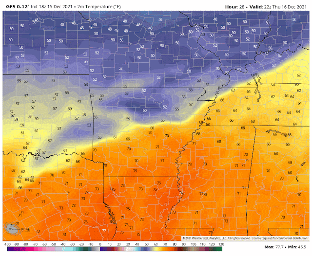 |
| Animation of the temperature see-saw over the next few days (through Saturday afternoon), from the GFS (American) model. Luckily, we avoid the extreme weather to our west! (WeatherBell) |
Thunderstorm round #1: Thursday into Friday
As the cold front makes its initial push into our area, temps will stay warm with lows near 60 overnight and up to 70 or just above Thursday and Friday afternoons as south winds bring in Gulf moisture. Winds could be fairly gusty on Thursday, especially in heavier downpours and thunderstorms. A line of showers and thunderstorms will move towards the Mid-South, slowing down as they approach the area as a cold front stalls. The line will then begin to move back to the north Thursday night as the front retreats as a warm front. Some models depict a broken line of showers and storms, and some depict a more solid line. Either way, storms could have heavy rainfall and gusty winds, especially west of the Mississippi River. After the front lifts north of the area Friday morning, we’ll dry out for a bit with just a few scattered showers lingering for the afternoon hours and warm temperatures once again.
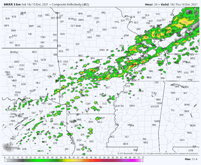 |
| HRRR model depiction off showers and thunderstorms moving through the area Thursday afternoon into Friday morning. Best severe threat stays to the west, but gusty winds can’t be ruled out (WeatherBell) |
Thunderstorm round #2: Saturday
The cold front finally makes it back to the metro area on Saturday morning, as a large area of high pressure to our north finally budges to the east. This will once again push a line of showers and possibly a few storms through the metro during the morning, but at this time it looks like it will be weakening as it does so, with a minimal severe threat. Still, some gusty winds, heavy rain, and lightning can’t be ruled out as the front pushes through. Temps will then fall from the low/mid 60s in the morning into the 40s by the time the sun goes down Saturday. Lows will plunge back to near freezing Saturday night.MUCH calmer next week, feeling like the holiday season!
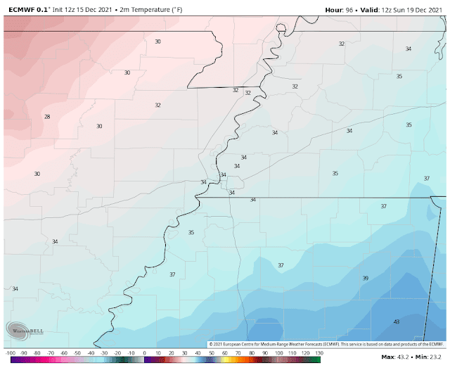 |
| Much cooler temps return by the weekend. There is widespread model support for lows in the low 30s by Sunday morning, with a frost or freeze likely. (Euro mode via WeatherBell) |
The weather calms down and gets into the holiday spirit for next week. A large area of high pressure will move in beginning Sunday, with chilly temperatures and lots of sunshine. Highs will only be in the low to mid 40s on Sunday! We rebound as the week goes on, with nights remaining chilly in the 30s and highs slowly rising through the 50s. We’ll be in the low 50s Monday, mid 50s Tuesday, and upper 50s by Wednesday.
Early look at Christmas weather
An early look (very early, so should be taken with a big grain of salt!) shows seasonable weather, if not a bit warmer than normal. At this time, we're not looking for anything record-breaking, and it’s also looking dry. That would mean a high in the upper 50s to around 60, with a mix of sun and clouds. This could easily change over the next 10 days, so stay tuned as the forecast is further refined!
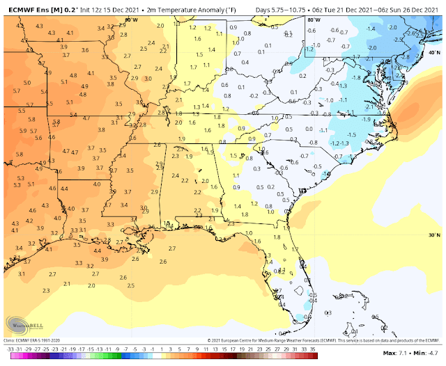 |
| European model ensemble depiction of temperature anomalies for the 5 day period from Dec. 21-26th. Warmer than average, but not looking record breaking. Other models are fairly in line with this as well. (WeatherBell) |
Christian Bowles
MWN Intern
----
Follow MWN on Facebook and Twitter for routine updates and the latest info!
Complete MWN Forecast: MemphisWeather.net on the mobile web or via the MWN mobile app
Download our iPhone or Android apps, featuring StormWatch+ severe weather alerts!
----
Follow MWN on Facebook and Twitter for routine updates and the latest info!
Complete MWN Forecast: MemphisWeather.net on the mobile web or via the MWN mobile app
Download our iPhone or Android apps, featuring StormWatch+ severe weather alerts!
 | |
| MWN is a NOAA Weather Ready Nation Ambassador | Meteorologist Erik Proseus is an NWA Digital Seal Holder |
No comments:
Post a Comment