
Surprise! We reached 65 degrees on Monday, which felt so good after chilly conditions much of last week and this weekend. Unfortunately, that warmth comes to an end tonight. Here's a quick look at the next several days.
 |
| Wind chills expected early Wednesday morning |
Highs for the first half of this week will struggle to reach 40, with a slow rise to the lower 50's by the weekend. While we will see a change in the weather, thankfully no precipitation is expected as Canadian high pressure moves in.
Another dry cold front is expected to move through Friday, bringing a halt to any warming that we gain over the latter half of the week.
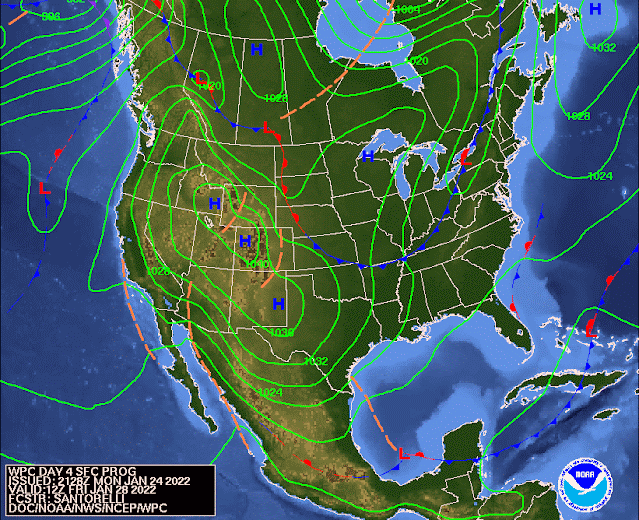 |
| Surface feature forecast for Friday morning showing another cold front approaching the Memphis area. (NOAA) |
The next chance for any precipitation looks to hold off until the middle of next week (which by the way is the start of February), and looks like it will be all rain.
So be sure you're prepared for the wind & colder temps on Tuesday and Wednesday!

Richard Hoseney
MWN Meteorologist
----
Follow MWN on Facebook and Twitter for routine updates and the latest info!
Complete MWN Forecast: MemphisWeather.net on the mobile web or via the MWN mobile app
Download our iPhone or Android apps, featuring StormWatch+ severe weather alerts!
MWN Meteorologist
----
Follow MWN on Facebook and Twitter for routine updates and the latest info!
Complete MWN Forecast: MemphisWeather.net on the mobile web or via the MWN mobile app
Download our iPhone or Android apps, featuring StormWatch+ severe weather alerts!
 | |
| MWN is a NOAA Weather Ready Nation Ambassador | Meteorologist Erik Proseus is an NWA Digital Seal Holder |
No comments:
Post a Comment