
** UPDATED: 12:00PM FOR ISSUANCE OF A WINTER WEATHER ADVISORY **
** UPDATED: 4:30PM FOR UPDATED OFFICIAL GRAPHICS FROM THE NWS **
ORIGINAL POST:
We're about 24 hours out from the second winter weather event of 2022. I will attempt to provide more detail to supplement what I wrote yesterday in this space, starting with a high level overview, then cutting to the chase.
Overview
Seems no winter weather event is easy to forecast in the south, but this one presents its own challenges like most. The Memphis area will basically be on the periphery of a pair of systems, one passing by to just to the north and another moving in from the south, probably merging with the one to our north once they pass us by to the east. Both are likely to have some effect on us in some way, then throw in temperatures (surface and low levels) that are transitioning from a rain profile to a snow profile (through various stages of "mix") and you have a real challenge.
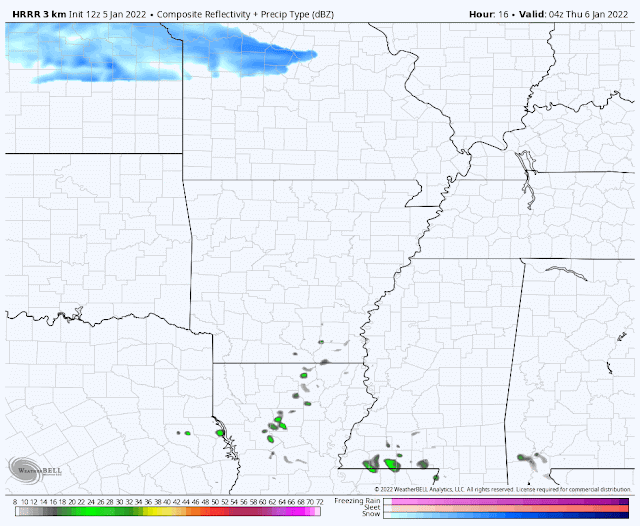 |
| HRRR model simulated radar forecast from 10pm Wednesday through 2pm Thursday. Note the precip moving north from MS and AR and becoming freezing rain and sleet, while snow (blue) moves southeast from Missouri and merges with the southern system over the Mid-South. (WeatherBell) |
What to expect
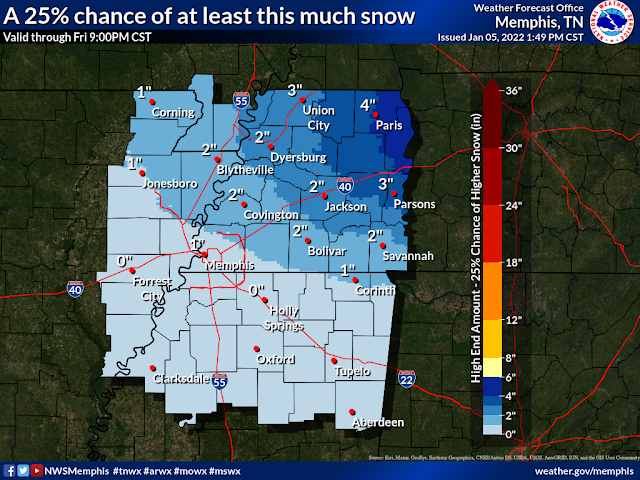
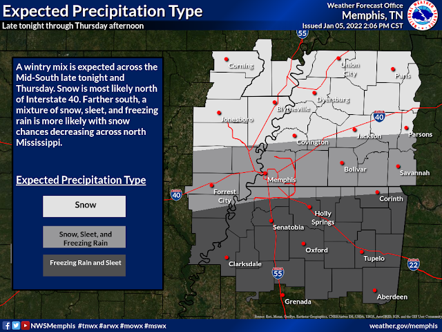
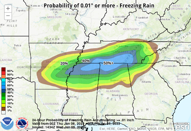
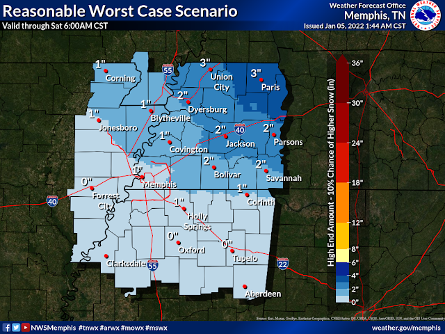
The details below are what I consider the "most likely" case for the immediate Memphis area, or near the I-40 corridor. Locations to the north (i.e. Tipton Co and points north) could see a bit more snow/sleet and less freezing rain, while northern MS (DeSoto, Tunica, Tate, Marshall) could lean more towards rain to freezing rain and less snow and sleet.
Precipitation timing: Early morning (3-5am) until early afternoon (12-2pm)
Precipitation types: Light rain to freezing rain early, mixing with sleet around rush hour, then changing to snow by mid-morning, ending as snow flurries or freezing drizzle
Precipitation amounts: Less than 0.10" of freezing rain, about 1/4" of sleet, less than an inch of snow
Temperature: Falling to 32 degrees by about 5-6am, then into the upper 20s before noon
Wind: North at 10-15 mph (wind chills 15-20 degrees)

What happens if...
What does it look like in boom and bust scenarios? If the system overperforms with precipitation from the south, icing would be the biggest problem. One tenth of an inch of ice would cause very slippery conditions, including on elevated roadways and overpasses and likely some power outages. If the northern branch of the two systems dips further south and temperatures are cold enough, the boom scenario would result in a bit less sleet and more than an inch of snow. Both of these scenarios have about a 10% chance of occurring.
In the bust scenario, the northern system misses us to the north and the southern system doesn't see as much precipitation as currently expected, reducing totals of all precip types. This would result in little to no hazardous conditions from freezing rain or sleet and only snow flurries later. Again, a low probability of occurrence, though either scenario is possible.
Impacts
With initial precipitation falling in liquid form and temperatures falling to freezing early, a light glaze of ice is likely to occur on exposed objects or elevated surfaces by or during rush hour. As precipitation mixes with sleet, a coating is likely on most surfaces by mid-morning, perhaps excluding heavily traveled thoroughfares where vehicular traffic will keep road surfaces a bit warmer. With light snow falling on surfaces with a bit of ice in place, it will overlay and "stick," coating most everything.
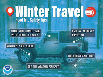
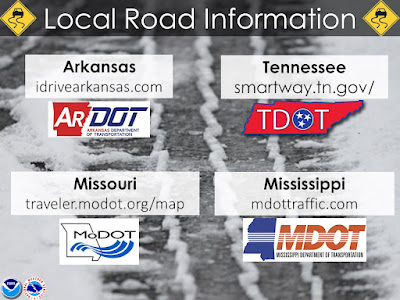
Plan ahead for the likelihood of some travel issues starting as early as the morning rush and continuing through the day and potentially into Friday. Temperatures Thursday night will dive into the upper teens and only climb to the mid 30s Friday with partial sunshine. You might want to plan those alternate routes that do not include high overpasses/flyovers and long stretches of elevated roadway. Here are some other safety tips:
MWN Meteorologist
----
Follow MWN on Facebook and Twitter for routine updates and the latest info!
Complete MWN Forecast: MemphisWeather.net on the mobile web or via the MWN mobile app
Download our iPhone or Android apps, featuring StormWatch+ severe weather alerts!
 | |
| MWN is a NOAA Weather Ready Nation Ambassador | Meteorologist Erik Proseus is an NWA Digital Seal Holder |
No comments:
Post a Comment