Overview:
After a much colder than average January for the Memphis metro we'll finally start to see a warmer pattern take shape for the next few days. A building ridge to our east will help bring warmer, moist air into the region into this weekend. As you can probably expect, with any warm flow coming off the Gulf you're also going to get plenty of chances for rain in the forecast. We'll wrap up discussion with a potentially significant system affecting the Mid-South next week (with relatively cold air in the area) before yet another arctic airmass overtakes the region.
January Climate Summary:
Before we talk about the upcoming weather, lets take a look at just how cold this January was.
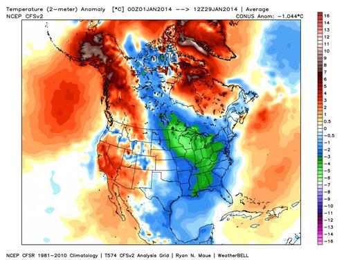 |
| 2-meter Temperature Anomalies for (most of) January |
The above image shows an average of observed temperatures for the month of January compared to climatology. This indicates that Memphis was nearly 3° Celsius (~5.5° Fahrenheit) below average for the period. Another interesting climate statistic to point out is that Memphis averages 14.5 days out of the month with a low of less than 32°. This January we have had 23 days that meet that criteria! It has without a doubt been a frigid January, so now lets get into the details of the brief warm up.
Weather Discussion:
Significant warming begins today with gusty south winds ushering warmer, moist air into the Mid-South. Expect this to continue through Saturday with rain chances beginning Friday and increasing into Saturday.
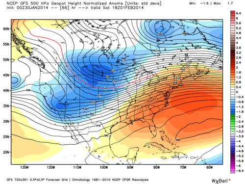 |
| GFS 500 mb Normalized Geopotential Height Anomalies mid-day Saturday |
Above is a modeled image of the middle sections of the atmosphere on Saturday. It showcases our warmer pattern with a ridge of high pressure to our east. The broad clockwise flow of this ridge brings warm, moist air from the Gulf of Mexico into the region.
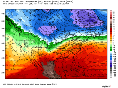 |
| GFS 850 mb Temperatures and Winds mid-day Saturday |
The effects of the ridge can be seen in the above modeled image of temperatures in the lower levels of the atmosphere. Relatively warm air can be seen as far north as New England (although snow pack in some of these areas works to prevent these warmer temperatures from reaching the surface).
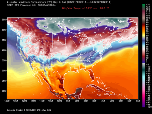 |
| GFS 2-meter Maximum Temperatures for Saturday |
Above are forecasted maximum temperatures for the same day, indicating temperatures as high as 60 degrees for the Memphis metro on Saturday.
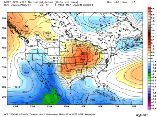 |
| GFS Mean Sea Level Pressure Normalized Anomalies for Sunday night |
Unfortunately a brief return to colder (but not frigid) temperatures is expected on Sunday as a cold front moves through the region. The above modeled image shows surface pressure conditions on Sunday evening, with a decent cold core high pressure system over the region. It's important to note that the orange colors do not represent warmer temperatures, but higher pressure values. Since this is a cold core high pressure system, this actually suggests cold temperatures.
Tuesday is where the forecast gets quite tricky, as we have relatively cold air over the area with a low pressure system and its associated precipitation setting up somewhere near the Mid-South.
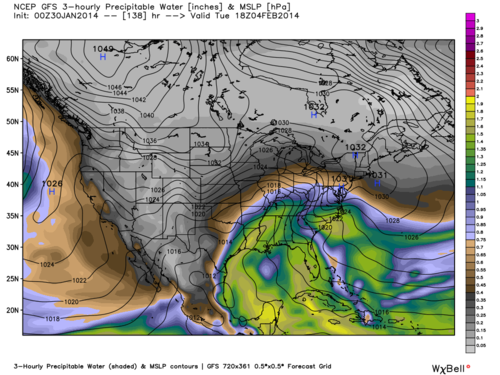 |
| GFS 3-hourly Precipitable Water Values for Tuesday afternoon |
Above is a modeled image of precipitable water values mid-day Tuesday. It is basically showing the extent of the deep moisture in the region due to the approaching low pressure system from the Gulf of Mexico. Values are peaking near 1.5 inches which is fairly significant for a potential winter weather event (given that relatively cold air being present at the surface).
Unfortunately I cannot answer all the questions concerning possible winter weather accumulations from this storm system (no one can this far out). This winter weather set up is similar to what we are used to with borderline temperature problems leading up to the event. We will not know for sure the extent of the cold air and the exact track of the low pressure system until the event is actually happening. Both of these things are extremely important as small changes in either factor will lead to huge differences in precipitation types and amounts. However, things will become a bit more clear over the next few days and we'll be sure to let you know when we have a better idea of possible precipitation types and accumulations. As of now we're confident the event will start as rain with a changeover of precipitation possible during the latter half of Tuesday and heading into Wednesday.
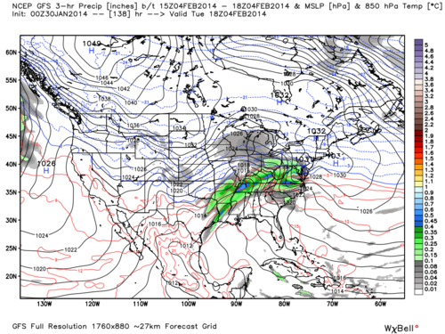 |
| GFS 3-hour Precipitation Amounts and 850 mb Temperatures for Tuesday afternoon |
Above is the same weather model's precipitation estimation for late Tuesday morning. This indicates some heavier precipitation is possible with the high amount of moisture present. Currently this model has the freezing line in the lower levels of the atmosphere farther north during the period of heaviest precipitation, meaning mostly rain with perhaps some change over at the end of the event (note that this is just one particular model solution,
not a forecast).
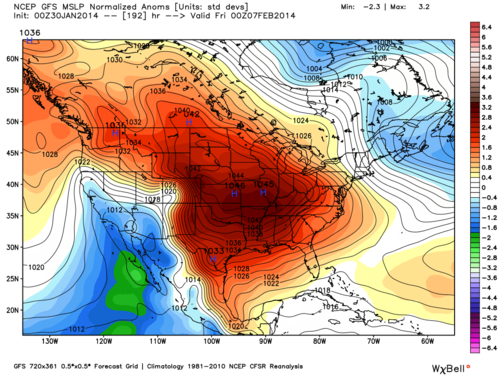 |
| GFS Mean Sea Level Pressure Normalized Anomalies for next Thursday night |
One thing I can say with some certainty is that frigid temperatures are likely to return for the first weekend of February. The image above shows a huge area of arctic high pressure building in at the end of the modeled period (once again orange and red colors suggesting high pressure strength, not warm temperatures). Don't let this warm Saturday fool you, winter is certainly not over!
Get full details on the forecast from MWN by clicking
here.
-William Churchill, MWN Social Media Intern
----
Follow MWN on
Facebook,
Twitter, and
Google+
Visit
MemphisWeather.net on the web or
m.memphisweather.net on your mobile phone.
Download our
iPhone or Android apps, featuring
StormWatch+ severe weather alerts!

No comments:
Post a Comment