Showing posts with label freezing rain. Show all posts

Tuesday, January 19, 2016

Tonight is worth monitoring - Winter Weather Advisory posted

** UPDATED at 3:35pm for southward extension of the Winter Weather Advisory, adjustments to the overview section, and red text in the discussion **

Yesterday I discussed the risk of reading much into medium-range snowfall forecasts, especially in terms of amounts, in the context of potential Mid-South snowfall this Friday. Today, we take a closer look at tonight's system, which now looks to bring some potentially impactful weather to northern portions of the metro. First the overview, then I'll get into the weeds:


Overview - what you need to know

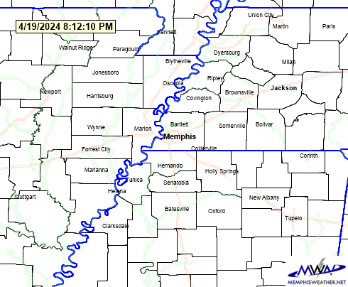
Watches/Warnings/Advisories:  Winter Weather Advisory for Tipton County, 9pm tonight til noon Wednesday. Winter Weather Advisory for Crittenden, Shelby, & Fayette Counties, 9pm tonight til 9am Wednesday.
What: Freezing rain / Sleet
Where: North of I-40, with the highest confidence in impacts over Tipton County
When: As early as midnight tonight, most likely between 3-9am Wednesday
How much: Light (0.10") icing in north Shelby/Crittenden/Fayette Co's; up to 1/4" of ice in Tipton County with additional minor sleet accumulation
Possible Impacts: Minor icing mainly on bridges/overpasses in north Shelby County. A glaze on all surfaces with minor sleet accumulation in Tipton County, resulting in hazardous travel before noon Wednesday.
Confidence: Moderate-High in Tipton County, Moderate for the rest of the metro

After careful review of all available data this morning, confidence has increased in the potential for a freezing rain /sleet event for areas north of the Bluff City. In our metro counties, Tipton is our chief concern. Areas from Crittenden County east through Shelby and Fayette County are of some concern for light icing as well. North Mississippi is not expected to see freezing precipitation of impact at this time.

Detailed discussion - the details behind the forecast

Precipitation will move across the region overnight tonight through mid-morning Wednesday as weak low pressure moves into the area and southerly wind increases overnight. Temperatures during the day today likely won't reach earlier forecasted highs due to cloud cover and easterly wind (which doesn't bring warm air), probably only reaching the mid 30s. This sets the stage for air to be near or below freezing north of I-40 tonight when precipitation arrives.

As the night progresses, very slow warming is expected as southerly wind increases aloft, but the freezing line will likely be very near the Shelby/Tipton border as precipitation falls most steadily in the 3-9am time frame. For northern Shelby and southern Tipton County, warm air above the surface means the surface temperature will determine whether the rain that falls freezes on contact (freezing rain, which glazes cold exposed surfaces) or not (at 33° or above). Further north in Tipton County, there appears to be some colder air trapped in the lowest couple thousand feet, which introduces the possibility of freezing rain mixing with sleet. A very small amount of precipitation is possible late this evening and early overnight as mid-level moisture moves over the region. However, due to very dry air in the low levels (today's dewpoint below 15° is Exhibit A), most of that initial precipitation should evaporate as it falls. It will serve to moisten up the low levels though, prepping the atmosphere for the steadier rain later in the night.

From the NWS, the probability of one tenth of an inch of freezing rain (enough for minor impacts, including hazardous roads) through 6am Wednesday.

Potential impacts

Temperatures could be near or just below freezing in Shelby/Fayette/Crittenden Counties during this early period, but any rain should be so light as to not cause much in the way of impacts. If you'll be traveling on overpasses or bridges overnight though (say for instance, the new mega-flyovers in east Memphis), you'll want to exercise caution.

The main impacts will be felt in Tipton County, where total ice accumulation from this event could reach 1/4" with minor sleet accumulation as well, especially near Covington. This will be enough to make roads slick (especially since the temperatures ahead of this system are cold and there is no sunshine to warm the roads) and glaze over trees, power lines, and other exposed surfaces. Widespread power outages are not expected though due to the relatively light amount of precip and, with temperatures warming above freezing during the day Wednesday, ice should melt as the day goes on. Caution is advised for those traveling after midnight and before about noon Wednesday in Tipton County and points north, or if you're heading east towards Nashville on I-40 during the morning.

Early afternoon winter weather graphic from NWS-Memphis. Click for larger image.
Given model trends, if there is a change to the forecast, it would most likely be the introduction of more slightly greater amounts of freezing rain over northern Shelby County. Everyone in west TN and east AR needs to monitor the situation carefully, but those from north of West Memphis to the northern suburbs of Memphis should be prepared for the possibility of light freezing rain that could impact travel early Wednesday morning. **UPDATE: This potential scenario is now covered by the expansion of the Winter Weather Advisory to include the counties bordering MS, including Shelby County. **

Looking ahead, rain is expected Thursday and Thursday night before likely changing to light snow early Friday. This system also has the potential for some winter weather impact on Friday. We'll tackle that one once we get through the first one!

We'll have the latest info on our social media channels listed below. Also be sure to download the MemphisWeather.net mobile app for current conditions from around the metro, our latest MWN Forecast, current watch/warning/advisory map, as well as our Twitter feed. StormWatch+, when activated, will let you know of any changes to the Winter Weather Advisories via push notification.

Erik Proseus
MWN Meteorologist

----
Follow MWN on Facebook, Twitter, and Google+
Visit MemphisWeather.net on the web or m.memphisweather.net on your mobile phone.
Download our iPhone or Android apps, featuring StormWatch+ severe weather alerts!

Thursday, February 19, 2015

Thursday evening update on Friday's winter storm [video blog]

Here's our evening update on the winter weather expected on Friday via video blog (14 min). Watch for full details or see below for the bottom line.


Total precipitation in west TN could exceed 2" for the weekend. NAM model shown above. Graphic courtesy WxBell.

Bottom line

Scattered light sleet/snow showers Friday morning become primarily freezing rain by lunchtime, increasing in intensity in the afternoon as temps near 30. Freezing rain becomes rain as temps rise above 32 by late afternoon (north MS) to early evening (southwest TN). Forecast winter precipitation amounts shown below.  Heavy rain will be a threat, including a slight chance of flash flooding, on Saturday and thunder is also possible. Precipitation ends Sunday morning as temperatures fall.


Erik Proseus
MWN Meteorologist

----
Follow MWN on Facebook, Twitter, and Google+
Visit MemphisWeather.net on the web or m.memphisweather.net on your mobile phone.
Download our iPhone or Android apps, featuring StormWatch+ severe weather alerts!

Sunday, February 15, 2015

Sunday afternoon update on President's Day Winter Storm [video blog]

I recorded a video update on the winter storm expected across the Mid-South tonight and tomorrow. This information is valid as of 2:30pm Sunday.  Winter Storm Warnings are in effect for the entire Mid-South from 6pm tonight to 6pm Monday.  Main period of precipitation will be 3am-3pm Monday with the heaviest between 6am-noon.


Here are a couple of the pertinent slides if you don't have 16 minutes to watch the entire video (we hope you do though!).


We'll update on social media throughout the event.  Follow us on our accounts listed below.

Be warm and stay safe,

Erik Proseus
MWN Meteorologist

----
Follow MWN on Facebook, Twitter, and Google+
Visit MemphisWeather.net on the web or m.memphisweather.net on your mobile phone.
Download our iPhone or Android apps, featuring StormWatch+ severe weather alerts!

Wednesday, January 8, 2014

Winter Weather Advisory: light icing expected Thursday AM

It seems we can't catch a break from wintry weather, and yet no good snowfall!

Before we ended our 67-hour streak of below-freezing temperatures this morning at 10am, the National Weather Service had issued a Winter Weather Advisory for the metro, in effect tonight until noon Thursday.  An upper-level disturbance will move across the area Thursday, bringing with it a good chance of precipitation.  Unfortunately, the remnants of the Arctic outbreak linger and temperatures will be near freezing for at least a portion of the precipitation period.

Winter Weather Advisory area in purple

Without going into much detail on model data, we'll just say it's not been cooperating and confidence in the event has been, and still continues to be to an extent, somewhat low. However, I'm convinced of a couple of things: precipitation will fall and temperatures will (as usual) be tricky, floating near the freezing point for perhaps a good part of the time precip is falling. The main concern for this event will be ice and the potential for hazardous travel conditions, mainly Thursday morning.

Light precipitation has already broken out across portions of AR and this will shift east this evening. Since our starting point for temperatures will be the lower 40s this evening, I expect intermittent periods of mainly light rain or sprinkles from the evening hours into the early overnight period as the lower atmosphere moistens up (the air is very dry in the lowest 3,000'). As it moistens, surface temperatures will be falling into the 30s. Some sleet could mix with the light rain after midnight through about 6am. This will not be a steady period of precipitation through 6am, but rather intermittent "showery" type of precip.

After 6am, and especially after 8am, temperatures will be hovering near the freezing mark as steadier precipitation arrives. The steady, but overall light, precip is expected to last throughout the morning.  The big question - and one that models disagree on - is temps during the morning hours.  One camp says they warm up during the precip resulting in very minor ice accumulations.  The other (and one we put more faith in for METEOROLOGICAL reasons, not HYPE), keeps temps near freezing for much of the morning.  The reason: with steady precip and cloud cover and no movement of warm air into the area from a warmer source nearby (advection), we don't see temps rising much on their own until precip tapers off some. If precip were to be more spotty than we are expecting, then temperatures likely would be a touch warmer and we'd see more rain than ice.

Below you'll see two graphics from the winter weather desk at the Weather Prediction Center at NOAA: the probability of accumulating (at least 0.01") freezing rain and the "worst case" freezing rain accumulation, defined here by the 90% threshold.  In other words, there is only a 10% chance of exceeding the values shown in the second image.  Our chances of accumulating freezing rain are near 100%.  The "worst case," according to WPC, is near 0.10".  (However it should be noted that one model that has been consistent for a couple of days says we get nearly 4 times that during the morning hours. It's an outlier, but it's also a consistent one.)

Probability of freezing rain accumulating at least 0.01" by noon Thursday

"Worst case" map showing the 90th percentile freezing rain accumulation, meaning there is only a 10% chance an area will see more than indicated.

The bottom line

So our forecast is for spotty light rain this evening through midnight, mixing with a little sleet after midnight.  The rain will become light freezing rain mixed with sleet by dawn as temps hit 32, then change back to rain showers by late morning as temps warm above freezing.  No (or VERY little) snow is expected due to above-freezing temperatures aloft. Total freezing rain/sleet accumulations could be up to 0.20" though will more likely be closer to 0.10".  The low will be 31 and tomorrow's afternoon high 40, though we'll be in the 31-34 range throughout the morning.

One-tenth of an inch of ice is enough to cause bridges/overpasses to freeze.  I understand TDOT is already on the roads pre-treating.  This is a wise move.  Plan ahead for tomorrow morning's commute.  By afternoon, I expect very few problems with rising temps, but the morning could be dicey.  I don't know about schools closing, but I do know you working parents want them in school after an extended winter break! LOL  Follow our social media accounts listed below for updates and more detail as they become available.

----
Follow MWN on Facebook, Twitter, and Google+
Visit MemphisWeather.net on the web or m.memphisweather.net on your mobile phone.
Download our iPhone or Android apps, featuring StormWatch+ severe weather alerts!

Saturday, December 7, 2013

Recapping yesterday's icy day and details on round 2 of wintry weather

Winter weather forecasts, at least from MWN and as far as we could tell most other local outlets, were pretty accurate for yesterday's winter weather system... with one critical exception: surface temperatures.

Rather than reaching the freezing mark by mid-morning (which they did) and then continuing to slowly fall, they stopped falling.  In fact, between periods of precipitation, there was actually a very slight rise to 32.5-33 degrees.  This made ALL the difference in the resultant amount of ice in the Memphis metro.  Instead of 0.25-0.50" of ice, which would have been likely had temps remained just below freezing, most places saw 0.10-0.20" and up to a quarter inch of sleet.  (Totals were MUCH higher just to our north where the air at the surface and aloft was colder.) Once precip tapered off and ended by late afternoon, the temperatures began falling, reaching the upper 20s by early evening.

Ice-covered trees in Bartlett Friday afternoon

The WXLIVE! weather station at MWN, covered in ice

The bottom line: one or two degrees of error on the forecast resulted in half or less the predicted ice, better road conditions that anticipated, and thankfully many less power outages. MLGW reached a peak somewhere above 8000 outages Friday afternoon and had nearly 100% restored by early Saturday morning. Kudos!  I won't say that any cancellations or postponements were for naught - the forecast and expected impacts were based on what we knew going into the event.  MWN picked up 0.60" of liquid (melted) precip after the temperature first hit 32 at 8:15 Friday morning. We were basically 1 degree from having a completely different scenario by last evening.


What's Next?

Looking ahead, we promised another round of wintry weather and that is still in play.  The NWS has issued Winter Weather Advisories for the entire area for the overnight hours tonight, ending at 6am Sunday.  Though precipitation amounts are not expected to be as high with the next round, there are a couple of key differences. Surface temperatures (at least overnight into tomorrow morning) will not be hugging the freezing mark - they'll start in the upper 20s.  In addition, very little melting today will mean trees and power lines START with minor ice accumulations, so anything additional will mean extra ice weight. One tenth of an inch to start and another one to two tenths falling totals a quarter inch of ice - which is Ice Storm Warning criteria.

Winter Weather Advisory posted for a large part of the area Saturday night until 6am Sunday

Forecast

As for what to expect, I've just hinted at it, but temperatures will not reach freezing today as clouds thicken ahead of tonight's storm and ice remains around the area. Light precipitation will start again tonight after 8pm, and maybe as late as midnight, continuing off and on overnight with light precip amounts expected. Most precipitation should taper off shortly after sunrise Sunday with 0.10-0.20" of an inch of freezing rain and minor sleet accumulation expected. Temperatures then rise above freezing by noon Sunday before another small round of precipitation moves through late in the day Sunday. I expect this late day light rain stay liquid with temps in the mid 30s.  For a complete forecast, including even COLDER temperatures in the week ahead, click here or check out our mobile apps (links below).

Impacts

So, while this does not appear to be a major event, additional power outages could result from the cumulative effects of icing (8000+ lost power with about the same amount of ice yesterday). There will also be less wind to dry the streets and they are starting off much colder than yesterday. I expect we could see some slick bridges and overpasses again late tonight and Sunday morning until temps rise above freezing. More trees branches will likely fall, especially those weakened by yesterday's storm.  If you have plans in the morning, be cautious.  If you don't have to go out early, things should improve by mid-day to early afternoon considerably.

Follow our social accounts below for the latest and greatest on round 2 of our early season winter blast!

----
Follow MWN on Facebook, Twitter, and Google+
Visit MemphisWeather.net on the web or m.memphisweather.net on your mobile phone.
Download our iPhone or Android apps, featuring StormWatch+ severe and winter weather alerts!

Thursday, January 24, 2013

Threat of freezing rain tonight, mainly north and east of the metro

As discussed yesterday, we had two chances of light icing in the area - one was this morning (which didn't materialize and had a very low probability anyway), and another is tonight.  The prospects for ice in the metro tonight are also looking less likely, which is a good thing because the precipitation chances and amounts are higher than they were last night!

The situation, in a nutshell, is this: a cold front that moved through overnight last night has stalled to our south and will begin moving north again tonight, as low pressure moves into the region from the west.  In the wake of the cold front, temperatures in the 30s are common, as you know if you have stepped outside today. It's cold!
A Freezing Rain Advisory is in effect for northeast AR, the MO bootheel, and west TN north of I-40, excluding Shelby County.  Light freezing rain and hazardous travel conditions are possible, especially in northern portions of the advisory area, overnight.
Thanks to cloud cover and wind that will be slowly shifting from east to southeast, temperatures are not expected to drop much overnight though.  In fact, low temperatures will likely be reached before midnight, then will slowly rise during the overnight hours.  Precipitation is expected mainly after midnight.  With temps rising overnight, the vast majority of the metro will remain above freezing all night and any precipitation will occur as plain rain.

Midnight temps (about when precipitation develops) should be above freezing for the metro according to this hi-res short-term model (RAP) graphic.  Greens are 35+, light blues are 30-35.
There is a chance however that the far northern portions of the metro (Tipton County in particular) could drop to freezing for a few hours as the precipitation starts, before rising above freezing by dawn.  This could mean a very light coating of ice, mainly on grassy, exposed, or elevated surfaces.  The main hazard would be for a few slick spots on bridges during the pre-dawn hours.  We predict the chance of light freezing rain in the northern metro to be about 20-30%.  The chance of icing that would cause any significant issues within the metro, including Tipton County, is less than 10%.  (Remember: freezing rain falls as a liquid and freezes on contact with a surface and temperatures at the ground must be 32F or lower.)


NOAA predicts that any significant icing (more than 0.10") will be found across the northern tier of TN, well north of the metro.
The high-res NAM model predicts temps (red line) to remain above freezing (dashed blue line) in Memphis tonight with precip (green boxes) falling between midnight and noon.  Diagram is read from right to left (starting at 7am Thursday on the right and continuing past 7pm Friday on the left).
The threat of freezing rain diminishes to near zero after dawn tomorrow morning, while rain showers stick around through mid-day as temperatures rise into the mid 40s.

If you are traveling early Friday morning east on I-40 towards Nashville north into northwest Tennessee, we recommend watching weather conditions in those areas closely.  Icing is more likely north and east of Jackson into middle TN and northern AL, especially before noon.

We'll continue to monitor new weather data as it arrives and let you know if we see any changes via our social feeds below.  You can always get the latest on current and forecast weather conditions via our mobile apps as well.  Download them via the links below.

----
Follow MWN on Facebook, Twitter, and Google+
Visit MemphisWeather.net on the web or m.memphisweather.net on your mobile phone.
Download our iPhone or Android apps, featuring a fresh new interface and StormWatch+ severe weather alerts!

Wednesday, January 23, 2013

Gauging the possibility of light icing Thursday morning and again early Friday

It's been a quiet several days in our local weather pattern since last week's double-blast of winter weather.  While temperatures have been on a roller coaster the past week, precipitation has been held at bay.  We have two chances of precip in the next 48 hours that are worth mentioning.  With cold air around, the threat of freezing/frozen precip has to be closely followed, and we're doing just that. Here's the latest:

Tonight, a cold front will move through the area bringing a bit of moisture with it. Though the air is pretty dry, there could be just enough moisture to squeeze out some light rain overnight, mainly after midnight. Chances are low (20-30%) that we'll even see any precipitation and temperatures are expected to be above freezing through the nighttime hours (though falling through the 30s). However, it's possible that any precipitation still lingering around at daybreak or shortly thereafter could pose a minor issue with low temperatures expected to be near freezing from 6-9am tomorrow.  Again, the chance of any precipitation in that time frame is very low - probably 10%.

Most of Thursday will be dry and cold with temperatures in the wake of tonight's front remaining in the 30s all day. Wind chills will be in the 20s.  Thursday night, another more significant round of precipitation will develop as low pressure approaches the area from the west.  Most of the precipitation will occur after midnight (early Friday morning) and continue through the morning hours Friday.  The potential for freezing precipitation is, again, very low, but we'll have to watch temperatures from midnight until about 6am Friday.

We are forecasting temperatures in the 33-36 range during this time period, and slowly rising. Just to our north however, temperatures will be a few degrees colder.  Northwest Tennessee and northeast Arkansas are at a greater risk of light freezing rain/icing early Friday.  Below is a probability map for light freezing rain from 6am Thursday to 6am Friday (covering both potential icing periods) and it shows the chances of light freezing rain to be almost zero in the metro, but above 50% in northwest TN.

Probability of freezing rain of 0.01"or more between 6am Thursday and 6am Friday. Notice probabilities increase significantly just north of the metro.
MWN will continue to monitor the situation and bring you the latest information on our social channels listed below.  For the complete forecast, click here.

----
Follow MWN on Facebook, Twitter, and Google+
Visit MemphisWeather.net on the web or m.memphisweather.net on your mobile phone.
Download our iPhone or Android apps, featuring a fresh new interface and StormWatch+ severe weather alerts!

Tuesday, January 15, 2013

UPDATED: Details on an Ice Storm Warning for much of the metro

UPDATED 10:30AM - all updates in red

An Ice Storm Warning is in effect from 9am today to 6am Wednesday for much of the metro, including Memphis and Shelby County, Fayette Co, and all of northwest MS, including DeSoto, Tate, Tunica, and Marshall Co.  A Winter Weather Advisory is in effect for Tipton Co and Crittenden Co.

Warning/advisory map updated at 10am CST

The National Weather Service is calling for 0.25-0.40" of freezing rain (ice) for the warned area, with lighter but not insignificant amounts for Tipton and Crittenden Counties, as well as much of northeast AR. Areas southeast of the metro will see freezing rain initially this morning, changing to rain as temps climb above freezing.

In the metro, temperatures will likely remain at or below freezing the entire day (high temp: 31-32).  Very few of the details in last night's blog post have changed.  Precipitation is expected to move in from the south, reaching MS counties in the metro after 9am and likely push across the MS/TN state line by 11am-noon.  The heaviest icing will occur during the afternoon hours, primarily from 2pm-6pm, with some light freezing rain or freezing drizzle continuing through the evening until around midnight.

While it's possible we won't see quite 1/4" of an inch of ice in the metro, it will be enough to warrant the Ice Storm Warning in our opinion - likely at least 0.15-0.20".  We're not going to quibble over 0.05" when a significant impact is expected.

Freezing rain accumulations of 0.25" are likely this afternoon and some locations will see higher amounts of up to 0.40" ice.

Early morning reports indicates some bridges and overpasses are still slick and more freezing rain (on the order of 5-10 times as much as yesterday's 0.04") will make travel and commerce difficult at best by this afternoon.  If amounts get close to 0.25", and Coupled with a 10-15 mph wind, there will likely be power outages from ice on power lines and trees that lose branches.  Plan ahead for the possibility.  Temperatures will not get above freezing until Wednesday morning after 9-10am when Mother Nature will be able to assist in ice removal via melting.

Finally, from last night's blog post:
Plan ahead for the likelihood of hazardous travel conditions in the afternoon and evening. Have an ice scraper in your vehicle when you leave home in the morning and plenty of gas in case your afternoon commute takes longer than usual. Know your alternate routes in case bridges are iced up. And above all, be patient, drive slowly and carefully, and watch out for the other guy! 
Finally, stay with MemphisWeather.net for the latest on this developing winter weather event, including our nowcasting on Twitter and Facebook. The MWN mobile app has StormView Radar with precipitation typed by color so you know what to expect, as well as latest conditions from multiple metro locations, and StormWatch+ severe and winter weather alerts for the latest warnings and advisories. Links to our services are below.
I would add these two things to the above - 1) If you are able to leave work, or otherwise be at home, after noon today, we strongly encourage it.  2) Those who remember the 1994 Mid-South Ice Storm - that was nearly 2" of ice.  This is NOT that bad (by a long shot), but nonetheless significant in these parts.

----
Follow MWN on Facebook, Twitter, and Google+
Visit MemphisWeather.net on the web or m.memphisweather.net on your mobile phone.
Download our iPhone or Android apps, featuring a fresh new interface and StormWatch+ severe weather alerts!

Monday, January 14, 2013

Round 2 of "Winter Weather Week 2013" set for tomorrow

What likely was just round 1 of "Winter Weather Week 2013" brought a whopping 0.04" of freezing rain and sleet this afternoon (with some snow flurries at times), but delivered a TKO to many in the metro as bridges and overpasses iced up and exposed surfaces glazed over.  Even as I write this, some 5 hours since the last sleet pellet hit the ground, bridges over the Mississippi River are backed up for miles.

So why call it round 1?  Because round 2 is set to arrive tomorrow and the potential icing associated with this round is higher than it was for today's weather.  There are a couple of key differences from today's system:

1.  Precipitation amounts are expected to be higher in the metro.
2. Temperatures appear to be slightly warmer.
3. Precipitation duration will be longer.

Nearly all numerical guidance (model data) from this afternoon indicated that the amount of precipitation expected tomorrow will be just under 0.25", while the human-generated forecasts indicate about half that will  fall.  The duration of the precip event, while today was just 4 hours, could be as long as 8 hours.  Daytime temperatures today peaked at 30-31.  Tomorrow, a pessimistic forecast has a high of 32 but computer models indicate it could get to 36.  (Computer models were also warm with today's event by a few degrees...)

18Z GFS model precipitation total forecast from noon-6pm. Much of this precipitation would be in the form of ice.

The National Weather Service has extended the Winter Weather Advisory for most of the metro to 6pm Tuesday, while Marshall and Tate Counties, and points east and south, are now under a Winter Storm Watch.  The delineation between the two lies at the 1/4" accumulation mark - a watch was issued for areas expected to get more than 1/4" of ice, the advisory for less than 1/4".


What we expect:

Period of chief concern: 10am-8pm Tuesday
Main precipitation types: freezing rain, possibly becoming rain for a couple hours in the afternoon and possibly mixed at times with sleet
Intensity of the precipitation: light to occasionally moderate (0.10"-0.20" ice)
Chance of precipitation: 80%.
Temperature during potential precip: 30-32 degrees
Expected impacts: Moderate - glazing of ice on trees and power lines that could cause spotty power outages and hazardous conditions on elevated road surfaces and possibly secondary roadways if precip is moderate for short periods of time.  The most hazardous conditions will be from mid-afternoon through rush hour if temperatures stay at or below 32.

In sum, tomorrow's winter weather event has the potential to be more hazardous than today's, but not quite to "ice storm" level, if temps do not reach 33+ for a couple of hours in the afternoon.  We already know what 0.04" of ice looks like.  Plan ahead for the likelihood of hazardous travel conditions in the afternoon and evening.  Have an ice scraper in your vehicle when you leave home in the morning and plenty of gas in case your afternoon commute takes longer than usual.  Know your alternate routes in case bridges are iced up.  And above all, be patient, drive slowly and carefully, and watch out for the other guy that doesn't read this blog!

Finally, stay with MemphisWeather.net for the latest on this developing winter weather event, including our nowcasting on Twitter and Facebook. The MWN mobile app has StormView Radar with precipitation typed by color so you know what to expect, as well as latest conditions from multiple metro locations, and StormWatch+ severe and winter weather alerts for the latest warnings and advisories. Links to our services are below.

(Last note: for those that like to look at the model data and have looked ahead to Thursday - we have zero confidence in the snowfall forecast from a certain model run earlier today.  It's an outlier and the situation is very fluid. Rest assured, if a round 3 appears later in the week, we'll be sure to provide our "no hype" forecast and opinion on this blog as it approaches.)

----
Follow MWN on Facebook, Twitter, and Google+
Visit MemphisWeather.net on the web or m.memphisweather.net on your mobile phone.
Download our iPhone or Android apps, featuring a fresh new interface and StormWatch+ severe weather alerts!

Winter Weather Advisory issued - MWN's forecast for possible wintry precip Monday

Winter Weather Advisory area in purple - see text for details
A Winter Weather Advisory has been issued for the metro from 10am today until noon Tuesday.  For more details on the atmospheric setup regarding this event, please refer to last evening's blog post.  Our general thought process has changed little since then.

I've pasted the text of the Advisory from the NWS below. However, in our estimation, we feel that this is a very conservative forecast based on continuing disagreement among the computer models and issued for an area larger than the metro where conditions could be worse than they are locally.

In the metro (from Crittenden to Fayette County east to west, and from Tipton to Tate County north to south), these are the impacts:

Period of chief concern: noon-6pm today
Main precipitation types: freezing rain or sleet
Intensity of the precipitation: very light to light (0.01-0.05")
Chance of precipitation: 40%.
Temperature during potential precip: 31-33 degrees
Expected impacts: minimal, mainly on elevated roadways and exposed surfaces, such as power lines, due to a potential light glazing of ice. Ground temperatures from recent warmth should keep (non-elevated) roadways from becoming hazardous

Plan ahead, especially for your afternoon commute.  Have an ice scraper in your vehicle today. Allow extra time for travel and, if precipitation has fallen or is falling, leave plenty of distance between you and other vehicles and do not make sudden lane changes or brake quickly.  Icy spots can come up quickly and with little warning.

There will be a lull in the precipitation this evening and most of the overnight hours.  Another round of  precipitation will be possible Tuesday, with most of that falling from mid-morning to afternoon when temperatures are expected to be above freezing. Some of this precipitation could also start off as very light freezing rain early Tuesday morning.

Stay with MemphisWeather.net for the latest on this developing winter weather scenario, including nowcasting on Twitter and Facebook during inclement weather.  Links to our services are at the end of this post.

Winter Weather Advisory  text from the National Weather Service for the entire region:

...WINTER WEATHER ADVISORY IN EFFECT FROM 10 AM THIS MORNING TO
NOON CST TUESDAY...
THE NATIONAL WEATHER SERVICE IN MEMPHIS HAS ISSUED A WINTER
WEATHER ADVISORY FOR FREEZING RAIN...WHICH IS IN EFFECT FROM 10
AM THIS MORNING TO NOON CST TUESDAY. 
* ICE ACCUMULATIONS...FREEZING RAIN ACCUMULATIONS OF LESS THAN ONE QUARTER OF AN INCH ARE EXPECTED...MAINLY ON TREES...POWER LINES AND ELEVATED ROAD SURFACES.
* TIMING...10 AM THIS MORNING TO NOON CST TUESDAY WITH THE
GREATEST POTENTIAL FOR ICING LATE LATE MONDAY EVENING THROUGH
SUNRISE TUESDAY.
* IMPACTS...SOME DAMAGE TO TREES AND POWER LINES WILL BE POSSIBLE.
ALTHOUGH GROUND TEMPERATURES REMAIN WARM AT THIS TIME... SLICK
AND HAZARDOUS ROAD CONDITIONS WILL DEVELOP ON BRIDGES AND OTHER ELEVATED ROAD SURFACES. WIDESPREAD HAZARDOUS ROAD CONDITIONS MAY DEVELOP IF PRECIPITATION IS MORE INTENSE THAN CURRENTLY ANTICIPATED.
PRECAUTIONARY/PREPAREDNESS ACTIONS...
A WINTER WEATHER ADVISORY MEANS THAT PERIODS OF FREEZING RAIN
WILL CAUSE TRAVEL DIFFICULTIES. BE PREPARED FOR SLIPPERY ROADS AND
LIMITED VISIBILITIES...AND USE CAUTION WHILE DRIVING.

----
Follow MWN on Facebook, Twitter, and Google+
Visit MemphisWeather.net on the web or m.memphisweather.net on your mobile phone.
Download our iPhone or Android apps, featuring a fresh new interface and StormWatch+ severe weather alerts!

Friday, January 11, 2013

If you don't like the weather, stick around...

What a gorgeous "spring-like" day today! After a couple of wet days, a mostly sunny, warm day is just what the doctor ordered as we head into a weekend that will easily be described as inclement, some night say a "split personality!" It will definitely be a tale of two airmasses as a potent cold front splits weekend weather in half.

A strong cold front positioned directly over the Mid-South Sunday morning will make for a tale of two weather patterns this weekend.

Saturday

Showers move back into the weather picture late tonight as a resurgence of moisture arrives from the south.  On Saturday, a very slow moving cold front will bisect Arkansas from northeast to southwest and waves of low pressure will ride along it, bringing a wet day to the Mid-South.  One low pressure wave will bring a round of steady rain and some thunderstorms during the morning and early afternoon hours as it moves by to the west, dropping a half-inch to an inch of rain. Then, a stronger low will move into the ArkLaTex area by late afternoon. This low will probably pull the front and rainfall back west just slightly, perhaps bringing a brief respite from the rain from late afternoon through the early evening hours. However, as it moves northeast, rain and storms will move back into the area overnight Saturday night.  Rainfall will be heavy with an additional 1-2" of rain expected Saturday night.  It will continue to be exceedingly warm and humid Saturday with temperatures starting in the 60s in the morning and topping out in the lower 70s despite the rain Saturday afternoon. Gusty south wind can also be expected, especially Saturday evening and night.


Sunday

The front will move slowly across the metro between midnight and dawn Sunday with heavy rain and thunderstorms likely as well.  Showers will continue throughout Sunday on the back side of the front with another half-inch of rain likely.  As the front moves through early Sunday, temperatures will fall from the 60s in the wee hours of the morning to the upper 40s by dawn.  Temps will continue to slowly fall throughout the day, reaching the upper 30s by dusk Sunday.


Scattered showers will continue Sunday night with temperatures in the 30s.  As cold air at the surface and aloft continues to move in, some rain could change over freezing rain or snow showers by dawn Monday, though any precipitation left over is expected to be light.  It won't take much freezing rain to create hazardous conditions for the Monday AM rush with temps near 30 expected though!  The best case is that precipitation completely moves out Sunday night before freezing air arrives.

Monday and beyond

Monday is a little tricky still as computer models disagree on the amount of moisture remaining behind.  Multiple models move another wave along the front to our east, spilling precipitation back over the area, which could be in just about any form with temperatures in the 30s all day - snow, freezing rain possible early, or maybe a cold light rain in the afternoon. One of the primary models, however, keeps us dry all day.

One computer model interpretation of possible freezing rain accumulation on Monday.  This model gives the metro about 0.10" of ice, which, if it verifies, could cause problems for transportation and commerce.  This is NOT a forecast, just a model interpretation, but it shows the the possibility of some icing.

The forecast to start the work week is highly uncertain!  It does look like the brunt of the precipitation will be well to our east Monday though, and the entire system will move out by Tuesday, leaving dry but cold conditions.  Highs in the 40s are expected all week with lows possibly in the 20s.


Severe weather chances

The Storm Prediction Center has the metro on the northeast edge of a Slight Risk zone on Saturday and Saturday night. The higher severe weather chances will be to our southwest, though some storms on Saturday could have strong, gusty wind.  Overnight Saturday night, a squall line is possible just ahead of the cold front, which could also bring a threat of damaging wind.  The tornado threat is low, however with sufficient shear in the atmosphere, they cannot be completely ruled out in the strongest storms.  Instability will be higher with this system than it was Thursday night, when a lack of unstable air resulted in showers but no thunderstorms in the metro.

A slight risk of severe thunderstorms is currently forecast just southwest of the Memphis metro on Saturday into Saturday night.  Damaging wind would be the primary threat.
Stay tuned to MemphisWeather.net via the links below for the latest on our wild weather weekend! We'll be sure to keep our social channels and forecast updated throughout the next several days.

----
Follow MWN on Facebook, Twitter, and Google+
Visit MemphisWeather.net on the web or m.memphisweather.net on your mobile phone.
Download our iPhone or Android apps, featuring a fresh new interface and StormWatch+ severe weather alerts!

Thursday, December 27, 2012

Winter Weather Advisory in AR for light freezing precipitation

Threat for light freezing rain early Friday morning. Travel may be difficult in east AR before 9am.
Light rain will arrive from the south early Friday, mainly after 3am.  Temperatures as light rain arrives will be near or slightly below freezing across east AR and could flirt with the freezing mark in far north MS and west TN.  Freezing rain could result as liquid precipitation freezes on contact with exposed surfaces.

Because light accumulation is possible in east AR which could affect travel conditions, a Winter Weather Advisory has been issued for this region:

...WINTER WEATHER ADVISORY IN EFFECT FROM MIDNIGHT TONIGHT TO 9 AM CST FRIDAY...

THE NATIONAL WEATHER SERVICE IN MEMPHIS HAS ISSUED A WINTER WEATHER ADVISORY FOR FREEZING RAIN...WHICH IS IN EFFECT FROM MIDNIGHT TONIGHT TO 9 AM CST FRIDAY.

* SNOW/SLEET/ICE ACCUMULATIONS...LIGHT ACCUMULATIONS OF FREEZING RAIN...LESS THAN A TENTH OF AN INCH.

* TIMING...FREEZING RAIN IS FORECAST FROM MIDNIGHT THROUGH 9 AM FRIDAY MORNING.

* IMPACTS...ROADWAYS ARE THE PRIMARY IMPACT. BE PREPARED FOR SLIPPERY ROADS AND HAZARDOUS IN FREEZING RAIN.

PRECAUTIONARY/PREPAREDNESS ACTIONS...

A WINTER WEATHER ADVISORY MEANS THAT PERIODS OF FREEZING RAIN WILL CAUSE TRAVEL DIFFICULTIES. BE PREPARED FOR SLIPPERY ROADS AND LIMITED VISIBILITIES...AND USE CAUTION WHILE DRIVING.


In west TN and far north MS, temperatures is rural areas could dip to the freezing mark, creating hazardous driving conditions, mainly on bridges and overpasses.  Conditions will improve by 9am as temperatures rise above freezing.  The low temperature in Memphis proper should be just above freezing and no signficant issues are expected in the city.

...FREEZING RAIN MAY MAKE TRAVEL SLIPPERY TONIGHT INTO FRIDAY MORNING...

THERE IS THE POSSIBILITY OF PATCHY FREEZING RAIN FROM LATE TONIGHT INTO FRIDAY MORNING ACROSS WEST TENNESSEE AND EXTREME NORTH MISSISSIPPI. THIS IS AN AREA ROUGHLY NORTH OF A LINE OF TUNICA TO IUKA.

ANY FREEZING RAIN OR SLEET THAT FALLS IS FORECAST TO TURN TO ALL RAIN BY MID-MORNING SOUTH OF A LINE FROM RIPLEY TO HUNTINGDON...NORTH OF THIS AREA IT MAY CONTINUE BEYOND THIS TIME.

MOTORISTS WHO ARE TRAVELING ACROSS THIS AREA ARE ADVISED TO MONITOR THE LATEST FORECAST AND BE AWARE OF TEMPERATURES WHICH WILL BE NEAR FREEZING. BRIDGES AND OVERPASSES ARE THE MOST VULNERABLE TO ICY CONDITIONS.

If you plan to be on the roads early Saturday morning, please be extremely cautious as roads could be slippery.

----
Visit MemphisWeather.net on the web or m.memphisweather.net on your mobile phone.
Download our iPhone or Android apps, featuring a fresh new interface and StormWatch+ severe weather alerts!
Nowcasting services available on our Facebook page and Twitter feed.

Monday, January 10, 2011

Threat switches from snow to freezing drizzle - Winter Weather Advisory in effect

Snow has moved out of the region this morning except for some flurries in some parts of the Mid-South. As the main weather system departs, another less potent one will swing by to our north over the next 24-30 hours. Much of the mid and upper-level moisture is departing with the overnight weather system, leaving only low-level moisture to work with. Thus the threat has shifted to freezing drizzle.

The Winter Storm Warning has been downgraded to a Winter Weather Advisory, effective until noon Tuesday for the entire Mid-South. Though amounts are expected to be very light, driving conditions could actually worsen as freezing drizzle could leave a very light glaze of ice behind. From the National Weather Service in Memphis:


URGENT - WINTER WEATHER MESSAGE
NATIONAL WEATHER SERVICE MEMPHIS TN
430 AM CST MON JAN 10 2011

...MAJOR WINTER STORM COMING TO AN END ACROSS THE MID-SOUTH BUT LINGERING LIGHT FREEZING DRIZZLE WILL CONTINUE TO BE A THREAT...

.STRONG LOW PRESSURE SYSTEM IS QUICKLY EXITING THE MID-SOUTH THIS MORNING. HOWEVER ANOTHER DISTURBANCE WILL SWING THROUGH THE AREA TODAY THROUGH TUESDAY MORNING. THE PRIMARY FOCUS WITH THIS SYSTEM WILL BE FREEZING DRIZZLE INSTEAD OF HEAVY SNOW. AREAS OF FREEZING DRIZZLE WILL ACCOMPANY THIS SYSTEM AND AFFECT PORTIONS OF THE MIDSOUTH TODAY BEFORE TAPERING OFF TUESDAY MORNING. LIGHT SNOW MAY ALSO MIX IN ESPECIALLY DURING THE OVERNIGHT HOURS.

...WINTER WEATHER ADVISORY IN EFFECT UNTIL NOON CST TUESDAY...
...WINTER STORM WARNING IS CANCELLED...

THE NATIONAL WEATHER SERVICE IN MEMPHIS HAS ISSUED A WINTER WEATHER ADVISORY FOR FREEZING DRIZZLE... WHICH IS IN EFFECT UNTIL NOON CST TUESDAY. THE WINTER STORM WARNING HAS BEEN CANCELLED.


* ICE ACCUMULATIONS: LITTLE IF ANY ICE ACCUMULATIONS ARE EXPECTED AREA WIDE.

* TIMING: LIGHT FREEZING DRIZZLE WILL BEGIN LATE THIS MORNING AND WILL BE INTERMITTENT THROUGH THE DAY. VERY LIGHT SNOW MAY MIX IN ESPECIALLY DURING THE OVERNIGHT HOURS. ALL PRECIPITATION SHOULD END BY LATE MORNING TUESDAY.

* IMPACTS: ROAD CONDITIONS WILL LIKELY WORSEN THROUGH THE DAY AS FREEZING DRIZZLE COMMENCES. THE DANGEROUS TRAVEL CONDITIONS WILL LIKELY CONTINUE INTO TUESDAY AS TEMPERATURES WILL STRUGGLE TO REACH THE FREEZING MARK IN MOST AREAS.

PRECAUTIONARY/PREPAREDNESS ACTIONS...

A WINTER WEATHER ADVISORY MEANS THAT PERIODS OF SNOW... SLEET... OR FREEZING RAIN WILL CAUSE TRAVEL DIFFICULTIES. BE PREPARED FOR SLIPPERY ROADS AND LIMITED VISIBILITIES... AND USE CAUTION WHILE DRIVING.


----
Get the latest weather conditions and much more by checking out MemphisWeather.net on Facebook and Twitter!

Wednesday, December 15, 2010

Thoughts on the current winter weather situation

A Winter Weather Advisory is now in effect until noon for the metro counties (3pm for Tipton Co. and points north) as light precipitation has developed and is moving east through the area. I expect light precip to continue to develop through the morning hours and affect the region as a warm front to our south starts moving in our direction.

Temperatures and dewpoints are crucial at this time, with the majority of the suburban area remaining just above freezing (35 at Memphis Int'l seems to be the warmest spot) and dewpoints still in the teens. I believe that as precipitation continues, temperatures will drop slightly and dewpoints will rise - caused by a process called evaporative cooling, in which moisture falling through a column of dry air moistens that column and cools the surrounding air.

A small amount of evaporative cooling will bring temps to near or just below freezing for a few hours this morning before rising again (back above freezing) by mid-morning. The biggest question is whether enough precipitation will affect the region to cause those temps to fall to freezing. For now, I believe that we will continue to see additional precipitation forming and, assuming this occurs, expect temps to dip slightly before rebounding later in the morning. Thus, a chance of freezing rain and/or sleet through mid-morning throughout the metro.

With temperatures already so close to freezing, please be extremely cautious on your commute into work or school this morning. A degree here or there could mean the difference between a glaze of ice (which is hard to see on roadways) and just wet streets.

MemphisWeather.net, this blog, and MWN on Facebook and Twitter will be updated throughout the morning. Stay tuned...

----
Get the latest weather conditions and much more by checking out MemphisWeather.net on Facebook and Twitter!

Tuesday, December 14, 2010

Updated Winter Weather Advisory for the Mid-South


A Winter Weather Advisory is now in effect for Shelby County and points south and west (Crittenden Co. and northeast MS) from 6am until noon on Wednesday. Light freezing rain and/or sleet will move into the Memphis metro area around or shortly after daybreak and could affect rush hour travel. Areas north and east of Shelby County, including Fayette and Tipton Counties, will be under the Advisory until 3pm as precipitation lingers in a frozen state a little longer. Any freezing rain and/or sleet will change over to light rain by noon in the suburban area.

Minor accumulations are possible during the morning, but rising temperatures will contribute to melting of any ice by early afternoon in the city and immediate suburbs, as well as over north MS. Locations north and east of a line from Jonesboro to Jackson to Corinth should be prepared for the possibility of more significant icing that could hamper travel, particularly on secondary roadways, by late morning to afternoon. Temperatures may not rise above freezing until late in the afternoon in those areas.

Temperatures will remain well above freezing Wednesday night, thus there is no threat of winter weather Wednesday night or Thursday. The next chance for wintry precipitation arrives Friday night. Check the MWN Forecast for details.

MWN on the web, Facebook, and Twitter (@memphisweather1) will have all of the information you need to stay on top of this winter weather scenario.

----
Get the latest weather conditions and much more by checking out MemphisWeather.net on Facebook and Twitter!

Winter Weather Advisory for Wednesday, December 15, 2010


URGENT - WINTER WEATHER MESSAGE
NATIONAL WEATHER SERVICE MEMPHIS TN
CIRRUS WEATHER SOLUTIONS / MEMPHISWEATHER.NET
1115 AM CST TUE DEC 14 2010

...FREEZING RAIN AND SLEET TO AFFECT THE MID-SOUTH ON WEDNESDAY...

.A DEVELOPING AREA OF LOW PRESSURE IN THE SOUTHERN PLAINS WILL TRACK ACROSS THE AREA AND GRADUALLY PUSH A WARM FRONT INTO THE MID-SOUTH BY LATE WEDNESDAY. MOISTURE AHEAD OF THE FRONT WILL PRODUCE LIGHT AMOUNTS OF PRECIPITATION THAT WILL FALL THROUGH THE CURRENT SHALLOW ARCTIC AIRMASS OVER THE REGION. TEMPERATURES ON WEDNESDAY WILL REMAIN NEAR OR BELOW FREEZING THROUGH THE MORNING HOURS. THE LIFT FROM THE WARM FRONT AND THE SUB-FREEZING TEMPERATURES WITH PRODUCE A MIXTURE OF SLEET AND FREEZING RAIN.


...WINTER WEATHER ADVISORY IN EFFECT FROM 6 AM TO 3 PM CST WEDNESDAY...

THE NATIONAL WEATHER SERVICE IN MEMPHIS HAS ISSUED A WINTER WEATHER ADVISORY... WHICH IS IN EFFECT FROM 6 AM TO 3 PM CST WEDNESDAY.

* SLEET/ICE ACCUMULATIONS: LESS THAN A QUARTER OF AN INCH.

* TIMING: WINTRY PRECIPITATION WILL MOVE INTO THE AREA BY 6AM. IT IS EXPECTED THAT TEMPERATURES WILL RISE ABOVE FREEZING BY LATE MORNING IN THE METRO AREA AND EARLY AFTERNOON IN AREAS NORTH OF THE SUBURBS... ENDING THE THREAT OF WINTRY PRECIPITATION. ANY LIGHT ACCUMULATIONS OF ICE THAT ACCUMULATE SHOULD MELT BY EARLY AFTERNOON AS TEMPERATURES WARM.

* IMPACTS: ROADS WILL BECOME SLICK QUICKLY WITH SECONDARY ROADS AND BRIDGES POSSIBLY BECOMING ICE-COVERED.

PRECAUTIONARY/PREPAREDNESS ACTIONS...

A WINTER WEATHER ADVISORY MEANS THAT PERIODS OF SNOW... SLEET... OR FREEZING RAIN WILL CAUSE TRAVEL DIFFICULTIES. BE PREPARED FOR SLIPPERY ROADS AND LIMITED VISIBILITIES...AND USE CAUTION WHILE DRIVING.

&&

Monday, December 13, 2010

Possibility of winter weather Wednesday morning

I was going to blog on the possibility of freezing rain Wednesday morning and then read Ryan Vaughan's blog post on the same topic. Ryan (@ryanvaughan on Twitter) is the Chief Meteorologist at KAIT-TV 8 in Jonesboro, a great guy, and very knowledgable about all things weather. He explains complicated weather phenomena in an easy-to-understand manner, as any TV weatherman worth his salt should be able to do.

I decided after reading his post that I couldn't do any better, particularly explaining the weather setup, so I decided to just share it! A very similar scenario is expected in Memphis early Wednesday with the timing of any potential winter precipitation being roughly between 4-10am. As in Jonesboro, any freezing precipitation should be very light with little accumulation. But of course it doesn't take much when it is glaze! Remember we're talking about Memphis drivers (yes, I mean you)!

So here it is: Ryan's Blog: Ice This Week?

Check back with MemphisWeather.net for the latest on the possibility of winter weather in the Mid-South.

----
Get the latest weather conditions and much more by checking out MemphisWeather.net on Facebook and Twitter!

Thursday, November 19, 2009

Winter Weather Awareness Week 2009 - part 4 (Precip Types)

...WINTER WEATHER AWARENESS IN THE MID-SOUTH...

NOVEMBER 16TH THROUGH 20TH IS WINTER WEATHER AWARENESS WEEK IN THE MID-SOUTH. PEOPLE ARE ASKED TO TAKE SOME TIME AND PREPARE FOR THE UPCOMING WINTER SEASON.

TODAY'S TOPIC IS WINTER PRECIPITATION TYPES.

SNOW -- SNOW FORMS IN THE CLOUDS AND REMAINS AS SNOW ALL THE WAY TO THE GROUND. IT MOST COMMONLY TAKES THE FORM OF SNOWFLAKES... WHICH ARE THE FAMILIAR SIX-SIDED ICE CRYSTALS. IT MAY ALSO FALL IN THE FORM OF SNOW PELLETS OR SNOW GRAINS.

SNOW FLURRIES ARE MOST COMMONLY SEEN AS A FEW SNOWFLAKES FALLING... ALTHOUGH VISIBILITIES CAN BE REDUCED AT TIMES. IN THE MID-SOUTH... THE TERM SNOW FLURRIES IS USED TO INDICATE THAT NO ACCUMULATION IS EXPECTED.

SNOW SHOWERS IS A TERM NOT OFTEN USED IN THE MID-SOUTH. IN THIS TYPE OF PRECIPITATION... THE SNOW FALLS AT VARYING INTENSITIES OVER BRIEF PERIODS OF TIME. ACCUMULATION MAY OCCUR... ESPECIALLY DURING MODERATE TO HEAVY SNOW SHOWERS.

BLOWING SNOW MOST COMMONLY REFERS TO SNOW THAT IS ALREADY ON THE GROUND AND IS LIFTED INTO THE AIR BY THE WIND.

IN THE MID-SOUTH... HEAVIER SNOWS MOST COMMONLY OCCUR WHEN COLD AIR IS ALREADY IN PLACE OVER THE REGION AND A STRONG UPPER LEVEL LOW PRESSURE SYSTEM MOVES OUT OF THE SOUTHWESTERN UNITED STATES. THE LOW SERVES TO PULL MOIST AIR NORTHWARD INTO THE COLD AIR. LIGHT SNOW OR SNOW FLURRIES CAN ALSO OCCUR IN THE COLD AIR THAT FOLLOWS THE PASSAGE OF AN ARCTIC COLD FRONT.

SLEET -- SLEET CONSISTS OF PELLETS OF ICE. IN FACT... FOR PEOPLE WHO HAVE TROUBLE WITH THE DIFFERENCE BETWEEN SLEET AND FREEZING RAIN... IT MAY BE EASIER TO ASSOCIATE SLEET WITH ITS TECHNICAL NAME WHICH IS ICE PELLETS. FOR SLEET TO FORM... SNOW BEGINS FALLING FROM THE CLOUDS BUT THEN GOES THROUGH A LAYER OF ABOVE-FREEZING AIR THOUSANDS OF FEET ABOVE THE GROUND. THIS CAUSES THE SNOW TO CHANGE TO RAIN. THEN... THE RAIN GOES THROUGH A LAYER OF BELOW-FREEZING AIR... USUALLY AT LEAST TWO TO THREE THOUSAND FEET THICK... AND THE PRECIPITATION TURNS INTO PELLETS OF ICE.

SLEET TYPICALLY OCCURS IN A FAIRLY NARROW BAND. THIS BAND USUALLY MOVES... BUT AT TIMES MAY REMAIN NEARLY STATIONARY... RESULTING IN ACCUMULATIONS OF SLEET.

IN THE MID-SOUTH... SLEET MOST COMMONLY OCCURS IN A NARROW BAND BETWEEN AN AREA OF RAIN TO THE SOUTH AND AN AREA OF SNOW TO THE NORTH.

FREEZING RAIN -- THIS WEATHER PHENOMENON IS SOMETIMES CALLED GLAZE BECAUSE OF THE GLAZE OF ICE IT PUTS ON SURFACES AT THE GROUND. FREEZING RAIN MOST COMMONLY OCCURS WHEN PRECIPITATION FALLS FROM THE CLOUDS AS SNOW... THEN GOES THROUGH AN ABOVE-FREEZING LAYER WHICH TURNS THE PRECIPITATION TO RAIN. THEN... THE RAIN REACHES THE GROUND WHERE TEMPERATURES ARE BELOW FREEZING. THE RAIN THEN FREEZES AS IT HITS EXPOSED OBJECTS. IN THE WORST CASES... EVERYTHING BECOMES COATED WITH A LAYER OF ICE.

IN THE MID-SOUTH... FREEZING RAIN COMMONLY OCCURS AS AN ARCTIC HIGH PRESSURE SYSTEM BEGINS TO MOVE AWAY FROM THE STATE. IN THIS SITUATION... COLD AIR IS STILL LINGERING AT THE GROUND BUT WARMER SOUTHERLY WINDS FROM THE GULF OF MEXICO BEGIN BRINGING MOISTURE BACK OVER THE TOP OF THE COLD AIR. SINCE THE AIR AT THE GROUND HAS NOT WARMED ABOVE FREEZING... THE RAIN THAT FALLS FREEZES ON THE GROUND AND OTHER OBJECTS. FREEZING RAIN... AND ITS COUSIN FREEZING DRIZZLE... OFTEN DEVELOP DURING THE LATE NIGHT HOURS... CREATING ICY CONDITIONS FOR MORNING RUSH HOUR.

FREEZING FOG -- WHILE THIS IS NOT PRECIPITATION FALLING FROM THE CLOUDS... IT IS ANOTHER WINTER WEATHER HAZARD. FREEZING FOG TYPICALLY DEVELOPS ON CLEAR... CALM NIGHTS WHEN TEMPERATURES ARE BELOW FREEZING. FOG FORMS AND FREEZES... USUALLY ON BRIDGES... OVERPASSES... AND OTHER ELEVATED ROADWAYS. IT CAN CREATE QUITE A SURPRISE FOR MOTORISTS... DUE TO THE PRESENCE OF CLEAR SKIES OVERHEAD.

FROST -- FROST DESCRIBES THE FORMATION OF THIN ICE CRYSTALS ON THE GROUND OR OTHER SURFACES IN THE FORM OF SCALES... NEEDLES... FEATHERS... OR FANS. FROST FORMS WHEN WATER VAPOR IN THE AIR TURNS DIRECTLY TO ICE CRYSTALS ON AN OBJECT. THE TEMPERATURE OF THE OBJECT MUST BE BELOW FREEZING FOR FROST TO OCCUR. HOWEVER... FROST IS SOMETIMES SEEN ON THE GROUND WHEN OFFICIAL TEMPERATURES ARE REPORTED TO BE ABOVE FREEZING. THIS IS BECAUSE THE OFFICIAL TEMPERATURE IS TAKEN ABOUT FIVE FEET ABOVE THE GROUND WHERE THE AIR CAN BE A FEW DEGREES WARMER THAN THE TEMPERATURE AT GROUND LEVEL.

$$

NWS/MWN

Tuesday, January 27, 2009

Precipitation types 101

With the impending winter storm that includes a forecast of several different precipitation types, I thought it would be an appropriate time to discuss the various precipitation types and how each occurs, with the help of some graphics from USA Today. We'll start with the easy ones.

In the wintertime (and any other time for that matter), rain occurs when precipitation falls from clouds through air that is above freezing all the way to the surface, or at least any sub-freezing air is very limited in depth and the temperature of that air is not too cold.


Snow is exactly the opposite - precipitation falls through air beneath the cloud layer that is below freezing, or the depth of that freezing layer is sufficient to maintain ice and snow crystals all the way to the ground. As happens many times in the Mid-South, we get some snow when the surface temperature is as high as 36-37 degrees. For this to happen, the depth of that above-freezing layer has to be very shallow, otherwise the snow would melt before reaching the ground and rain would result. See the graphic below.


Sleet (or ice pellets) and freezing rain are terms that are typically interchanged, incorrectly I might add, but both can contribute to an "ice storm." They form through different processes, however. In the graphic below, freezing rain results when precipitation falls through a warm layer that melts it, creating rain. Once the rain nears the ground, it encounters a very shallow (sometimes a few hundred feet thick is all) freezing layer and the liquid precipitation freezes on contact with a surface. This produces a glaze of ice that is very dangerous as accumulations can cause downed trees and power lines and very slick road conditions.

Sleet, on the other hand, is produced by liquid precipitation that falls through a deeper sub-freezing layer than in the freezing rain scenario, causing re-freezing and producing ice pellets (sleet). Sleet is already frozen before reaching the ground and typically does not accumulate on trees and power lines as readily as freezing rain, unless it is coming down hard enough and in cold enough temperatures at the surface.

Hopefully this helps explain the differences between the various precip types. Obviously, an icy condition is more dangerous than snow and snow is definitely more fun to play in during and after the winter storm!