
The Winter Weather Advisory has been expanded to include the remainder of the metro east of the MS River due to expansion of precipitation heading in our direction and model trends indicating that around an inch of snow will be possible most of the metro starting late tonight and lasting through mid-day tomorrow. An updated map is shown below. The morning commute could be hazardous depending on the exact start time of the snow. Temperatures are still expected to warm above freezing by tomorrow afternoon, helping to melt the snow, especially on roadways. The remainder of the original blog post below is still applicable.
 |
| Winter Weather Advisory now in effect for the metro east of the MS River in purple. Added counties have blue outline. Winter Storm Warning still in effect southeast of the metro (pink color). |
Original blog post (4:20pm):
Yet another winter weather threat has emerged, primarily for areas to our south and east. Following this threat is a distinct warming trend that most people in the Mid-South are probably about ready for.

Beginning with the latest winter weather threat, we will once again be on the fringe of a major system. Our eastern and southern counties have been added to a Winter Weather Advisory (see map above) by the National Weather Service and this is where we expect the best chances for snow accumulation to be. Elsewhere in the metro light accumulations remain possible. The best time frame for this activity is from the very early hours of the morning tomorrow, tapering off in the afternoon. Due to low temperatures overnight in the low 20s, any amount of snow, but especially those that see an inch or more, will pose travel hazards from the morning rush hour through mid-day. Northeast Mississippi, including Tupelo, could see several inches of snow.
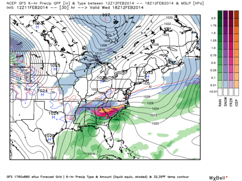 |
| GFS 6-hourly Precipitation Amount and Type, valid from 6AM to Noon Wednesday |
Meanwhile in the Mid-South, high pressure will begin to build in as the cold air is slowly eaten away each day. As a result we expect upper 40's for highs by Thursday, then lower 50's by Friday and Saturday. Southerly winds become dominate by Sunday and warmer, moist air is pushed in from the Gulf of Mexico. Lets check out some images detailing this more significant warming.
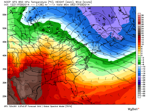 |
| GFS 850mb (5,000') Temperatures and Winds valid late Sunday night |
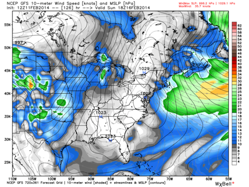 |
| GFS 10-meter Wind Speeds and sea level pressure valid at noon Sunday |
 |
| GFS Surface Temperature Departure from Normal valid Monday morning |
-William Churchill, MWN Social Media Intern
----
Follow MWN on Facebook, Twitter, and Google+
Visit MemphisWeather.net on the web or m.memphisweather.net on your mobile phone.
Download our iPhone or Android apps, featuring StormWatch+ severe weather alerts!
No comments:
Post a Comment