
Outside the advisory area, a little light freezing rain is possible, mainly after rush hour, before all precipitation becomes rain. Very little or no ice accumulation is expected outside the advisory at this time, including in Memphis and Shelby County. It should be noted that although the Winter Weather Advisory extends until 6pm, precipitation should change to all rain in the metro no later than noon.

At 8pm, temps are in the upper 20's and are not expected to move much overnight under cloudy skies with a steady breeze. Any precipitation that manages to fall in the early morning could be in the form of light freezing rain due to surface temperatures being just below freezing (especially north and west of the metro). By mid-morning we expect temperatures to rise just above freezing for most of the area with the possible exception of Tipton County and areas north of I-40 in AR, where it will take a bit longer to warm up.
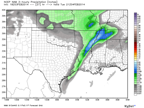 |
| NAM 3-hourly Precipitation valid from noon to 3PM Tuesday |
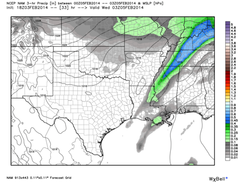 |
| NAM 3-hourly Precipitation valid from 6PM to 9PM Tuesday |
Cold and cloudy conditions look to follow for the remainder of the work week. Check out the full MWN forecast here and follow us on Facebook and Twitter for the latest updates. We'll have more on another potential winter weather event this weekend as time gets closer and models start to converge on a possible solution.
-William Churchill, MWN Social Media Intern
-Erik Proseus, MWN Meteorologist
----
Follow MWN on Facebook, Twitter, and Google+
Visit MemphisWeather.net on the web or m.memphisweather.net on your mobile phone.
Download our iPhone or Android apps, featuring StormWatch+ severe weather alerts!
No comments:
Post a Comment