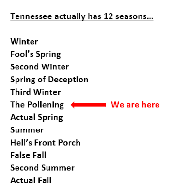
One week ago - last Thursday - we were preparing for a Friday night special, a Moderate Risk zone that extended from Memphis into Mississippi. While Memphis escaped the worst of that system, many in north Mississippi cannot say the same. It's Thursday again, and like last week, another severe weather event is lining up for Friday night. This time it appears to be aiming a bit further north. While no two weather events are alike (and this one is a different scenario than last week), it does serve to remind us that we are now into the grips of "The Pollening" season, a.k.a. spring severe weather season. So let's chat about tomorrow night.
Overview of Friday's severe weather threat
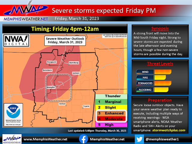
The potential for severe weather tomorrow night has been monitored by the Storm Prediction Center and local meteorologists since Monday. As of today, the event has come into better focus and the more general global models have "handed off" the details to the higher resolution models that provide additional clarity. The risk level has accordingly increased to the point where the Memphis metro is now in a level 4 (of 5) Moderate Risk for severe weather. This means that severe weather somewhere in the area is likely, not necessarily in your neighborhood, but probably within the greater metro somewhere. The timeframe of most concern for big storms is 4pm-midnight Friday. A few thunderstorms of the more general variety, and more than likely some showers, are possible during the day. These may play a role in the ultimate outcome in the evening in fact.
Tornado threat
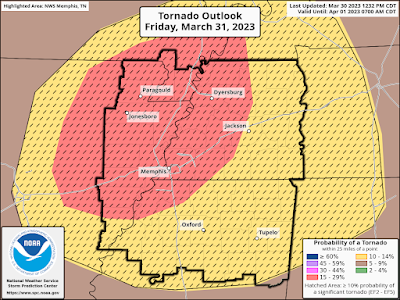
The Moderate Risk can be broken down by severe weather type to provide additional information on the probability of specific threats. Starting with the tornado threat, we have a 15% risk of tornadoes within 25 miles of any location in the metro. In addition, there is a 10% chance of a strong tornado (EF-2+) within 25 miles. This threat level drives the overall Moderate Risk for the event, as it is certainly elevated and worth preparing for... just in case. There will be plenty of strong wind and "spin" (or shear) in the atmosphere to support rotating storms if they can get going. However, as the Memphis NWS stated this morning in their discussion, "...this system is not a slam dunk. One potential area for failure is the presence and duration of Friday morning showers." As mentioned in the paragraph above, early-day precip could limit the storm fuel available later in the day, reducing the severe weather risk locally. This will bear watching, as it certainly contributed to a reduction in instability last Friday night north of the MS/TN state line.
Damaging wind threat
In addition to the tornado threat, the more likely scenario is a damaging wind event. As mentioned, there will be a LOT of wind energy with this system, from the surface up. Wind gusts outside of storms tomorrow afternoon and evening could easily top 40 mph and the winds aloft will also be screaming, contributing to storms moving at highway speeds once they form. The wind risk is 30%, which is the chance of 60 mph or higher wind gusts within 25 miles. In addition, there is a 10% risk of 75 or greater mph wind. I would expect that any storm will be capable of damaging wind, and it's likely that we will have a broken to solid line of storms move through in the evening hours, which could lead to widespread power outages and wind damage. If it's outside and not very secure, you risk losing it in the storms.
Hail threat
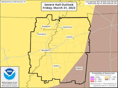
Most severe storms are capable of hail, and that risk also exists tomorrow night, though it is not as elevated of a risk as wind, at 15% chance within 25 miles. While large hail is not a major threat, it is also something to keep in mind. Rainfall for the event is also expected to be in the 1-2" range. Minor flash, urban, or stream flooding is possible during the evening hours. As always, you know to turn around and don't drown. Avoid the low-lying areas and roadways that are prone to holding water during and immediately after heavy rain.
SUMMARY
Timing: 5pm-11pm Friday
Overall Threat: Moderate Risk (level 4 of 5)
Tornado Risk: 15% (10% chance of an EF-2+) (level 4 equivalent)
Wind Risk: 30% (10% chance of 75+ mph) (level 3 equivalent)
Hail Risk: 15% (level 2 equivalent)
Flooding Risk: 15% (Slight Risk - level 2 of 4)
Preparation
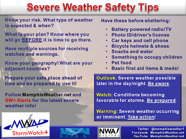
Be prepared to execute your severe weather plans anytime after 5pm Friday. That includes being ready to use your safe place if necessary, having outdoor stuff secured, and having multiple ways of receiving weather warnings, including LOCAL TV/radio, NOAA Weather Radio, Wireless Emergency Alerts on your phone, and a reliable weather warning app such as StormWatch+ that is programmed ahead of time. Storms will be moving quickly so lead time could be reduced.
Once the final line of storms moves through late in the evening, the severe weather risk ends. Fortunately it won't be too deep into the night when that occurs. We'll provide routine updates via our social media channels shown below throughout the event to keep you informed and safe!
Also, once this threat passes, know that there is another severe weather risk next Tuesday. We'll take them one at a time!
MWN Meteorologist
----
Follow MWN on Facebook and Twitter for routine updates and the latest info!
Complete MWN Forecast: MemphisWeather.net on the mobile web or via the MWN mobile app
Download our iPhone or Android apps, featuring StormWatch+ severe weather alerts!
 |  |
| MWN is a NOAA Weather Ready Nation Ambassador | Meteorologist Erik Proseus is an NWA Digital Seal Holder |

.png)
No comments:
Post a Comment