
As we near the end of the week, increased cloud cover will keep temperatures closer to 90, however humidity values will go up with dew points reaching 70. It will feel quite muggy! Perhaps the most important point of this blog is the increased rain and thunderstorm chances due to a slight pattern shift in the upper atmosphere. This shift, in which the wind aloft will blow from the northwest (called "northwest flow"), will lessen the cap on the atmosphere, allowing storms to form more easily.
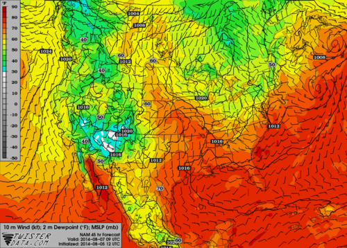 |
| Surface dew points and near surface winds early Thursday morning. |
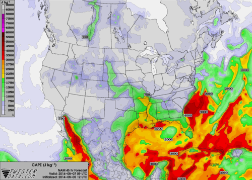 |
| CAPE, a measure of unstable air, early Thursday morning. Values above 2000 will easily support t'storms. |
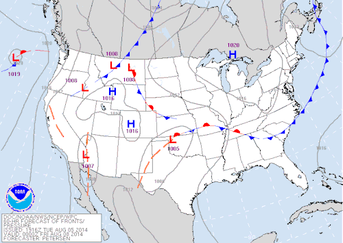 |
| The Weather Prediction Center's forecast of surface fronts late Thursday evening. Note the front across northern portions of the Mid-South. |
Due to the uncertain nature of these MCS's, predicting any severe weather associated with them is difficult, but strong wind and possibly small hail is not uncommon as they pass through. For now, no severe weather is predicted for the Mid-South, due mainly to uncertainty in exact timing and track of any storm complexes. However, much of the region could get welcome rain over the next week, as the abundance of June precipitation has evaporated and soil and vegetation are beginning to dry out.
Stay tuned to our social media feeds, website, and mobile apps for the latest on the effects of the upcoming weather pattern shift over the region. Links can be found below.
William Churchill, MWN Social Media Intern
Erik Proseus, MWN Meteorologist
----
Follow MWN on Facebook, Twitter, and Google+
Visit MemphisWeather.net on the web or m.memphisweather.net on your mobile phone.
Download our iPhone or Android apps, featuring StormWatch+ severe weather alerts!
No comments:
Post a Comment