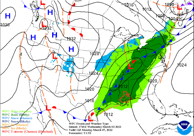
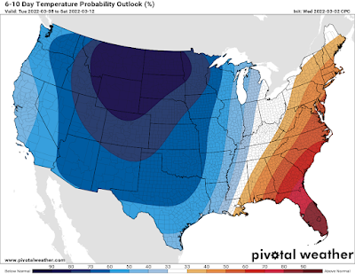
What a week (in a great way)! High temperatures the past four days have looked more like April than March - 71, 77, 80, 79 - and we're on track for another day in the upper 70s today despite the arrival of high clouds ahead of our next cold front. Sunshine and warm high pressure overhead have contributed to these well above average marks, and we even tied a record on Thursday with that high of 80 degrees!
That kind of weather has brought on a case of spring fever for many of us, but while a little spring cleaning and preparation is a great idea, don't start putting those plants in the ground just yet! More on that in a minute, but first let's talk about how this early streak of fine weather ends (because you know it will...).
This weekend - windy and warm
The arrival of high clouds and a very gusty wind today signal the approach of the next weather-maker that will undo the spring conditions we've had this week in favor of early spring storms. That front will drop to the Missouri-Arkansas border by Sunday morning, but stall out for about 24 hours before finally making a significant push through the area. The upper level pattern is responsible for the stalling, and ultimately its resumption of southeastward movement through the Mid-South.
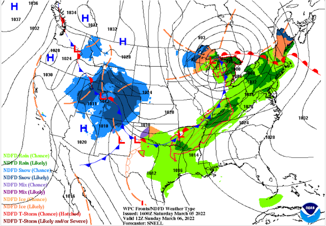 |
| Surface weather map on Sunday morning shows a front stalling to our north and scattered rain around the area south of it. We'll still be in very mild air. (NWS) |
Ahead of it, look for strong southerly breezes to continue this weekend and clouds to build as moisture from the Gulf of Mexico arrives on strong wind. That means very warm temperatures in the 70s during the day and 60s overnight tonight. With the moisture increasing, we'll see spotty showers around the area this evening and overnight.
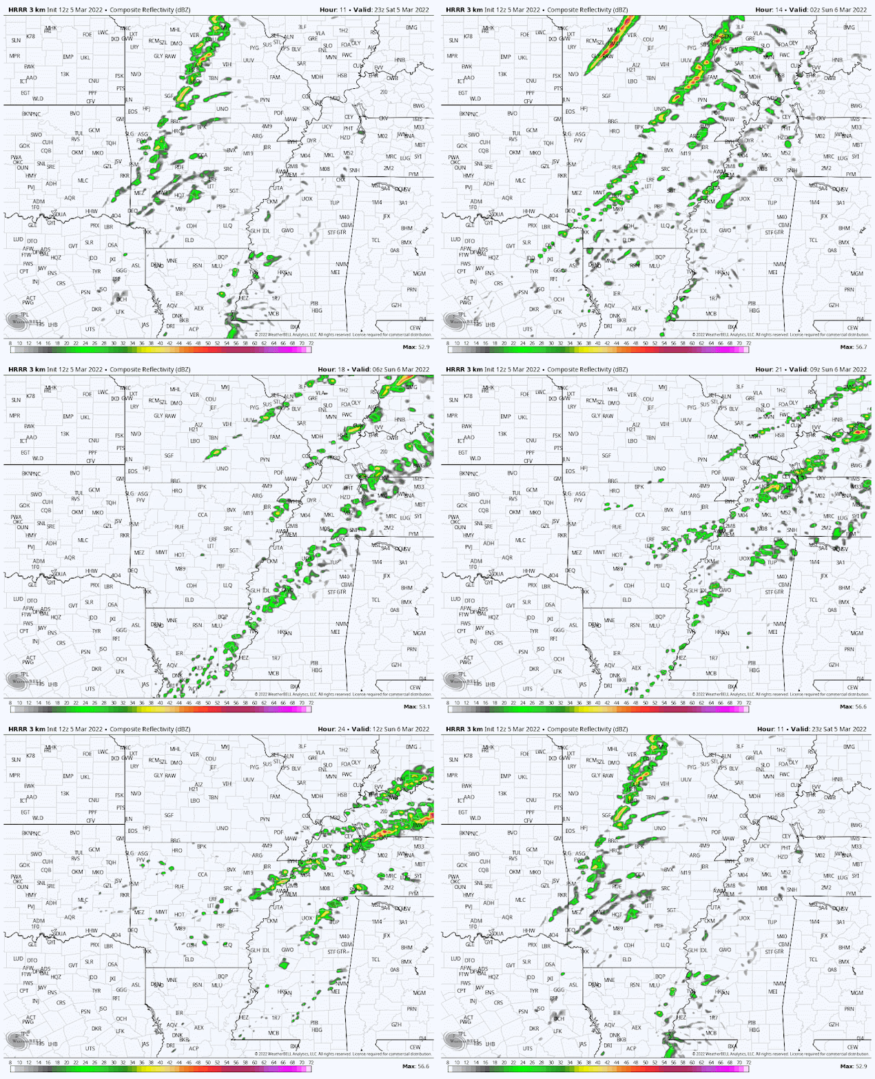 |
| The HRRR forecast model radar for 5pm tonight through 6am Sunday shows spotty showers becoming a bit more numerous by morning. (WeatherBell) |
By morning, it appears activity will become a bit more widespread as the front gets closer, but still scattered. A few thunderstorms could also mix in, mainly north of the I-40 corridor, on Sunday morning to early afternoon. These are NOT expected to be severe. By Sunday mid-afternoon, upper level high pressure builds briefly and squashes our rain chances a bit more heading into Sunday evening. Look for another day or wind gusts to 25+ mph tomorrow with highs again in the upper 70s. So to recap - spotty showers this evening, increasing to scattered coverage with a chance of lightning on Sunday, drying for while by late afternoon.
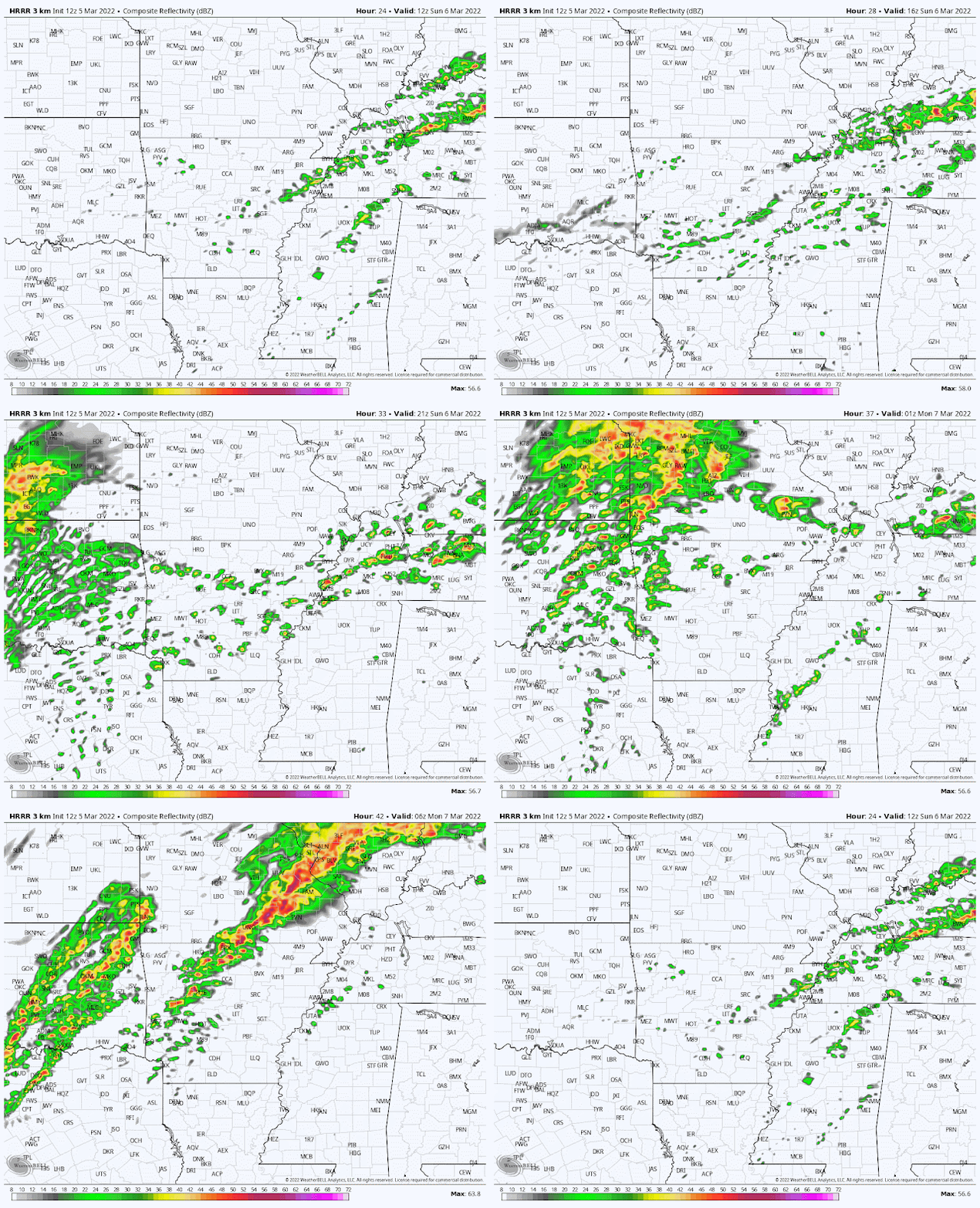 |
| The rest of the day Sunday through Sunday night, according to the HRRR model. Daytime showers lift north Sunday evening, only to orient into a line to our north and west overnight. Much of the night could be dry. (WeatherBell) |
Sunday night/Monday storms
Sunday night is when the cold front finally gets some assistance front a shift in the upper levels as a trough approaches. That will cause it to accelerate southeast. Rain chances respond accordingly after midnight Sunday night and peak Monday morning, likely starting during the morning rush. In addition, with upper level support, strong wind at all levels, and a modicum of "storm fuel" available thanks to warm temperatures (mid 60s) and dewpoints (low 60s) overnight, thunderstorms appear likely. A squall line is likely to form to our northwest overnight and move into the Memphis area, probably in a slightly weakened state owing to the time of day, Monday morning. Current broad-brush timing is 6-10am and will be refined.
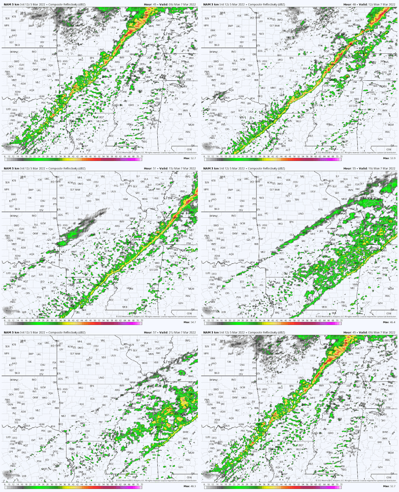 |
| Switching to the NAM3 model to show what radar may look like from 3am to 3pm Monday. The squall line (which may look a bit different than this - the NAM3 tends to underestimate this far out) moves through Monday morning in the 6-10am timeframe, then showers continue as temperatures drop. (WeatherBell) |
A few storms in that line could be severe with strong wind gusts the main concern, though a non-zero spin-up tornado chance also exists. We're currently on the eastern edge of a Level 2 Risk of severe storms, with the largest part of the risk over southern MO in to AR.
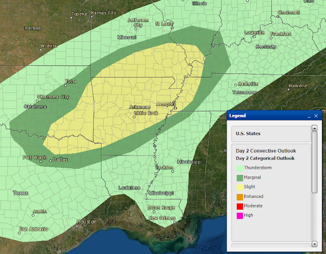 |
| A Slight Risk (level 2) for severe weather is forecast roughly from the Memphis area west for Sunday night and early Monday morning. Our main timeframe of concern is 6-10am. Strong wind gusts are possible and a brief spin-up tornado can't be ruled out. (NWS/SPC) |
Once the line moves through, those gusty south winds switch direction to the northwest, dropping temperatures as showers continue. Monday's high in the upper 60s to near 70 occurs ahead of the front, with temperatures falling into the 50s quickly that afternoon, and 40s by Monday evening.
Mid-week cooldown
That cooldown leads us to a period of below normal temperatures starting Tuesday. There will still be clouds around as southwest flow aloft will be pushing another rainy system through Tuesday night. Look for Tuesday morning lows in the mid 30s with wind chills in the 20s and afternoon highs in the mid 50s. Most of the rain Tuesday night falls to our south, but a consensus of models brings some light rain into the city. We'll keep an eye on it as there are outliers. By Wednesday morning, with lows in the low 40s, it appears the southerly storm track dries up and we get a couple of decent days. Wednesday's high will be in the upper 50s, while Thursday sees sunshine and highs in the mid 60s.
Late week Arctic blast
By late Thursday, we'll be watching an even stronger front dive out of the central U.S. towards the eastern U.S. with a significant push of cold air behind it. Depending on the amount of moisture ahead of it, we could see some Friday showers, but the big news is likely to be a blast of cold air that reminds us we are not yet to our average "last freeze" date just yet (March 18 in the city)! By next weekend, early indications are that lows drop back into the 20s with highs in the 40s again.
 |
| The European model ensemble currently predicts with near certainty low temperatures next Saturday morning being below freezing. (Probability of 32° or lower near 100%.) Better hold off on planting for a while! (WeatherBell) |
It is not atypical for freezes to occur well into mid and even late March, though the duration of cold air gets shorter, and the warmth that typically follows a bit warmer than in February. So let's put the brakes on the spring planting for at least a few more weeks, then evaluate what the end of the month looks like before deciding on a time to plant.

MWN Meteorologist
----
Follow MWN on Facebook and Twitter for routine updates and the latest info!
Complete MWN Forecast: MemphisWeather.net on the mobile web or via the MWN mobile app
Download our iPhone or Android apps, featuring StormWatch+ severe weather alerts!
 |  |
| MWN is a NOAA Weather Ready Nation Ambassador | Meteorologist Erik Proseus is an NWA Digital Seal Holder |