
Wednesday night an upper level trough will move through the region while parts of the metro could be right around the freezing mark at the surface. We expect any precipitation that falls to be liquid, so we will have to watch temperatures very closely (especially in areas that have already had a lot of snow/ice). The chance of frozen precipitation at this point is low and we expect any activity to be light. The most likely form of winter precipitation (if not rain) will be light freezing rain or freezing drizzle.
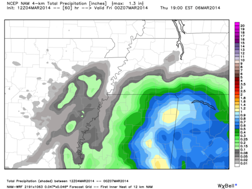 |
| 12z NAM Total Precipitation through Thursday evening. |
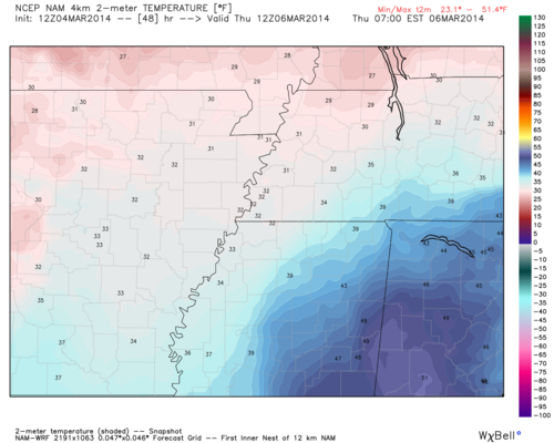 |
| 12z NAM Surface Temperatures valid Thursday morning |
However, any areas in Tipton, Crittenden, and parts of Shelby county with left over snow/ice Wednesday will have to watch their temperatures more closely Wednesday night as that lingering ice pack helps keep the temperatures lower. These are the areas that will be impacted the most if they happen to get some freezing precipitation. Areas that have seen more melting will likely stay above freezing and could see some cold rain.
As always just a few degrees will determine what falls in the Mid-South, but thankfully we are dealing with little moisture. As a result we expect only minor impacts, if any, but will continue to keep an eye on this system and will let you know of any changes to the forecast.
--William Churchill, MWN Social Media Intern
----
Follow MWN on Facebook, Twitter, and Google+
Visit MemphisWeather.net on the web or m.memphisweather.net on your mobile phone.
Download our iPhone or Android apps, featuring StormWatch+ severe weather alerts!
No comments:
Post a Comment