Another warm weekend with near record-breaking temperatures, but we finally get a break next week! After an especially warm first three weeks of the month, we finally see some cooler temperatures behind this weekend’s showers. Starting on Sunday and leading into most of next week, we’ll see temperatures right around average, with some days even below. This decrease in temperatures doesn’t come without consequences however; we’ll see an increased chance for showers and maybe a thunderstorm or two come mid-week.
Friday/Saturday: Will this heat ever end?
Short answer: yes. Long answer: More near-record temperatures – highs in the low 90s – kick off this weekend along with high winds! A warm and windy southerly breeze will help keep temperatures up along with the sun shining through a few clouds. Summer temps only start off the weekend though as a "cold" front moves through on Sunday, bringing cooler, near-average temperatures for the week ahead.
 |
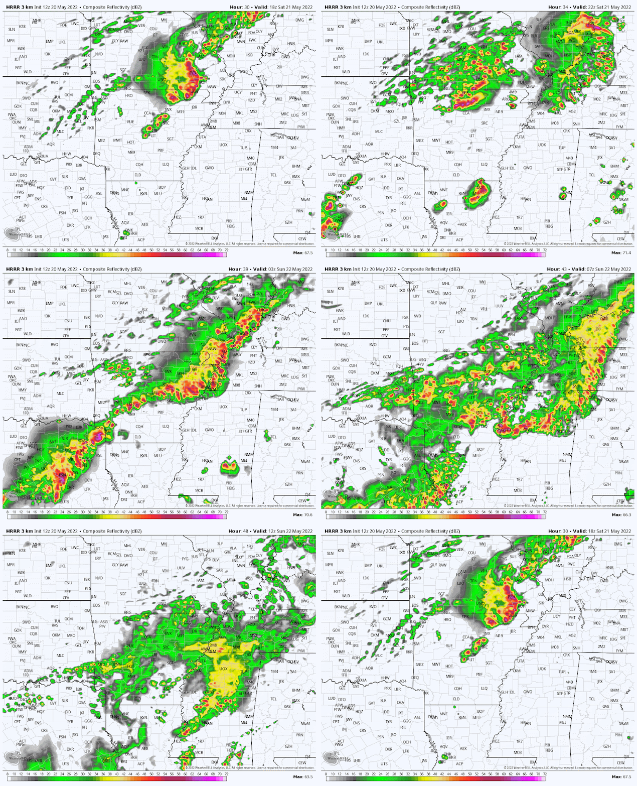
HRRR model from 1pm Saturday to 7am Sunday showing overnight showers and thunderstorms that continue throughout
Sunday. (WeatherBell) |
Saturday evening/Sunday
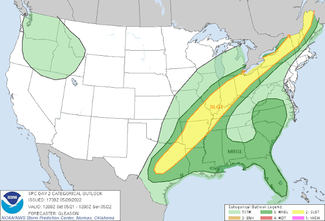
Chances of isolated thunderstorms increase Saturday afternoon but showers and thunderstorms are expected starting Saturday evening and throughout Sunday. Fans of the Storm Prediction Center Convective Outlooks have likely noticed that we are right on the cusp between a Slight (level 2) and Marginal (level 1) Risk for Saturday night. If things do take a turn for the worse however, and stronger storms take shape, we’re looking at main threats of small hail, high winds, and heavy rain (a typical May thunderstorm). Starting Saturday night and heading into Sunday, we start to see temperatures fall, with highs on Sunday peaking in the low 70s!
 |
| SPC Day 2 Convective Outlook: Most of the metro appears to be in a Slight Risk (level 2) with some towns to the east of Memphis in a Marginal Risk (level 1) for severe weather. |
Monday: A break from the rain
Temperatures stay in the 70s again on Monday, but conditions dry up, as rain chances decrease to start a new work week. Clouds will decrease, but a slight temperature increase will start on Monday as temperatures are expected to reach the upper 70s. They will increase a little more in the days following, though will still be cooler than the near-record temps we’ve had the rest of the month.
Tuesday/Wednesday
Temperatures increase and will peak in the 80s on Tuesday and Wednesday as more rain comes into the region. Showers are likely throughout both days and isolated thunderstorms, some of which may be severe, are not out of the question. These days will bring the highest temperatures of the week, likely only reaching the mid 80s as clouds and rain will keep higher temperatures away.
Thursday/Friday
As of right now, temperatures look like they’ll decrease a bit by the end of next week, and chances for rain diminish. Highs towards the end of the week will be in the 70s, and overnight lows will stay in the 60s. There’s a slight chance for showers early on Thursday, but otherwise expect a few clouds, lots of sun, and below-average temperatures to cap off this upcoming week!
All in all, this week will bring more pleasant and spring-like conditions, like more normal temperatures and lots of rain. A cold front to start off and a high pressure system moving in by the end of the week will keep temperatures in the 70s most days, and in the 60s every night. Be prepared for lots of rain and remember that severe weather has not been ruled out yet!
MWN Meteorologist Intern
----
Follow MWN on Facebook and Twitter for routine updates and the latest info!
Complete MWN Forecast: MemphisWeather.net on the mobile web or via the MWN mobile app
Download our iPhone or Android apps, featuring StormWatch+ severe weather alerts!
 |  |
| MWN is a NOAA Weather Ready Nation Ambassador | Meteorologist Erik Proseus is an NWA Digital Seal Holder |


No comments:
Post a Comment