Wednesday, December 26, 2018

Wet & windy Thursday; an early look at New Year's forecast

It's crazy to think that Christmas has already come and gone for the 2018 year. All eyes are now on New Year's Eve and New Year's Day; we are almost to 2019 folks! For the last few days of 2018, we will experience some pretty dreary conditions unfortunately. Maybe Mother Nature is sad to see 2018 go? Regardless, clouds continue to spread across the Mid-South today with these clouds expected to hang around over the next few days.

Visible satellite imagery loop from today around 12:30 PM until 1:30 PM. (College of DuPage; GOES 16)
By Friday, we will get a brief break from the dreariness before more clouds arrive Saturday into Sunday. New Year's Day looks pretty pleasant, but we may have to deal with more rain on New Year's Eve first. But don't worry - we've got you covered!


Today

While we had a few scattered showers move through the metro area this morning, the majority of us have stayed dry so far. Cloudy skies will continue through the remainder of the day with highs climbing to near 59. 

We will begin to see a pattern shift late this evening as winds begin to increase as well as our rain chances. As for winds, all of the Memphis area is included in a Wind Advisory from midnight tonight through 6 PM tomorrow. What does this mean? This means that wind is expected to be upwards of 20+ mph with gusts into 30s likely. If you have any loose outdoor decorations, I would make sure they are secured to the ground before you head to bed tonight.


As for our rain chances, expect for scattered showers to begin developing after 10 PM, with an increasing chance through the rest of the overnight hours. 

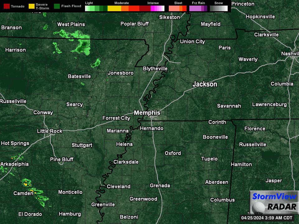
HRRR loop now through 6 AM tomorrow shows scattered showers developing just before midnight and moving through much of the Mid-South by the early morning hours. (WeatherBell)

Thursday

Tomorrow looks to be characterized by windy and wet conditions. Highs will reach an unseasonably warm 65 degrees by the afternoon. Expect rain to hang around through the majority of the day with some late morning/early afternoon thunderstorms being possible. While we could see a few thunderstorms, widespread severe weather is not expected. Once again, it will be pretty windy tomorrow. Southerly winds will continue around 25 mph with gusts upwards of 35 mph, particularly in the morning. 


Winds should begin to calm down by the evening hours and showers should become more scattered in the evening as well. Temps will fall to 47 overnight. 

Friday

After some dreary conditions, we will get a nice break from the wind and rain on Friday. Mostly sunny conditions are expected throughout the day with highs near 58. Overall, it will be a very nice and pleasant day. 

Weekend at a glance

Periods of cloudiness and periods of brief sunshine will dominate this upcoming weekend with highs much cooler - remaining in the upper 40s both days. We could see some light rain both days as well, although the daytime should remain dry. If we do see some rain, it will primarily develop in the evening to overnight hours both days. Overnight, temps will dip down into the mid 30s, but no worries - we aren't expecting any winter shenanigans at this time.

A quick look at New Year's Eve and Day

Lots of New Year's festivities will be taking place both Monday and Tuesday, as well as fans coming into town for the Liberty Bowl. For those of you already thinking of what to pack/what to wear for New Year's Eve activities, it looks like it could be wet for a good portion of the daytime hours. Highs will reach near 50. A layered approach with the poncho on top will be best at the football game!

Luckily for those venturing out in the evening, showers should *hopefully* clear out into the evening hours. While we can't make any promises this far out, models do currently indicate that things should dry out for the Mid-South by midnight. Temps will likely be in the 30s by midnight, so you'll definitely want to bundle up if you are planning on heading downtown for New Year's Eve festivities.  Keep those fingers crossed for dry weather at midnight folks!


On Tuesday, clouds will clear throughout the day leaving behind dry conditions and highs in the mid 40s. For the first few days of 2019, temps will remain a few degrees below average. Can you believe it is already almost 2019? 


Caroline MacDonald
MWN Meteorologist

----
Follow MWN on Facebook and Twitter for routine updates and the latest info!
Complete MWN Forecast: MemphisWeather.net on the mobile web or via the MWN mobile app
Download our iPhone or Android apps, featuring StormWatch+ severe weather alerts!
MWN is a NOAA Weather Ready Nation Ambassador Meteorologist Erik Proseus is an NWA Digital Seal Holder

Thursday, December 20, 2018

A look ahead to your Christmas forecast

Weekend Before Christmas

The weather looks to cooperate for all your weekend Holiday parties and festivities! A cold front will pass through overnight tonight (Thursday night – Friday morning). Friday morning some drizzle will still be possible, but as the front moves out, the moisture will move out as well, allowing skies to gradually clear by late in the day. Drier, colder air will be moving in Friday after the frontal passage, keeping temperatures in the lower 40s and dropping to near freezing at night. All in favor of Friday’s forecast being our Christmas forecast? I wish!

Decent weather is expected Saturday and Sunday with high temperatures in the mid 50s and lows in the mid 40s. There is a chance of some showers late Saturday night into Sunday morning as another cold front pushes through Sunday. The GFS model (shown below) for 6pm Saturday through 6pm Sunday has only 0.02 inches of rain falling and most of it remaining in north MS. Other models have rain occurring further west and north, but the most significant precipitation occurring east of I-40.

GFS model showing most most measurable rainfall remaining in north MS early Sunday, though other models are a little more bullish for the metro. (WxBell)

Christmas Eve (Monday)

Christmas Eve looks to be just an average December day! The high temperature is forecast to be slightly above average (mid 50s) and the low right near average (mid 30s). Some sun is likely to peek out on Christmas Eve, but at least we’ll be waking up to 30 degree temperatures on Christmas morning!


Christmas Day Outlook

Christmas Day is when the forecasting challenge arrives. One reliable model is hinting at scattered showers throughout the day as moisture returns to the area. Changes to this forecast are likely with 5 days still to go before the holiday, but prepare for the possibility.

The big Christmas Day question: Will it be cold enough to “feel” like Christmas? The average is high for Christmas Day in Memphis is 48 and the average low is 33. The forecasted high is in the mid 50s, which puts us above average, but not necessarily warm. It’ll be cool enough to keep on that tacky Christmas sweater and still be comfortable!


Christmas Climatology

The charts below show Christmas Day climatology for the Memphis area. The warmest December 25th on record occurred in 1889 with a high of 76°. The coldest December 25th on record occurred in 1983 when the temperature reached 0° and didn’t climb above 16°. Anyone remember this Christmas Day?

The warmest Christmas Days in Memphis recorded history. 

The coldest Christmases in Memphis history.

Be sure to follow us throughout the upcoming weekend as we fine-tune the forecast for Christmas Day! Hopefully the rain chances disappear, though don't count on a White Christmas this year! You can find the latest forecast on our mobile app or website with links posted below.

Lauren Pounds, Guest Blogger
MWN Social Media Intern

Editor's Note: Lauren has been a dedicated social media intern for MWN for 2 years and is about to depart #TeamMWN as she prepares for a busy last semester at Mississippi State and graduation in May. It was only fitting that she have the opportunity to write a blog "in her own words" before moving on, since she has completed her first real forecasting class. My deepest appreciation and thanks to Lauren for the amazing job she has done for me, and all of you, the past two years! We wish her the best this spring, and in the future, as she achieves her dream of becoming a meteorologist! 
--Erik ]

----
Follow MWN on Facebook and Twitter for routine updates and the latest info!
Complete MWN Forecast: MemphisWeather.net on the mobile web or via the MWN mobile app
Download our iPhone or Android apps, featuring StormWatch+ severe weather alerts!
MWN is a NOAA Weather Ready Nation Ambassador Meteorologist Erik Proseus is an NWA Digital Seal Holder

Sunday, December 16, 2018

November 2018 Climate Data for Memphis, TN

November Climate Recap

The month of November was well below normal in the temperature department with persistent cool air for nearly the entire month. All but seven days were below average with two of those occurring on the last two days of November as a warm spell bridged the flipping of the calendar to December. The coldest temperatures occurred mid-month with a week-long string of temperatures more than 10 degrees below average. During that period, a record cold maximum temperature was observed with a high of only 30 degrees on the 14th. Seven days never reached 50 degrees.

Precipitation also ended below average, about one-fourth of normal, despite having measurable rain on nearly half of the days of the month. There were many days with less than 0.10" and only 2 days with more than an inch. There was no severe weather in the metro in November, though thunderstorms rumbled through on the evening of the 5th as highs reached 70 degrees. The only severe weather warnings issued by the National Weather Service for the month were a few Tornado Warnings that evening south of the greater Memphis area, with storms knocking down some trees in southern Marshall County, MS.

Another interesting event was the first winter weather event of the 2018-2019 season on November 14, as a potent upper level low moved over the Mid-South. Snowfall was generally under an inch in the metro, but the 0.6" recorded at the airport ranked 6th for most snowfall on a November day in history and the most in November in nearly 30 years.


Memphis International Airport, Memphis, TN


Temperature
Average temperature: 47.9 degrees (5.3 degrees below average)
Average high temperature: 56.4 degrees (6.2 degrees below average)
Average low temperature: 39.3 degrees (4.4 degrees below average)
Warmest temperature: 71 degrees (6th)
Coolest temperature: 25 degrees (27th)
Heating Degrees Days: 508 (140 above average)
Cooling Degree Days: 1 (12 below average)
Records set or tied: Record cool maximum - 30 degrees on the 14th. Record warm minimum - 64 degrees on the 30th.
Comments: The average temperature for the month ranked in the top 10% coolest on record.

Precipitation
Monthly total: 4.25" (1.24" below average)
Days with measurable precipitation: 14 (4.5 days above average)
Wettest 24-hour period: 1.19" (5th)
Snowfall: 0.6" (0.6" above average)
Records set or tied: Record snowfall occurred on 14th (0.6").
Comments: Three days recorded more than 0.5" of rain, two of which were over 1".

Miscellaneous
Peak wind: Northwest/43 mph (25th)
Average wind: 7.9 mph
Average relative humidity: 75%
Average sky cover: 60%

Click here for a daily statistical recap for Memphis International Airport.

Cirrus Weather Solutions / MemphisWeather.net, Bartlett, TN


Temperature
Average temperature: 46.5 degrees
Average high temperature: 57.6 degrees
Average low temperature: 37.1 degrees
Warmest temperature: 71.4 degrees (6th)
Coolest temperature: 22.5 degrees (28th)
Comments: Data was unavailable for November 13.

Precipitation
Monthly total: 4.91" (automated rain gauge), 4.90" (manual CoCoRaHS rain gauge)
Days with measurable precipitation: 11
Wettest date: 1.36" (5th) (via automated gauge)
Snowfall: 0.3" (14th)
Comments: None

Miscellaneous
Peak wind: Northwest/23 mph (25th)
Average relative humidity: 81%
Average barometric pressure: 30.11 in. Hg

Click here for a daily statistical recap for Bartlett, TN.

MWN Forecast Accuracy

MWN average temperature error: 2.64 degrees
MWN forecast temperatures within 2 degrees of actual: 58%
MWN average dewpoint error: 2.07 degrees
MWN forecast dewpoints within 2 degrees of actual: 67%

MWN's forecasts extend out five periods (2.5 days, or roughly 60 hours). Historical accuracy statistics can be found here.

Climate Outlook - December

The December climate outlook for the United State from the Climate Prediction Center is shown below. Temperatures are forecast to be above normal for much of the nation except the Rocky Mountains and inter-mountain west. For Memphis, odds of above normal temperatures in December are 39%, near normal 33% and below normal 28%. Memphis typically averages just over 43.6° degrees for the month of December.


A wet December is forecast for much of the United States except the northern tier of states. For Memphis, odds of above normal precipitation in December are 44%, near normal 33% and below normal 23%. December is historically the wettest month of the year in Memphis, averaging about 5.75" of precipitation. This month could be exceptionally so.


----
Follow MWN on Facebook and Twitter for routine updates and the latest info!
Complete MWN Forecast: MemphisWeather.net on the mobile web or via the MWN mobile app
Download our iPhone or Android apps, featuring StormWatch+ severe weather alerts!
MWN is a NOAA Weather Ready Nation Ambassador Meteorologist Erik Proseus is an NWA Digital Seal Holder

Friday, December 14, 2018

Rain coming to an end soon, but for how long? First thoughts on Christmas weather

Storms are currently rolling through the Mid-South, bringing a good splurge or rain. With the weekend now here, it brings the question: "How wet is the weekend supposed to be?" We will break down those rain chances, talk about how long we remain dry next week, and even take a peak at early projections for our Christmas forecast.

Tonight and Tomorrow

With that low pressure system gradually moving through the Mid-South, we are receiving showers and storms. As of 5pm, a bulk of the storm activity is getting close to wrapping up. That said, rain will not be ending. Instead, showers will continue for tonight as they remain scattered. When not light rain, drizzle/foggy conditions will be taking place. With the rain and clouds, don't look for much day-vs-night temperature changes taking place: low of 46.

National Weather Service's surface analysis map, showing the low pressure system bringing rain for the Mid-South.
Your Saturday will start with lingering rain as we wait for the low to propagate out of our area. The morning brings the greatest chance for rain, with shower activity becoming lighter and more isolated by the afternoon. Minimal diurnal shifts remain a part of the forecast, so our high will only be 50 degrees. Saturday night cooler air creeps in as we just start to lose the clouds. By this point, that low is now out of the area and high pressure starts to build in, bringing an end to our rain chances.

Sunday-Wednesday

Weather Prediction Center's QPF Totals showing that we aren't expecting much rain over the next 5 days.
Sunday through Wednesday, high pressure takes over, drying us out over this period of the forecast. With the dry weather comes the return of sunshine and clear nights: that means that we will see our diurnal temperature swings return. One thing of note is that today's low is going to be bringing in more Pacific like air, rather than Arctic, so we won't be pulling in colder air. Instead, look for our highs to range between the mid to upper 50s. Meanwhile, that diurnal swing effect means that we have our nighttime lows getting into the upper 30s.

Wednesday Night-Friday


Wednesday night brings the return of clouds and rain chances. A shortwave will drop from the north, meaning that we will have conditions, though minimal, for getting some shower activity going. With the rain comes cloud cover which should help insulate us and keeping our temps a little warmer overnight, with a low near the mid 40s.

A shortwave Wednesday night into Thursday in the Mid-South brings minimal rain chances that night and through the day.


Rain chances from Wednesday night last into Thursday, though rain chances never climb too high. The weak shortwave mean that at most we will see scattered rain chances through the day as we remain mostly cloudy. Highs remain in the mid 50s. By that evening, we dry out somewhat as the clouds try to hang on. Lows in the lower 40s.

Friday takes on an interesting look for the forecast with a low pressure system setting up behind the shortwave. Depending on how fast and how far the low digs will determine how much moisture is pumped out of this system late Friday and into Saturday. Likewise, we need to watch how fast the cold air on the back side of the low infiltrates. For now, we are sticking with our normal forecast and saying mostly sunny skies for your Friday and temps climbing to the mid 50s. We will keep watching Friday night into Saturday as more model runs/data come available.


Christmas Outlook


With Christmas less than two weeks away (queues holiday panic), we are close enough to get some rough idea what that time frame will look like. At the moment, as per the Weather Prediction Center, it looks to be a good chance we keep an above average weather pattern for that time frame. For those that don't like warm Christmases, we do have some good news so don't freak yet. Looks like we will be remaining near average precipitation wise, so no major wash outs for Christmas foretasted at the moment. In fact, ensemble forecasts look like they place us in a ridge during that time frame, which would mean we remain dry. All this said, there is still plenty of time for this forecast to change. Likewise, you know where to go to in order to find those changes!


The WPC's temperature and precipitation outlooks are showing near average precipitation and above average temperature probabilities for the week of Christmas.


Reggie Roakes
MWN Meteorologist

----
Follow MWN on Facebook and Twitter for routine updates and the latest info!
Complete MWN Forecast: MemphisWeather.net on the mobile web or via the MWN mobile app
Download our iPhone or Android apps, featuring StormWatch+ severe weather alerts!
MWN is a NOAA Weather Ready Nation Ambassador Meteorologist Erik Proseus is an NWA Digital Seal Holder

Saturday, December 8, 2018

Winter Weather Advisory in effect - what to expect

6:45pm UPDATE --

The forecast remains largely on track. Temperatures are dropping into the mid 30s this evening with several hours of precipitation to move through. Though they are not far from freezing at the surface, there remains a bit of warm air aloft as well that is keeping precipitation from changing to anything wintry just yet. Within the next few hours, some sleet could mix in, particularly in far northern areas of the metro (i.e., mainly Tipton Co). That area will also be the first to reach freezing tonight and a changeover to light freezing rain is expected, probably between 10pm-midnight.

Current StormView Radar loop
Temperatures are expected to hold for several hours overnight in the 32° (north) to 35° (south) range with the potential for a light wintry mix as far south as the the immediate metro as we head into the early morning hours (2-5 am). By sunrise, most precipitation will be gone, but lingering very light precip will likely be in the form of snow flurries or freezing drizzle through about 9-10am in TN portions of the metro.

Early evening HRRR model output shows a wintry mix remaining primarily north of the metro, but inching south into the immediate metro overnight with lingering flurries or freezing drizzle during the morning hours. (WeatherModels.com)

Overall, Tipton County stands the best chance for up to 0.10" of an ice glaze on exposed surfaces and bridges. Very light icing will also be possible in Crittenden, Shelby and Fayette Counties by morning. As stated below, "wait and see" is the best approach for morning travel. I expect the primary roads will be OK, but elevated roadways could be slippery. Treatment has not been applied ahead of time due to the constant rain before it changes over, so any road treatment will have to wait until the ice forms.


ORIGINAL POST (9:45am) --

Earlier this morning, the National Weather Service - purveyor of all watches/warnings/advisories - extended a Winter Weather Advisory south into the I-40 corridor, a.k.a. the Memphis metro along this part of I-40.  What does that mean for us? Let's answer your questions.

What is a Winter Weather Advisory?

The NWS issues a Winter Weather Advisory when a winter weather event is expected to cause a some degree of inconvenience, but is not expected to be a major hazard to travel and commerce (when a warning would be required). A combination of precipitation types is possible. An Advisory is basically a "Junior Warning." Caution is advised while traveling or working outdoors during an advisory.


When is it in effect and who does it include?

The advisory is in effect for those counties in purple above. Basically if your county has I-40 running through it or you are north of I-40, you're included. In addition, DeSoto and Tunica Counties are also included. The advisory runs from 6pm this evening through 9am Sunday.

What is driving this potential winter weather?

A fairly common wintertime pattern is in place, with a low pressure system moving along the Gulf Coast over the next 24 hours and an "inverted trough" (or weaker pressure extending north from the low) crossing the Mid-South. The low and trough are providing the lift and precipitation. Cold high pressure to our north is seeping the cold air into the region. Areas to the north of the metro, in northeast AR and northwest TN, are deeper into the cold air and are already experiencing winter weather conditions, including freezing rain, snow and some sleet.

As the Gulf low and trough move east tonight, the colder air will wrap in behind them, dropping south into the I-40 corridor. That will be the impetus for today's rain to change over to freezing or frozen precipitation. The kicker (there always is one, and it's the same as usual in these scenarios) is that precipitation will be departing late tonight as the cold air arrives.

The high-resolution NAM model from this morning shows temperatures remaining above freezing until early Sunday morning, when they could touch the freezing mark for a few hours. (WeatherModels.com)


So what can we expect in the metro, and when?

Rain today. Cold, yucky, hot chocolate-sipping, wintertime rain.

After 10pm tonight, some colder air will start working into the mid levels of the atmosphere and surface temperatures will be in the mid 30s. We could start to see some light sleet mix with the cold rain. No travel hazards are expected during this time. (Yes, you can safely go see the Grizzlies drag LeBron and the Fakers through the mud and return home with no issues.)


After midnight, and likely closer to 3am, surface temperatures will near freezing (especially in Tipton County) and precipitation will diminish in intensity. This is when we could see some light freezing rain (if the surface temperature drops to 32), sleet, or light snow mix in with the rain. We call it "wintry mix" because it's darn near impossible to know what exactly will fall. It should all be pretty light though, with minor accumulation on grassy surfaces, exposed objects, and maybe some bridges possible, especially in Tipton County.

The high-resolution HRRR model from this morning shows wintry precipitation remaining north of the metro until early Sunday morning, as precipitation is departing. The best chance of minor accumulation will be Tipton County and points north. (WeatherModels.com)

The high-resolution NAM model depiction of total accumulation of various winter weather types above. Sleet (top left, orange) should mainly avoid the metro with no accumulation expected. Snow (lower right, blue) should be about the same. Minor accumulation of freezing rain (top right, red) could occur as far south as I-40, while rain (lower left, green) will be widespread. (WeatherBell)

By dawn, most precipitation will be over. After that, a bit of freezing drizzle or flurries are possible for a couple more hours but shouldn't affect morning church-goers or dedicated joggers. Overall, we advise a "wait and see" approach to those headed out in the early morning, but honestly, I don't really expect too many problems. A slippery bridge here or there, mainly north of I-40, is possible. With lows right at 31-32° and highs in the upper 30s, by late morning everything should be thawing and drying out.

Starting Monday, a warming trend brings us back to near 50 by Tuesday with highs remaining in the 50s the rest of the week. Rain is a good bet Thursday and Friday with no winter shenanigans in view. Here's hoping for (and we're forecasting as of now) a dry and seasonal weekend next week!

Stay updated

Get the latest updates on our winter weather threats via our Facebook and Twitter feeds, as well as the latest precipitation-typed radar loop, current conditions around the metro, and forecast in our mobile app. All links are below.

Erik Proseus
MWN Meteorologist

----
Follow MWN on Facebook and Twitter for routine updates and the latest info!
Complete MWN Forecast: MemphisWeather.net on the mobile web or via the MWN mobile app
Download our iPhone or Android apps, featuring StormWatch+ severe weather alerts!
MWN is a NOAA Weather Ready Nation Ambassador Meteorologist Erik Proseus is an NWA Digital Seal Holder

Thursday, December 6, 2018

Cold rain returns, but let's talk about frozen precip potential

Below-average temperatures will continue to hold onto the Mid-South over the next several days with highs remaining in the lower to mid 40s and overnight lows in the mid 30s. The next few days will be characterized by scattered showers throughout the day, continuing into this weekend. There are some concerns about frozen precipitation Saturday night into Sunday morning, but more on this later.


Overall, expect areas near and south of the metro area to receive more precipitation over the next few days with decreasing precipitation as you move northward. Some areas could see up to 2 to 3 inches of precipitation over the next few days (yes this is the rain-only form).

The 72-hour precipitation map from the Weather Prediction Center has areas around the Mid-South receiving 2 to 3 inches of precipitation between now and Sunday morning with others receiving closer to an inch. (Pivotal Weather)

Today

We will continue our downward trend in temperatures today with highs only expected to reach 46. Cloudy skies will remain overhead as we prepare for scattered showers that will arrive by evening. Breezy winds around 10 mph could make things feel even colder at times today. Be sure to bundle up before heading out the door and you may want to grab the umbrella for this afternoon and evening.

The HRRR model loop shows scattered showers increasing in coverage this afternoon into this evening. These scattered showers will continue into tomorrow. (WeatherBell)

Friday & Saturday

We will end this week with some pretty chilly and dreary conditions. Showers will begin to increase throughout the day Friday, continuing into the overnight hours Friday and into Saturday. Rain on both days will be a very cold rain, so keeping an umbrella handy will be ideal. 

The high-res NAM model from early Friday through Saturday evening shows scattered, mainly light, showers on Friday with continuous rain through most of the day Saturday. (Tropical Tidbits)

Temperatures will stay just warm enough throughout both days that wintry precipitation is not a concern. Highs both days will be in the low 40s with overnight lows in the mid 30s, so temperatures will not vary too much through the day. 

Sunday

Showers will continue through the early morning hours on Sunday and could *potentially* turn into light snow or freezing rain. The biggest concern with Sunday's forecast is where our temperatures will be. If surface temperatures can cool enough, then we could see some freezing rain. Temperatures just aloft will also be borderline for the potential for some light snow. It appears right now that there is a slightly better chance for light snow mixing with rain than freezing rain.  It will remain cold on Sunday, with most of the day spent in the 30s.

GFS model loop from late Saturday through mid-day Sunday shows a very small window of opportunity for frozen precipitation early on Sunday. Regardless, any precipitation should begin to move out by the afternoon hours on Sunday. (Tropical Tidbits)
Those to the north of the metro area have the greatest chance of seeing freezing precipitation from Saturday into Sunday, as surface temperatures will be colder the farther north you move. If you have travel plans north of Memphis this weekend, keep that in mind.

Greatest chance of seeing any type of wintry mix and snow appears to be north of I-40. Chances increase the farther north of the metro area you move. (NOAA/NWS)

This is an evolving forecast that will need to be monitored over the next few days. For latest trends and thinking, be sure to check out our social media accounts (linked below) and the MWN forecast online and on our app.


Next Week

Things will remain around to slightly below average early next week. For those curious, around this time of year our "average" high temperatures is in the low 50s with our "average" low temperature in the mid 30s.

Later next week, we will begin to warm slightly with highs nearing the upper 40s to lower 50s. Overnight lows will be in the low to mid 30s. This will leave us right around that average category. Through the first half of next week, we should remain dry with plenty of sunshine for all. 

Weather Prediction Center 6 to 10 day outlook for temperature shows the Memphis area right around average for next week. (Pivotal Weather)

Caroline MacDonald
MWN Meteorologist

----
Follow MWN on Facebook and Twitter for routine updates and the latest info!
Complete MWN Forecast: MemphisWeather.net on the mobile web or via the MWN mobile app
Download our iPhone or Android apps, featuring StormWatch+ severe weather alerts!
MWN is a NOAA Weather Ready Nation Ambassador Meteorologist Erik Proseus is an NWA Digital Seal Holder

Monday, December 3, 2018

Much cooler week ahead; keeping an eye on this weekend

After an extremely warm end to last week and the weekend, we have finally dropped back down into a fall to winter-like pattern. Temperatures are expected to remain below average through the entire week with rain chances coming towards the weekend. Dry conditions will remain for the first half of the week with some sunshine expected by midweek.

First half of the week 

We will continue to transition back into our colder spell over the next few days with high temperatures slowly falling through the 40s. While today's high will be in the upper 40s, Tuesday and Wednesday's highs will be in the lower to mid 40s.

Clouds will begin to increase today and hang around a bit longer tomorrow. However, by Wednesday skies will begin to clear to introduce more sunshine to our weather pattern. Luckily, we are not expecting any rain over the next few days.

The Weather Prediction Center's Frontal Analysis for early Wednesday shows high pressure dominating much of the central and southeastern regions of the U.S. This high pressure will help to keep rain chances out through the first half of the week. (NOAA/WPC)
Overnight temperatures will fall to near freezing tonight, with temps dipping down into the upper 20s to lower 30s Tuesday and Wednesday nights. If you haven't already, you may want to pull out the extra blankets and turn on the heat once again.


Thursday & Friday

Our dry spell could only last so long as rain chances are re-introduced Thursday evening. We should make it through the majority of the day with partly sunny skies and highs in the upper 40s. Scattered shower chances will begin to increase into the evening to overnight hours with additional showers possible on Friday.

GFS model loop from Thursday evening through late Friday evening show very light showers moving through the Mid-South. Isolated showers will be possible Thursday evening with an increase in showers on Friday. (TropicalTidbits)
Light rain is expected to continue into Friday, helping to keep high temperatures in the lower 40s. Showers shouldn't be too heavy, but heavy enough that you may want to keep the umbrella handy Friday to keep the cold, drizzle away. 


Glance at this upcoming weekend

Rain and cooler temperatures are expected to continue into this weekend. Highs are expected to be in the upper 30s to near 40 both Saturday and Sunday with overnight temperatures falling near to below freezing.

Saturday looks pretty gross if you ask me with a cold rain expected through a good portion of the day. While we are several days out, we will need to continue to keep an eye on things for Saturday night.

GFS loop from early Saturday through Sunday evening shows showers moving through the Mid-South on Saturday with a possible wintry mix mixing in overnight Saturday. Rain and this possible wintry mix should move out Sunday morning. (TropicalTidbits)
Temperatures may become just cold enough to allow for some flakes to mix in on Saturday night. This is still only a possibility, but worth mentioning. Moisture from Saturday's showers may move out earlier than expected, which would eliminate this wintry mix potential. However, the chance still remains for now. We will keep an eye on this through the remainder of the week, and will provide additional information as we draw closer to the weekend. You can check our latest thinking in the MWN Forecast anytime via the web or our mobile app (links provided below).


Caroline MacDonald
MWN Meteorologist

----
Follow MWN on Facebook and Twitter for routine updates and the latest info!
Complete MWN Forecast: MemphisWeather.net on the mobile web or via the MWN mobile app
Download our iPhone or Android apps, featuring StormWatch+ severe weather alerts!
MWN is a NOAA Weather Ready Nation Ambassador Meteorologist Erik Proseus is an NWA Digital Seal Holder