Monday, June 30, 2014

Recap of significant flash flooding in the Memphis metro - June 29, 2014 #memflood

A once-in-a-generation rainfall event resulted in significant flooding across portions of the metro on Sunday. Thunderstorms containing torrential rain began entering the area during the wee hours of the morning (between 1-2am) and continued nearly unabated in waves for nearly 10 hours, resulting in rainfall totals of about double the typical monthly totals for the month of June. Local rivers and tributaries to the Mississippi River quickly rose and created an urban flooding scenario as water backed up into streets and low-lying areas, including a mobile home park west of the airport, where 100 trailers were flooded and rescues were performed.

Several atmospheric factors came together to produce the copious rainfall amounts we saw locally. These included a very moist atmosphere with precipitable water (PW - the amount of water in a column of air) values of over 2" (or nearly a "worst case" for this time of year), a southwesterly flow of about 45-50 mph into the lower levels of the region, blowing over a stationary outflow boundary positioned just to our south which helped generate lift and storm initiation, and finally unstable air just south of the boundary which also provided some lift (see below). Storms continuously developed just west of the metro and trained over the same areas for many hours.

Strong flow into the storm from the southwest, overriding a boundary just south of the metro, contributed to significant precipitation rates, as forecast by the Weather Prediction Center during the event on Sunday morning.
Below is a map of radar-estimated rainfall amounts for the weekend, highlighting the areas from west of the city, across Shelby and Fayette Counties where rainfall amounts were highest. Following that, the departure from normal precipitation for the past week, dominated by the weekend precipitation.

Two-day storm total precipitation based on radar estimates, ending late Sunday afternoon
Departure from normal precipitation for the past seven days. Note the swath of 4-10" departures across the metro and into east-central AR.
A radar screenshot (below) taken early Sunday morning shows the mass of storms between Memphis and Little Rock in the storm initiation zone with waves moving east from that area paralleling I-40 into Shelby and Fayette Counties. At this time, Flash Flood Warnings (green boxes) were in effect from Little Rock to Arlington, TN, which subsequently were extended further east into Fayette and northern Marshall Counties.

At one point yesterday morning,Flash Flood Warnings were in effect from Little Rock to Arlington, then got extended east even further!

Selected rainfall totals for this event:

June 29th rain totals

  • Memphis Int'l Airport - 5.87"
  • MemphisWeather.net in north Bartlett - 4.69" (est.)
  • Agricenter in Cordova - 6.13"


June 28-29th rain totals

  • Memphis Int'l Airport - 7.09"
  • MemphisWeather.net in north Bartlett - 6.06"
  • Agricenter in Cordova - 7.48"
  • West Memphis, AR airport - 6.86"
  • Collierville - 5.77"
  • Germantown - 6.99"
  • Somerville - 3.95"
  • Olive Branch - 5.94"
  • Pleasant Hill, MS - 5.66"
  • Madison, AR - 10.80"


As far as records go, Memphis International Airport broke a daily record for rainfall on Sunday with 5.87". In addition, that total is the seventh highest daily rainfall amount in Memphis recorded history (dating to the 1870s)! The June total at Memphis will be 13.40", which makes this month the 2nd wettest June on record, trailing only June 1877 which recorded 18.16" of rain.

    
The Mississippi River experienced a slight rise Sunday morning, but that was largely due to the effects of the larger tributaries dumping huge amounts of water in the river. The Mississippi River is primarily affected by rainfall upstream, not in the immediate area, but the fact that it was relatively low allowed the tributaries like the Wolf River, Loosahatchie River, and Nonconnah Creek to effectively flow into it, therefore the flooding that occurred along these bodies of water abated fairly quickly once the rain stopped (within a few hours). Had the Mississippi River been several feet higher (say at spring levels in the 25-32 foot range), the tributaries would not have drained as efficiently and flooding along their banks would have been much worse and more prolonged.

The Mississippi River gauge in downtown Memphis rose almost two feet between 3am and 3pm Sunday due to excessive flow from the area tributaries into the river.
The Wolf River at Hollywood Street in Frayser climbed Saturday with storms in the area, then jumped more than 10 feet again Sunday and is receding much more slowly.
The Nonconnah Creek near Memphis Int'l Airport rose about 22 feet Sunday, but had fallen back to pre-storm levels by 3am Monday. This gauge is very near the mobile home park that was flooded.
Nonconnah Creek at Winchester Road rose 4 feet on Saturday afternoon then another 14 feet on Sunday morning, falling back to pre-storm levels by Monday morning.
The Loosahatchie River in Frayser also rose about 15 feet Sunday and has dropped a few feet but remains very high on Monday.
A similar situation on the Loosahatchie River at Brunswick Road, which is just below flood stage on Monday
Overall, this once-in-a-generation storm caught most forecasters off guard until it was in progress, but it was definitely a learning event. We're thankful that, despite people being displaced and losing possessions, no lives were lost and no major injuries were reported. Let's hope we don't see anything like this again in a long time!

How were you impacted by the flooding on Sunday? You can find more pictures and video of the mobile home park flooding in the timelines on our social channels listed below.

Erik Proseus
MWN Meteorologist

----
Follow MWN on Facebook, Twitter, and Google+
Visit MemphisWeather.net on the web or m.memphisweather.net on your mobile phone.
Download our iPhone or Android apps, featuring StormWatch+ severe weather alerts!

Sunday, June 29, 2014

Flash Flood Emergency for Memphis/Shelby County - heavy rain continues

UPDATE - 12:45pm:

The bulk of the precipitation is now exiting the metro, leaving behind only a few light showers. Mainly dry conditions for the next couple of hours will help the smaller streams and tributaries absorb remaining runoff and push it into the larger creeks and rivers, which will continue to remain high (likely near or above flood stage) throughout the afternoon and evening hours. Use extra caution on roads near the larger tributaries, such as the Wolf River, Nonconnah Creek, and Loosahatchie River.

As for the rest of the afternoon, unfortunately some peeks of sunshine could mean scattered showers and t'storms redevelop. Whether they affect the metro is TBD, however we're keeping a chance of rain in the forecast into early evening and remain hopeful that it'll be gone for most evening activities. (It's worth noting that the latest high-resolution model data keeps rain chances around until 8-9pm.)

After this evening, we expect dry and hot conditions until Wednesday when a weak cold front arrives. The abundant rain may temper the expected mid 90s highs on Monday and Tuesday a bit as saturated ground is harder to heat than dry ground. That could be offset by higher humidity values though as the water evaporated from the ground. One more "worth mentioning" is that one model is trying to form more precip over us in the early morning hours Monday. Not sure that will happen, but I'll throw it out there!

As of noon, we have had the 7th wettest day in recorded Memphis history at 5.87" of rain and are now the second wettest June on record at 13.40" for the month. Unbelievable.


ORIGINAL POST WITH STATS UPDATED AS OF NOON:
Rain and thunderstorms began around 2am this morning and have continued, mainly in a heavy manner, ever since. I posted this at 8:30am and last updated at noon. Earlier this morning, the National Weather Service pulled the trigger on a very rare "Flash Flood Emergency" for Memphis and Shelby County, and DeSoto and northern Tunica Co. in MS and has since extended it until 4:30pm this afternoon. Flash Flood Warnings are also in effect for Crittenden Co in AR, Fayette Co in TN, and northern Marshall Co in MS.

Flash Flood Warnings are in maroon hatch, river Flood Warnings in green outline, and Flash Flood Watches in green shading. A Flash Flood Emergency is in effect for Memphis and Shelby County

Records are seemingly falling as fast as the rain does. As of noon, the Memphis International Airport has received 5.87" of rain since midnight. The daily rainfall record has been shattered and we're now into the top 10 wettest days on record at #7. In addition, the month of June has now seen 13.40" of rain, becoming the second wettest June on record. The top spot belongs to June 1877, which saw 18.16" of rain.

Storm total rainfall estimates from the NWS Doppler show 5-8" across portions of the metro since yesterday.


Top 10 wettest days in Memphis (through 11:30am today)

Top 10 wettest Junes in Memphis (through 11:30am today)

Beyond the stats, the situation is becoming life-threatening. Already reports are coming in of stranded motorists and water rescues by the Memphis Fire Department. Local rivers and creeks are rising above flood stage due to massive runoff, which will cause further backup of water on streets and low lying areas as the water has no place to go.

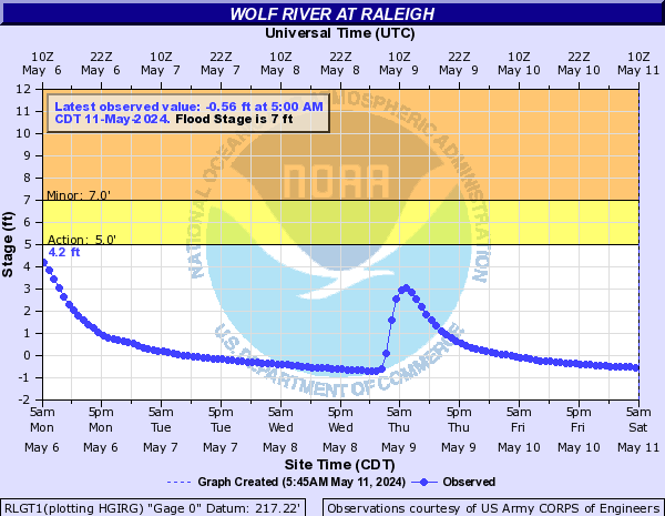
The latest hydrograph (plotted river stage) for the Wolf River in Raleigh (Austin  Peay).

With continued periods of rainfall and thunderstorms with heavy rain expected through the afternoon hours, this will likely be the worst flooding in the Memphis metro since the first weekend in May 2010, when the National Guard was called in to help with rescues in Millington.

When will we see a break? Well, for good, by early evening when the entire system exits. However, it appears areas north of the TN/MS line still have a couple of hours of rain and thunder to deal with, though late morning. Then scattered "summertime" thunderstorms will begin to pop after lunch time and will affect mainly north MS and east AR, but we could also see a few southwest TN. All of the activity looks to be done by about 6pm, I hope! That's the best educated guess I have right now.

In the meantime, if you don't have to go out this morning, don't. If you do, use EXTREME caution, plan your route on roads that you know are not prone to flooding or that cross creeks that flood, and if you do encounter water across the road...


... it could save your life!

Erik Proseus
MWN Meteorologist

----
Follow MWN on Facebook, Twitter, and Google+
Visit MemphisWeather.net on the web or m.memphisweather.net on your mobile phone.
Download our iPhone or Android apps, featuring StormWatch+ severe weather alerts!