
The forecast remains largely on track. Temperatures are dropping into the mid 30s this evening with several hours of precipitation to move through. Though they are not far from freezing at the surface, there remains a bit of warm air aloft as well that is keeping precipitation from changing to anything wintry just yet. Within the next few hours, some sleet could mix in, particularly in far northern areas of the metro (i.e., mainly Tipton Co). That area will also be the first to reach freezing tonight and a changeover to light freezing rain is expected, probably between 10pm-midnight.
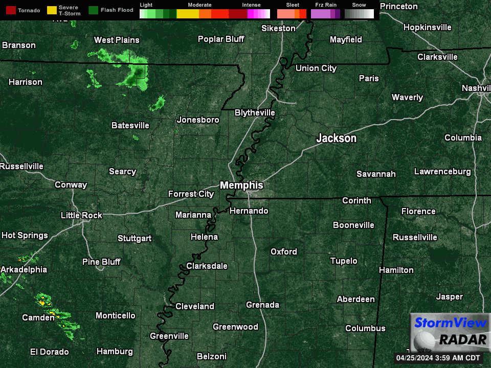 |
| Current StormView Radar loop |
 |
| Early evening HRRR model output shows a wintry mix remaining primarily north of the metro, but inching south into the immediate metro overnight with lingering flurries or freezing drizzle during the morning hours. (WeatherModels.com) |
Overall, Tipton County stands the best chance for up to 0.10" of an ice glaze on exposed surfaces and bridges. Very light icing will also be possible in Crittenden, Shelby and Fayette Counties by morning. As stated below, "wait and see" is the best approach for morning travel. I expect the primary roads will be OK, but elevated roadways could be slippery. Treatment has not been applied ahead of time due to the constant rain before it changes over, so any road treatment will have to wait until the ice forms.
ORIGINAL POST (9:45am) --
Earlier this morning, the National Weather Service - purveyor of all watches/warnings/advisories - extended a Winter Weather Advisory south into the I-40 corridor, a.k.a. the Memphis metro along this part of I-40. What does that mean for us? Let's answer your questions.
What is a Winter Weather Advisory?
The NWS issues a Winter Weather Advisory when a winter weather event is expected to cause a some degree of inconvenience, but is not expected to be a major hazard to travel and commerce (when a warning would be required). A combination of precipitation types is possible. An Advisory is basically a "Junior Warning." Caution is advised while traveling or working outdoors during an advisory.
When is it in effect and who does it include?
The advisory is in effect for those counties in purple above. Basically if your county has I-40 running through it or you are north of I-40, you're included. In addition, DeSoto and Tunica Counties are also included. The advisory runs from 6pm this evening through 9am Sunday.What is driving this potential winter weather?
A fairly common wintertime pattern is in place, with a low pressure system moving along the Gulf Coast over the next 24 hours and an "inverted trough" (or weaker pressure extending north from the low) crossing the Mid-South. The low and trough are providing the lift and precipitation. Cold high pressure to our north is seeping the cold air into the region. Areas to the north of the metro, in northeast AR and northwest TN, are deeper into the cold air and are already experiencing winter weather conditions, including freezing rain, snow and some sleet.As the Gulf low and trough move east tonight, the colder air will wrap in behind them, dropping south into the I-40 corridor. That will be the impetus for today's rain to change over to freezing or frozen precipitation. The kicker (there always is one, and it's the same as usual in these scenarios) is that precipitation will be departing late tonight as the cold air arrives.
 |
| The high-resolution NAM model from this morning shows temperatures remaining above freezing until early Sunday morning, when they could touch the freezing mark for a few hours. (WeatherModels.com) |
So what can we expect in the metro, and when?
Rain today. Cold, yucky, hot chocolate-sipping, wintertime rain.After 10pm tonight, some colder air will start working into the mid levels of the atmosphere and surface temperatures will be in the mid 30s. We could start to see some light sleet mix with the cold rain. No travel hazards are expected during this time. (Yes, you can safely go see the Grizzlies drag LeBron and the Fakers through the mud and return home with no issues.)

After midnight, and likely closer to 3am, surface temperatures will near freezing (especially in Tipton County) and precipitation will diminish in intensity. This is when we could see some light freezing rain (if the surface temperature drops to 32), sleet, or light snow mix in with the rain. We call it "wintry mix" because it's darn near impossible to know what exactly will fall. It should all be pretty light though, with minor accumulation on grassy surfaces, exposed objects, and maybe some bridges possible, especially in Tipton County.
 |
| The high-resolution HRRR model from this morning shows wintry precipitation remaining north of the metro until early Sunday morning, as precipitation is departing. The best chance of minor accumulation will be Tipton County and points north. (WeatherModels.com) |
 |
| The high-resolution NAM model depiction of total accumulation of various winter weather types above. Sleet (top left, orange) should mainly avoid the metro with no accumulation expected. Snow (lower right, blue) should be about the same. Minor accumulation of freezing rain (top right, red) could occur as far south as I-40, while rain (lower left, green) will be widespread. (WeatherBell) |
By dawn, most precipitation will be over. After that, a bit of freezing drizzle or flurries are possible for a couple more hours but shouldn't affect morning church-goers or dedicated joggers. Overall, we advise a "wait and see" approach to those headed out in the early morning, but honestly, I don't really expect too many problems. A slippery bridge here or there, mainly north of I-40, is possible. With lows right at 31-32° and highs in the upper 30s, by late morning everything should be thawing and drying out.
Starting Monday, a warming trend brings us back to near 50 by Tuesday with highs remaining in the 50s the rest of the week. Rain is a good bet Thursday and Friday with no winter shenanigans in view. Here's hoping for (and we're forecasting as of now) a dry and seasonal weekend next week!
Stay updated
Get the latest updates on our winter weather threats via our Facebook and Twitter feeds, as well as the latest precipitation-typed radar loop, current conditions around the metro, and forecast in our mobile app. All links are below.Erik Proseus
MWN Meteorologist
----
Follow MWN on Facebook and Twitter for routine updates and the latest info!
Complete MWN Forecast: MemphisWeather.net on the mobile web or via the MWN mobile app
Download our iPhone or Android apps, featuring StormWatch+ severe weather alerts!
 | |
| MWN is a NOAA Weather Ready Nation Ambassador | Meteorologist Erik Proseus is an NWA Digital Seal Holder |
No comments:
Post a Comment