
We're finally putting this week's wet weather in the rearview mirror as the unofficial start of summer - Memorial Day weekend - arrives. In fact, the three-day weekend looks fabulous with sunny skies, warm but not overly hot temperatures, and acceptable humidity levels. The dry spell that starts today continues for nearly a week as temperatures warm back to near 90 by mid-week before the next front approaches.
Friday: upper low spins by to our north
Trailing the wet system that departed yesterday morning, an upper level low pressure system has been moving slowly by to our north. Today, that low is pulling into the Ohio Valley with northwesterly wind aloft, which is bringing in additional cloud cover. Fortunately the clouds will keep their moisture aloft and rain chances are nearly nil. Those clouds, and a westerly breeze, will keep temperatures in check with highs in the mid 70s. By this evening, the clouds dissipate relatively quickly and wind becomes light. That will make for idea radiational cooling conditions, meaning we'll wake up to temperatures in the 50s on Saturday morning with the potential for some patchy fog thanks to saturated ground, light wind, and clear sky.
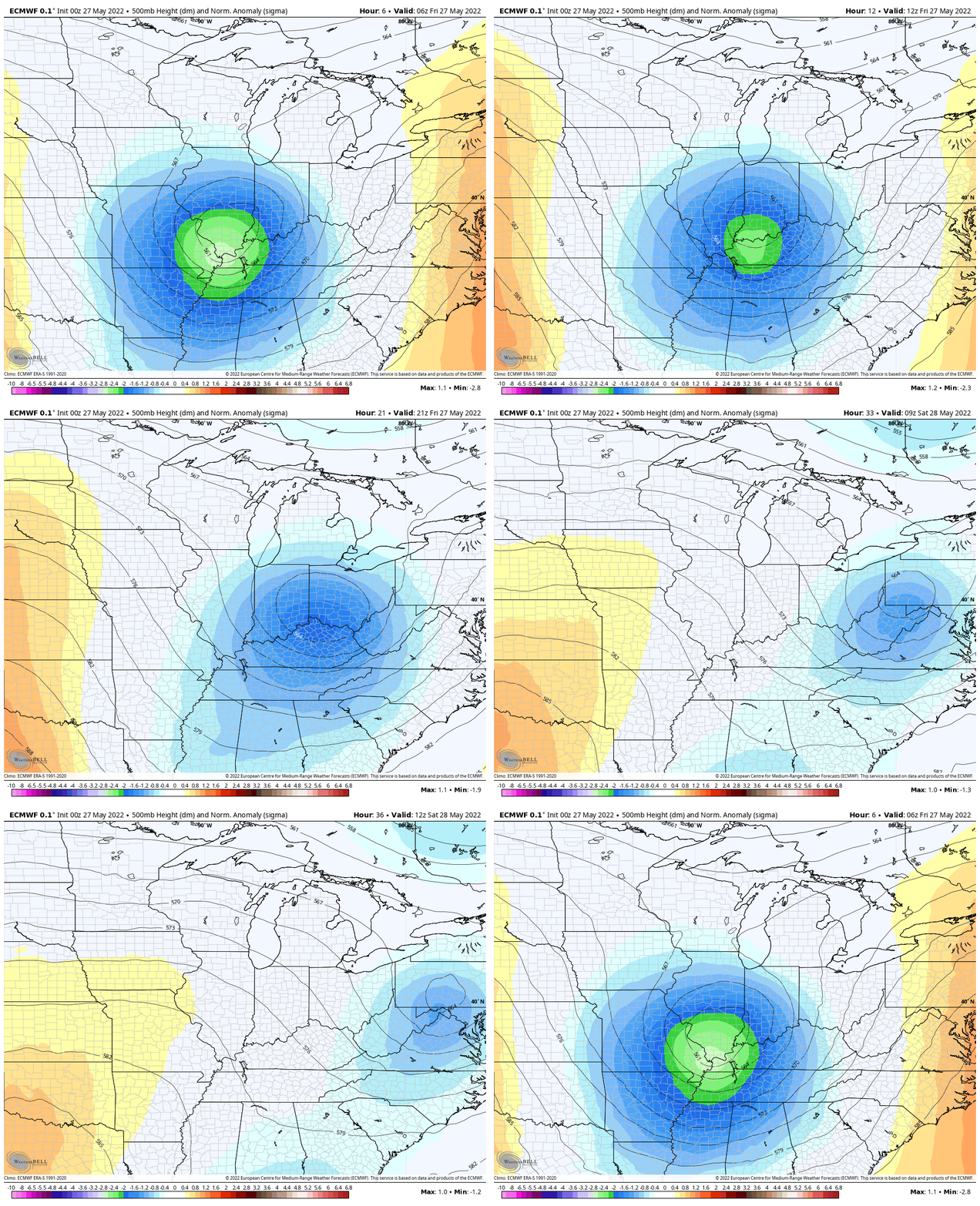 |
| An upper level low pressure center will move off to the northeast over the next 24 hours, according to the European model. High pressure builds in for the coming week. (WeatherBell) |
Memorial weekend: grill, swim, or work on the tan
We really couldn't ask for a much better weekend to kick off summer! Abundant sunshine is expected throughout the three-day holiday with slowly moderating temperatures. Though Saturday starts cool in the upper 50s, the afternoon will be pleasant with highs in the low 80s and a very slight south breeze. That south wind increases a bit on Sunday but sunshine remains. Morning lows will be a bit warmer in the mid 60s with highs in the mid to upper 80s.
By Monday, the warming trend moves the mercury up a couple more degrees, but still shy of 90, with mostly sunny skies and a south breeze. Dewpoints remain near 60, which is comfortable for this time of year. The sunshine will be great for working on those pasty legs and arms and taking a dip in the pool, though the cooler mornings and recent rain might mean it's a tad chilly yet!

Mid-week: dry and hot
If you have to go back to work Tuesday, it'll be a good day to be in the air conditioning. Temperatures warm to 90 degrees in the afternoon with mostly sunny skies and a south breeze. By Wednesday, moisture levels increase, resulting in stickier conditions and increasing high clouds. A stray shower can't be ruled out, but it should be mainly dry. Highs will be in the lower 90s.

End of the week: cold front arrives
Though still about a week out, computer models are indicating the next cold front arrives on Thursday. I've increased rain chances into the "scattered" range for thunderstorms during the day with slightly cooler temperatures due to rain and cloud cover. A lingering shower could stick around Friday, but the front appears to dry up and move off to our south. Temperatures drop back to the lower to mid 80s with lows in the 60s. Overall, with one rain day over the coming week and not excessively hot conditions, there's not a lot to complain about for the coming week!
In closing: I want to proactively extend great appreciation for my team, led by meteorologist Richard, for taking the reins of MWN over the coming week. My wife and I will be celebrating our 25th wedding anniversary in a "tropical climate" next week. You'll be in good hands, and we'll be recharging for the next 25!

When I return, the first order of business will be onboarding two brand new interns, who I look forward to introducing you to! Be safe and keep those who gave everything for our country in your thoughts this Memorial Day weekend!
MWN Meteorologist
----
Follow MWN on Facebook and Twitter for routine updates and the latest info!
Complete MWN Forecast: MemphisWeather.net on the mobile web or via the MWN mobile app
Download our iPhone or Android apps, featuring StormWatch+ severe weather alerts!
 |  |
| MWN is a NOAA Weather Ready Nation Ambassador | Meteorologist Erik Proseus is an NWA Digital Seal Holder |


