Remember when fall came for a few days and we had low humidity, below average highs, and refreshing, if not cool, mornings? Yeah, forget about that because it’s in the past now. Whether you like it or not, summer is back! “False fall” is behind us and we are now entering our “second summer.”
The weather cooperated with us this weekend for the Cooper Young Festival and Memphis football! Plentiful sunshine and highs in the low 90s occurred both days. Overnight lows were back to near 70 as well. It was hot, but still a great weekend for outdoor plans!
Monday-Wednesday
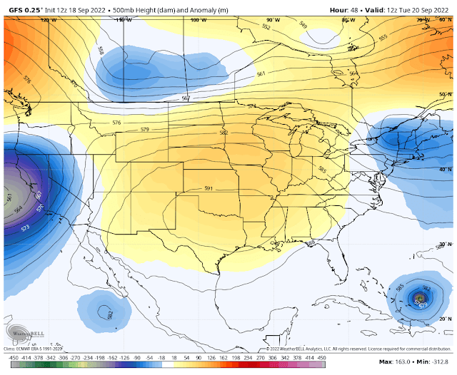
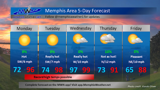
The heat from the weekend is just a taste of what is to come for the start of the work week. A strong high pressure over the southern plains is responsible for the heat we will be feeling. As a result, dry conditions and potentially record-breaking heat will move into the Mid-South. Monday’s record high is 97, Tuesday’s is 100, and Wednesday’s is 98. All of those are in jeopardy, in addition to the record for the latest 100-degree day, which is September 20th (Tuesday). Although the record-threatening heat won’t last too long, it’s still mid-September and we would typically expect average highs to be in the mid 80s.
Thursday-Friday
 |
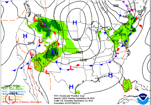
| Surface forecast map valid 7am Thursday. A cold front will be just to our south by that time. (NOAA/NWS) |
Thankfully, a cold front will move through the region early Thursday bringing drier air and a drop in temperatures, although it's doubtful there will be any precipitation, as rain chances remain to our north. When I say a drop in temperatures however, I do not mean below average… I mean the upper 80s to low 90s. 😒 While we will still be above average, the air will feel more comfortable. Overnight lows will also drop from the mid 70s into the mid 60s.
Next weekend
The slightly cooler trend established after Thursday’s cold front will continue into next weekend, though it will still be too warm for late September. Highs will be in the low 90s and lows will be in the upper 60s. Just like this weekend, there will be decent weather for the Memphis football game against North Texas. It’ll be hot in the stadium and for tailgating though since the game starts at 2:30pm.
Owen Basselman
MWN Intern
----
Follow MWN on Facebook and Twitter for routine updates and the latest info!
Complete MWN Forecast: MemphisWeather.net on the mobile web or via the MWN mobile app
Download our iPhone or Android apps, featuring StormWatch+ severe weather alerts!
 |  |
| MWN is a NOAA Weather Ready Nation Ambassador | Meteorologist Erik Proseus is an NWA Digital Seal Holder |


No comments:
Post a Comment