
In fact, according to the National Weather Service, the corridor from northwest MS to southern IL and IN has the greatest rainfall deficit of any region in the nation. Views of the nationwide departure from normal and a southeast U.S. regional view clearly show the major issue we are dealing with, sticking out like a sore red thumb.
 |
| Year-to-date rainfall departure from normal. The vast majority of the nation has received less precipitation than a typical year in 2012. Courtesy NOAA/NWS. |
 |
| A closer look at rainfall deficits in the southeast U.S. The Mid-South is ground zero for rainfall deficits in the U.S. |
 |
| Year-to-date precipitation at Memphis International Airport is just over 50% of a n average year |
Official drought status
The Drought Monitor provides a scale of the degree of drought that is occurring in an area. Below is the condition of the lower 48 United States as published on the Drought Monitor. D0 means "abnormally dry," D1 is "moderate drought," D2 is "severe drought," D3 is "extreme drought," and D4 is "exceptional drought."
| Week | Date | No drought | D0-D4 | D1-D4 | D2-D4 | D3-D4 | D4 |
| One Year Ago | 07/12/11 | 64.33 | 35.67 | 28.70 | 23.69 | 18.67 | 11.96 |
| Last Week | 07/10/12 | 20.02 | 79.88 | 60.84 | 37.19 | 11.61 | 0.74 |
| Current | 07/17/12 | 19.25 | 80.75 | 63.54 | 42.23 | 13.53 | 0.99 |
Comparing conditions to last year at this time, you can see from the comparison graphic below that the degree of the drought is not nearly as bad as last year, but is far more widespread. The Southern Plains and Gulf Coast were in dire straits last year at this time, however it doesn't take an exceptional (D4) drought to cause significant impacts.

Waterways
Drought throughout the mid-section of the nation, coupled with a lack of snow this past winter up north, means that the Mid-Mississippi and Lower Ohio River Valleys, including their tributaries, are seeing extremely low water levels as well. In fact, restrictions have been placed on barge traffic on the Mississippi to keep the normally fully-loaded barges from running aground in shallow water. In order to keep the barges afloat, they have to carry less cargo and fewer barges can be pushed by one towboat.
Dredging of the river bottom to deepen the water has also commenced in several areas to allow large boats to dock without hitting bottom and the dock for the riverboats in Memphis has temporarily shifted from Beale Street Landing to the cobblestones or even Greenbelt Park on Mud Island. The Mississippi River at Memphis, for instance, was at -7.2 feet as of 7am Thursday - a far cry from it's peak 14 months ago at 48.0 feet on May 10, 2011! The extremely low levels place the river gauge reading at #9 on the list of lowest water marks since records began. The record lowest stage is -10.7 feet set in 1988. The extended forecast (which does not consider the impact of future precipitation) brings the river dangerously close to the -10 feet mark by mid-August.
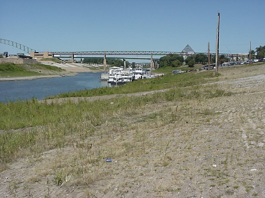 |
| The historic cobblestones and Mud Island with the river at -6.8' at Memphis. Photo courtesy NWS-Memphis. |
Natural Disaster?
Due to excessive heat and abnormally dry conditions, the U.S. Agriculture Department has declared most metro counties federal disaster areas this week, including Shelby, Tipton, Crittenden, DeSoto, Tunica, and Tate Counties. This declaration means that farmers are eligible for low-interest, emergency loans designed to help them recover from crop loss this year. There are now almost 1,300 counties in 29 states designated as drought disaster areas. |
| Areas declared as federal disaster zones due to drought (as of 7/16/12). Courtesy USDA. |
----
Visit MemphisWeather.net on the web or m.memphisweather.net on your mobile phone.
Download our iPhone or Android apps, now with StormWatch+!
Nowcasting services available on our Facebook page and Twitter feed.
No comments:
Post a Comment